
3 P.M. UPDATE:
Our old friend is back. The "cap".
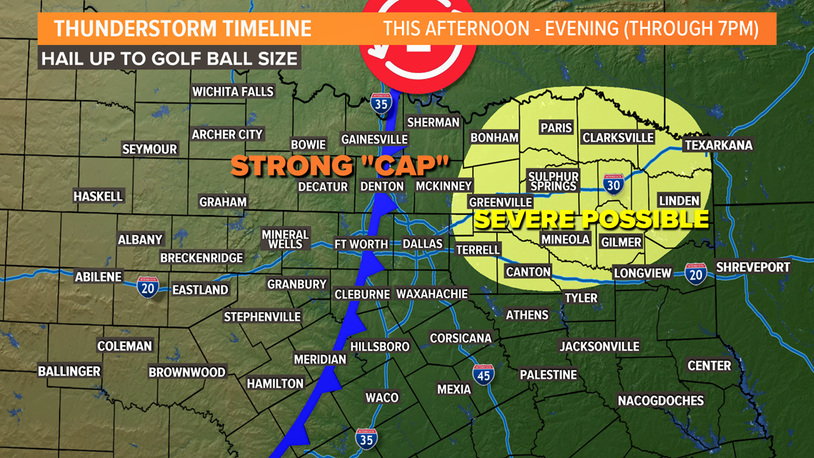
A strong cap has developed over the Dallas-Fort Worth area. This will limit thunderstorm development the rest of today in the D-FW area.
However, just to the east of D-FW the cap is weaker, so thunderstorms are possible through the evening. Some of which could be severe with large hail (up to the size of golf balls the main threat.

Elsewhere clearing will continue with temps climbing into the 80s across the western half of North Texas during the afternoon.
Any thunderstorms the do develop will move east during the afternoon and evening with most of North Texas storm-free by this evening into tonight.
EARLIER TODAY
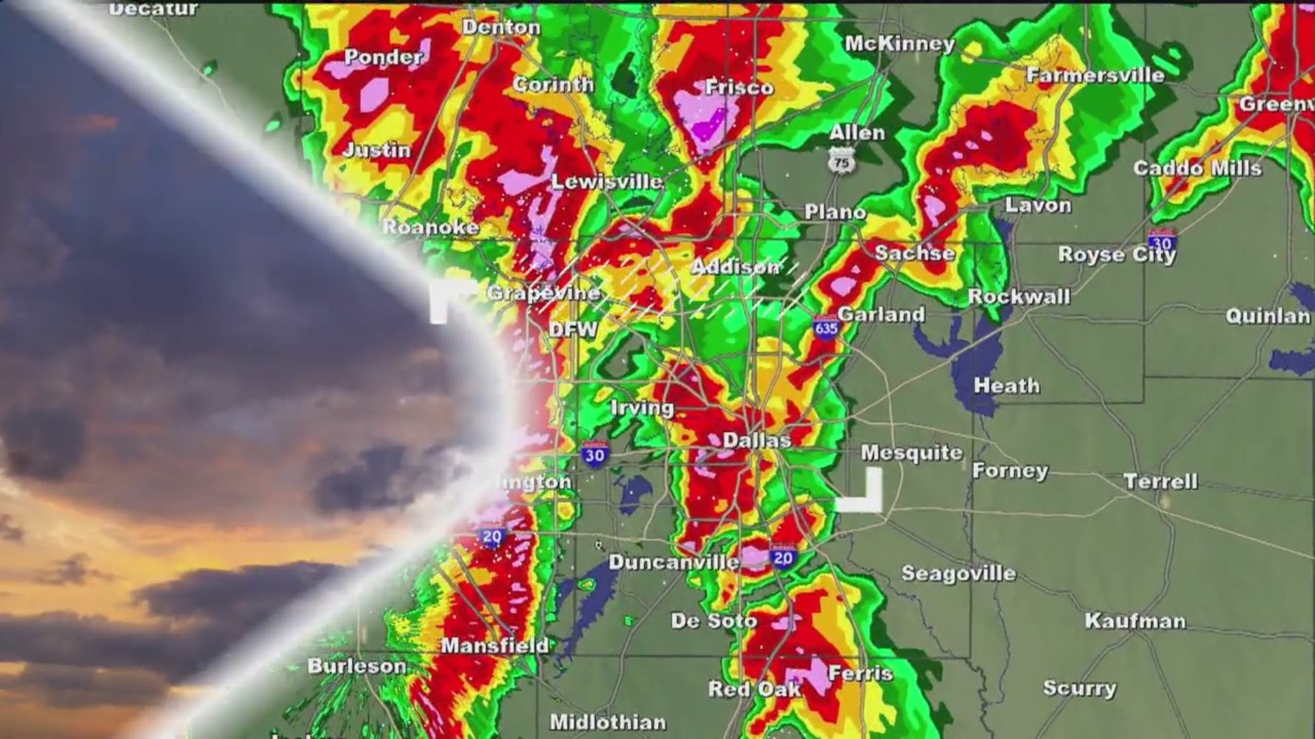
Several storms moved across the Dallas-Fort Worth area bringing hail the size of golf balls to some locations.
Here's a Facebook Live from when the storms went through the D-FW area earlier: