DALLAS — After a soggy, cloudy weekend, another round of storms has brought severe weather and tornadoes to the region on Tuesday.
We're tracking news relating to the storm -- including the latest severe weather watches and warnings, as well as traffic, flight and other delays -- here.
Quick look
- D-FW and most of North Texas are finished with storms and severe weather
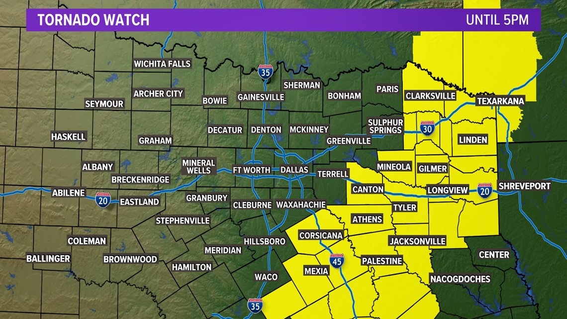
- Navarro, Henderson, and Van Zandt counties remain in a Tornado Watch until 5 p.m., but the threat for storms will really only exist in those areas through around 2-3 p.m.
- Most of North Texas will be breezy, cool, and dry the rest of Tuesday. Western areas will even see sunshine!
Tracking the storms
Severe storms are not done just yet for PARTS of North Texas. Most of the area is done with severe weather. But lingering storms in Navarro, Henderson, and Van Zandt counties could still pose a severe threat through around 2-3 p.m.

You can track how the weather might affect traffic by clicking here. You can see radars from across the region and state right here.
Follow along with our live coverage of the storms here:
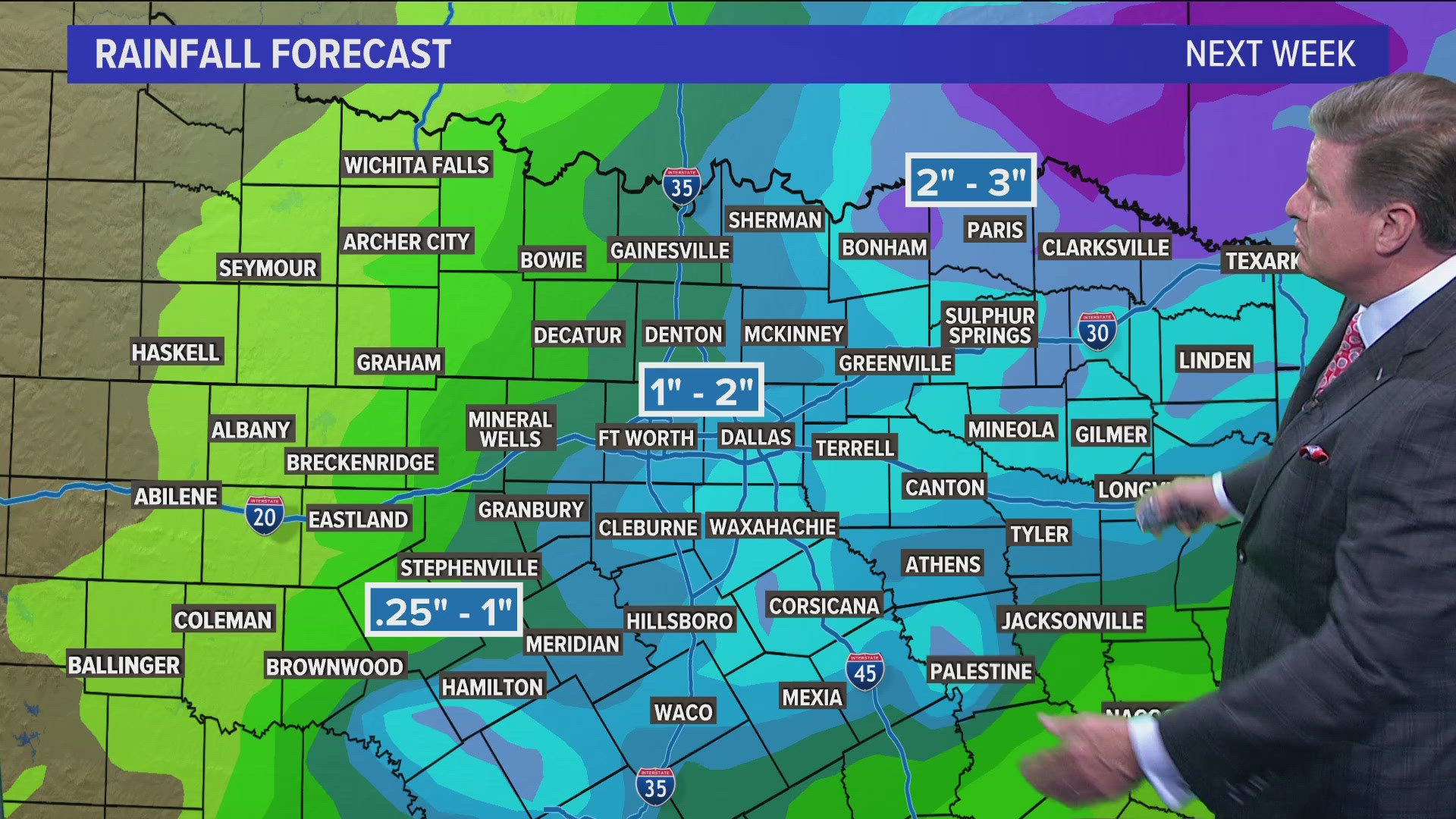
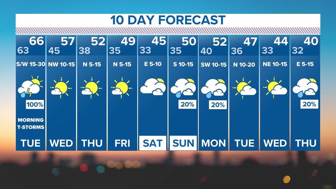
The 10-day outlook looks a little more like December
The weather looks to settle middle part of the week. After Tuesday's storms move out, sunshine and cooler weather return. Morning lows will dip into the 30s along with highs in the 40s. The cooler than normal temps seem to stick around through next week and possibly leading up to Christmas.

Other news: