
DALLAS — Updated at 6:10 a.m. Friday with additional information.
Heavy rainfall has come to an end across most of North Texas. There could be some pockets of heavier rain in far eastern or northeastern North Texas today, but most places are finished with heavy rain.
There will be on and off showers and drizzle throughout the day. Enough to keep the roads wet, and to want to keep the umbrella with you.
It will also be cloudy, cool to chilly, and breezy today.
Highs will only be in the 40s to low 50s this afternoon. Even though it is fall, these temps are 20°+ below normal for this time of the year!
Rain will slowly taper off from west to east today. By this evening, rain should be more intermittent.
Best chances of a dry Friday evening will be across western North Texas with better chances for lingering rain across eastern North Texas.
For the DFW area, dress warm for sure! However, you’ll likely need the umbrella or poncho if you are planning on sitting out at any Friday football games this evening.
All rain will come to an end tonight into Saturday morning. Skies will clear on Saturday with sunshine returning and warmer temps. Highs look to be in the 60s.
Sunday will be even warmer, and actually a rather nice fall day. Highs on Sunday will climb into the 70s.
If you are curious about rainfall, we definitely saw a widespread rain across North Texas. However, not everyone saw decent totals.

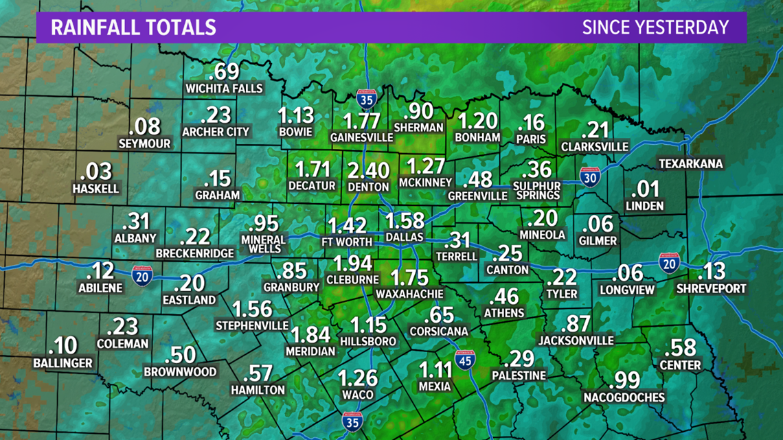
Highest totals were in the central part of North Texas, including the DFW area. Totals there ranged from around 1 to 2+ inches. Lesser totals were to the west and east of the DFW area with totals less than an inch in most of those locations.
Probably not drought busting just yet, but definitely a step in the right direction!
Previous Story
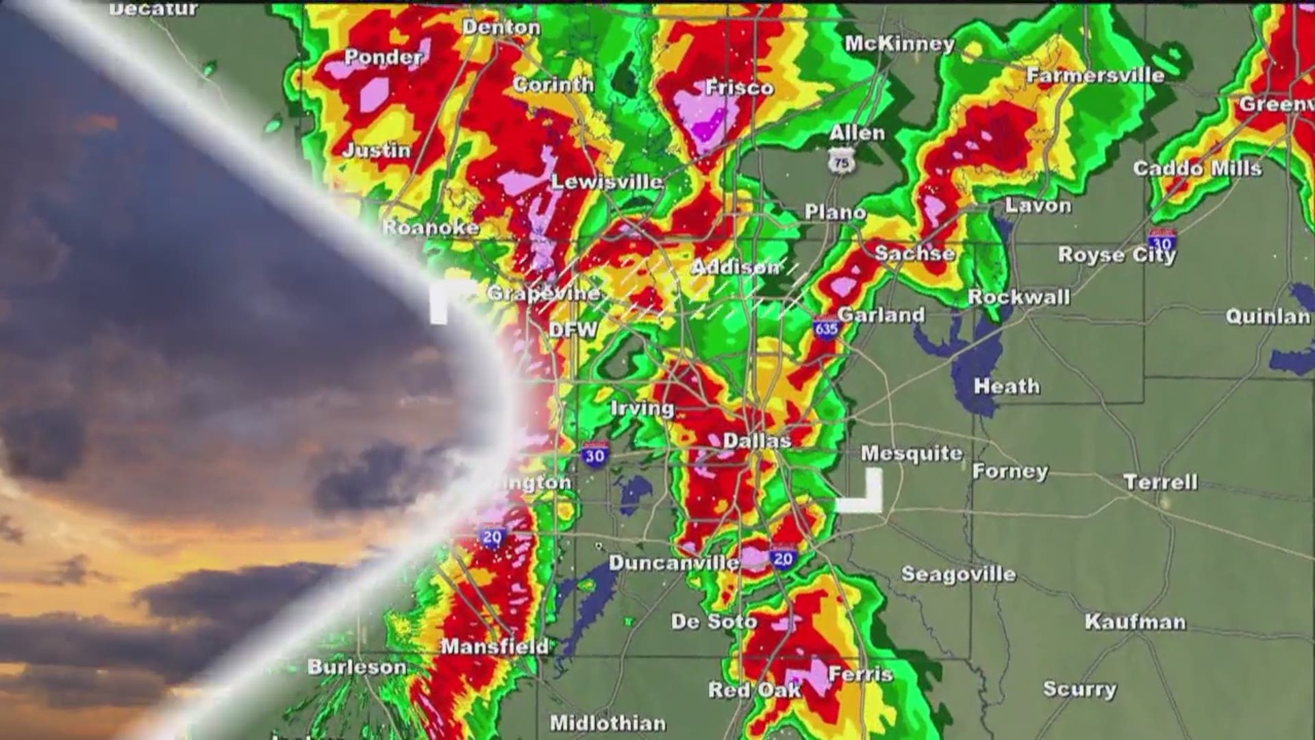
A cold front and much-needed rain is moving through North Texas and it's finally starting to feel like fall.
Pockets of heavy rain are expected in the Dallas-Fort Worth area Thursday evening into Friday. At this time, the risk for severe weather is low.
An estimated 1 to 3 inches of rain is expected as the cold front moves through the area.
Click here to check the latest conditions for your commute.
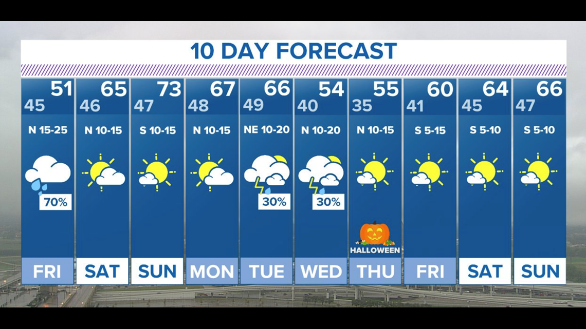
Friday’s high temperatures will struggle to make it out of the 40s. Tomorrow is expected to be cloud, wet and chilly.
After that, the sun will come out for the weekend before chances for more rain return next Tuesday and Wednesday.
Here's a look at the forecast for the next 10 days:
Flight delays:
The rain prompted several delays and canceled flights at both D/FW Airport and Dallas Love Field.
Snow in October
While the rain is causing flight delays and cancelations in North Texas, the panhandle is experiencing road closures due to snow.
Around 12:50 p.m. Thursday, The National Weather Service in Amarillo reported near whiteout conditions in Amarillo.
Weather predictions show Amarillo could receive up to 2.3 inches of snow.
Several areas have already received 1 to 2 inches of snow as of 3:51 pm. Thursday. Four inches of snow was reported five miles west of Amarillo.
Around 9 p.m., the NWS tweeted that the last of the snow band was passing through Amarillo. The snow is expected to push east throughout the rest of the evening.
Temperatures however will dip overnight, which will likely cause wet roadways to freeze. Officials urge people to drive slow and be careful while commuting.
Remember to download the WFAA app to check one of our dozens of local radars near you as well as the latest forecast, cameras and current conditions.
Check Weather Alerts here.