
North Texas could see all modes of winter weather Wednesday. How do we know which type of precipitation will fall at your house?
There are several layers of the atmosphere and each layer has its own temperature, dew point, wind, etc.
When forecasting winter weather every single layer is important and impacts what precipitation will be when it makes it to the ground.
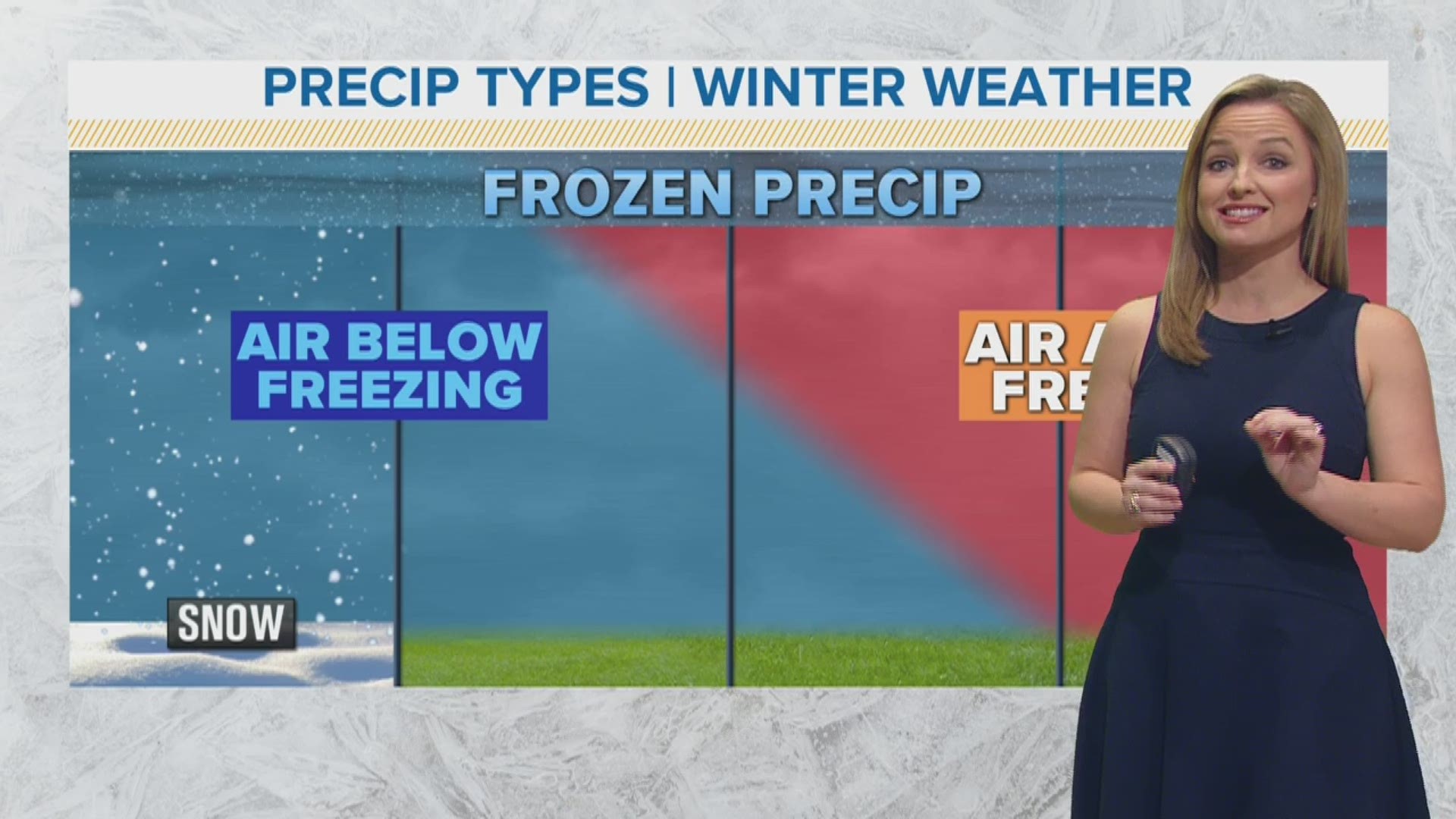
All precipitation starts as ice crystals, so we will start with a look at conditions needed for snow to fall.
SNOW:
The precipitation that falls from the cloud has to go through several layers that have temperatures at 32 degrees or lower to stay snow. If one layer is above freezing then the crystals will melt.
Snow accumulates and causes slick spots on roadways and makes for hazardous travel. Depending on how intense the snow is and how windy it is, low visibility could make it very dangerous on the roads.
SLEET:
For sleet to occur, there is a small layer of warm air that wedges in higher up in the atmosphere that melts the ice crystals to rain. The key for sleet though is several layers below before the surface have to be below 32 degrees for the precipitation to re-freeze before reaching the surface.
FREEZING RAIN:
Freezing rain is similar to sleet with a wedge of warm up in the upper levels melts the snow to rain. The difference between sleet and freezing rain is the depth of cold air before the surface is shallow. This does not give the rain enough time to re-freeze before it reaches the surface.
You will think freezing rain is just rain, but when it makes contact with a car, sidewalk, power line, etc. it freezes. This can cause major problems. The ice that piles up on power lines can add weight causes them to snap and break. The ice can cause slick spots on sidewalks, parking lots, bridges, overpasses and roads causing hazardous travel.
RAIN:
Warm air melts ice crystals to rain and temperatures remain above 32 degrees all the way to the surface.
Any movement in the storm can change how fast or slow the cold air arrives and that could change what precipitation type falls at your house.
Remember to download the WFAA app to check one of our dozens of local radars near you as well as the latest forecast, cameras and current conditions.