
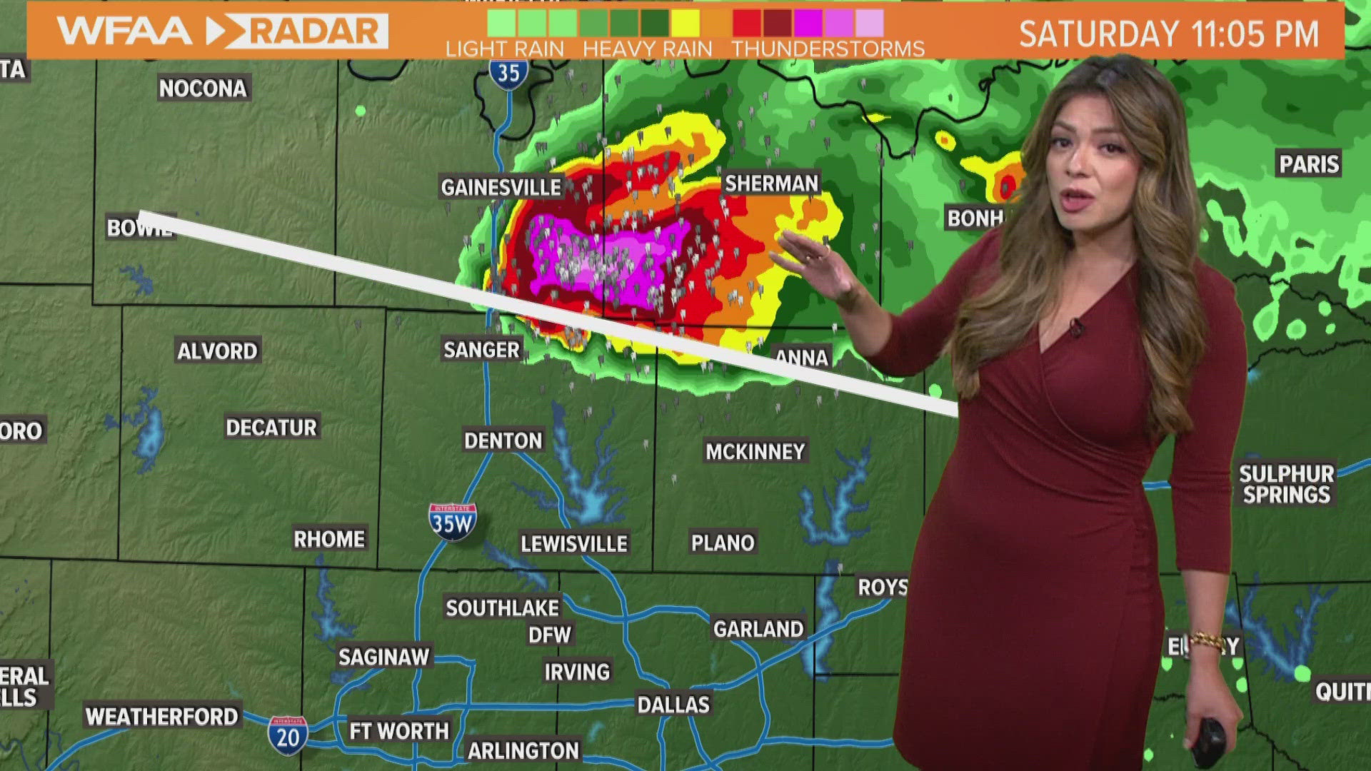
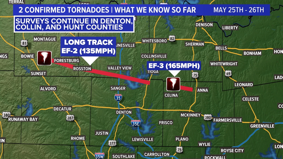
DALLAS — It was a very busy Saturday night due to a long-lived supercell thunderstorm caused abundant damage and produced at least an EF-3 tornado northeast of Celina and a long-track EF-2 tornado from Montague County thru Cooke County and into Denton County. Damage surveys continue and more details on how many tornadoes and exact ratings will be known in the coming days.

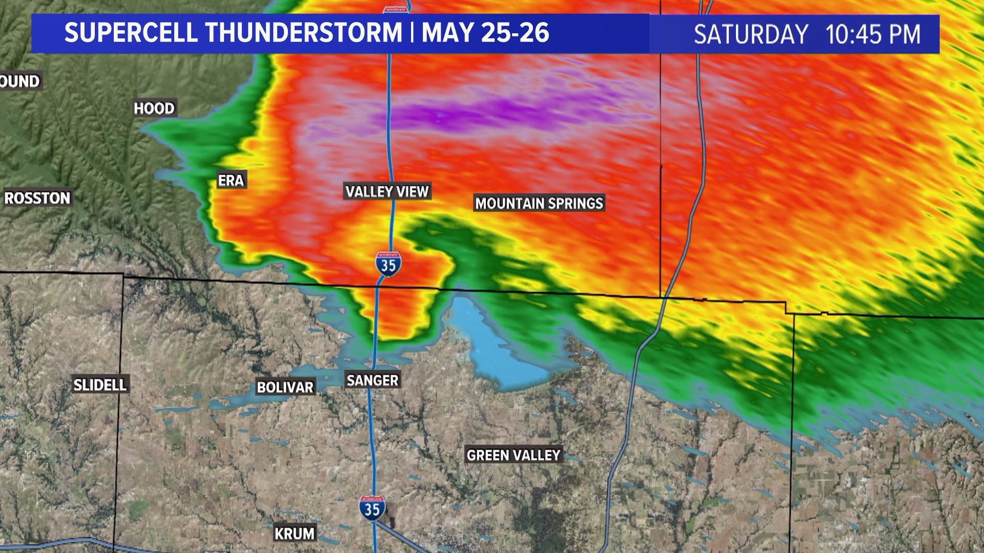
A supercell thunderstorm is a strong or severe thunderstorm that spins. This rotation is what aids tornado formation and large hail production.
The National Weather Service will be out surveying the damage from that supercell to determine if it produced more than one tornado (every time a funnel touches the ground counts as a separate tornado), the path of the tornado, the path length, the path width, and the max wind speeds. The type of damage will give a better understanding of the wind speeds and it will then be assigned a rating.
Most of North Texas was completely dry Saturday night, except for one very strong storm. This is how it happened:
The environment was ideal
Storms need moisture, instability and lift to develop. Supercells need all of those three ingredients plus wind shear or a change in wind speed from the ground up. Generally, we see strong wind shear when there is a strong jet stream.
The moisture content was there. The high humidity across the region could be felt with dew points in the 70s. The air felt dense on Saturday.
The instability was plentiful since showers and storms did not develop earlier in the day. That means the atmosphere had a lot of energy it had not used up yet.
The lift or lifting mechanism to kick start this supercell was an outflow from storms that developed over Oklahoma and northwest Texas.
The wind shear was also present due to a strong jet stream in place. A strong jet stream is common during the spring when our hemisphere transitions from the cooler winter months to the hotter summer months.
All of the ingredients where there, which is why a big portion of North Texas was under an Enhanced Risk (level 3 out of 5).
No competition from neighboring storms
Once the thunderstorm developed, it did not take long to grow. The environment was primed for thunderstorm growth.
Since no other storms around this supercell developed, the storm was not competing for moisture or energy with other storms. This is what kept feeding the storm, even with the loss of the sun's energy. It was for this reason that the storm trekked over 100 miles while maintaining its strength.
Unfortunately, this storm went on to cause a lot of damage. It is always important to keep up with the forecast, have a way to get warnings, and have a severe weather safety plan in place for when those warnings are issued.
More coverage of Saturday night's severe weather: