DALLAS —
Storm chances arrive Monday and Tuesday
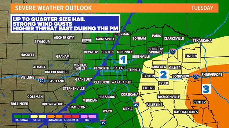
Another round of t-storms is likely in North Texas this week with the best chances being Tuesday morning thru around the midday hours.
Timing:
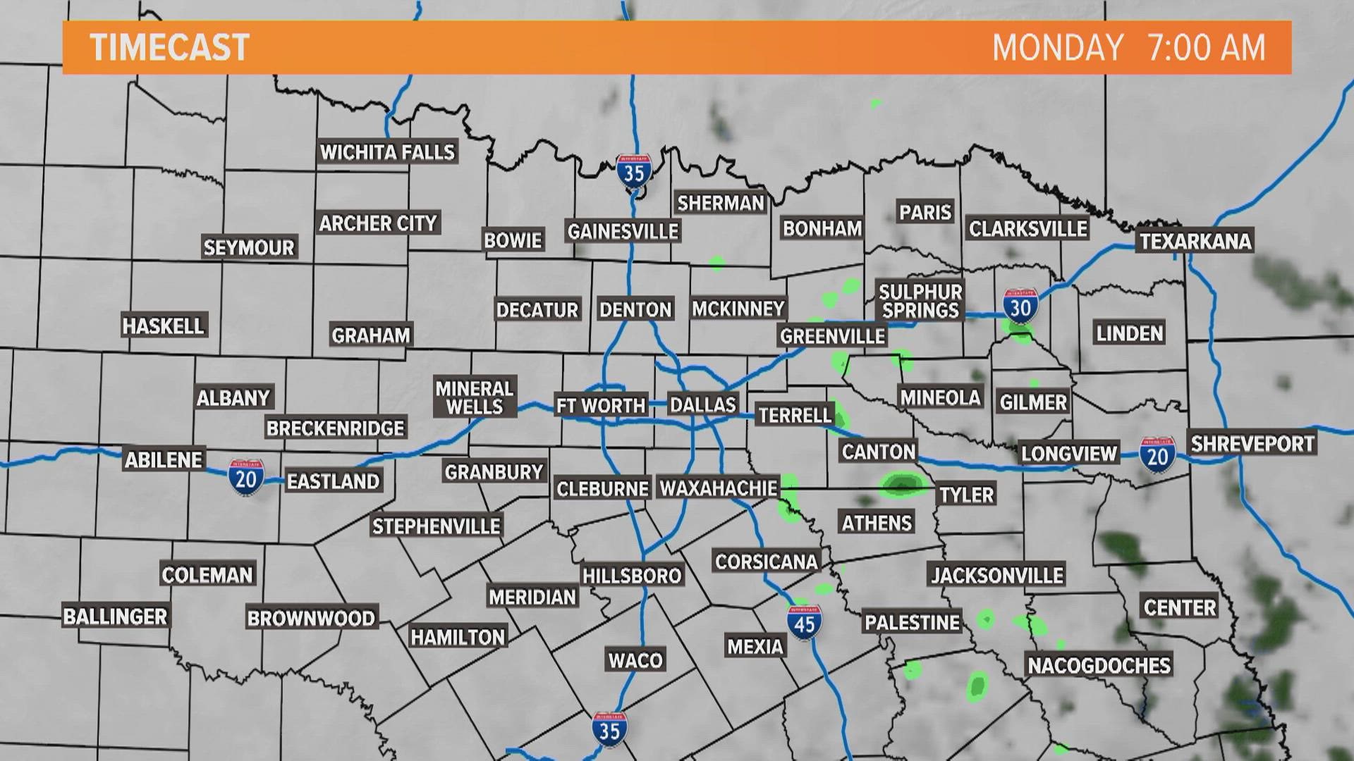
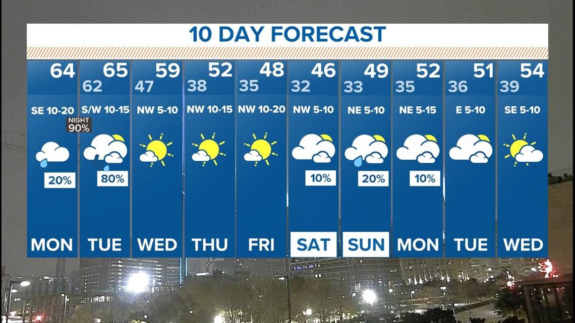
Monday itself will be breezy and cloudy. Can't rule out a passing shower or maybe a late day thunderstorm, but overall rain coverage looks low. Highs will be in the 60s.
Better chances for showers and storms will be the late night hours into Tuesday morning as a cold front sweeps west to east across North Texas.
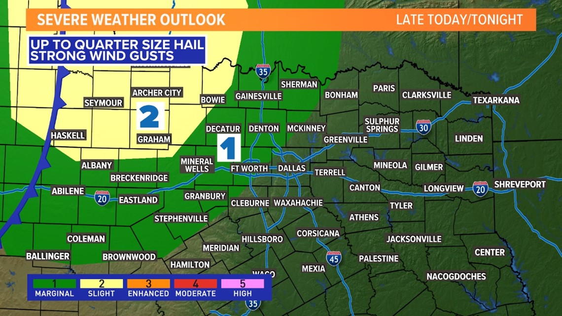
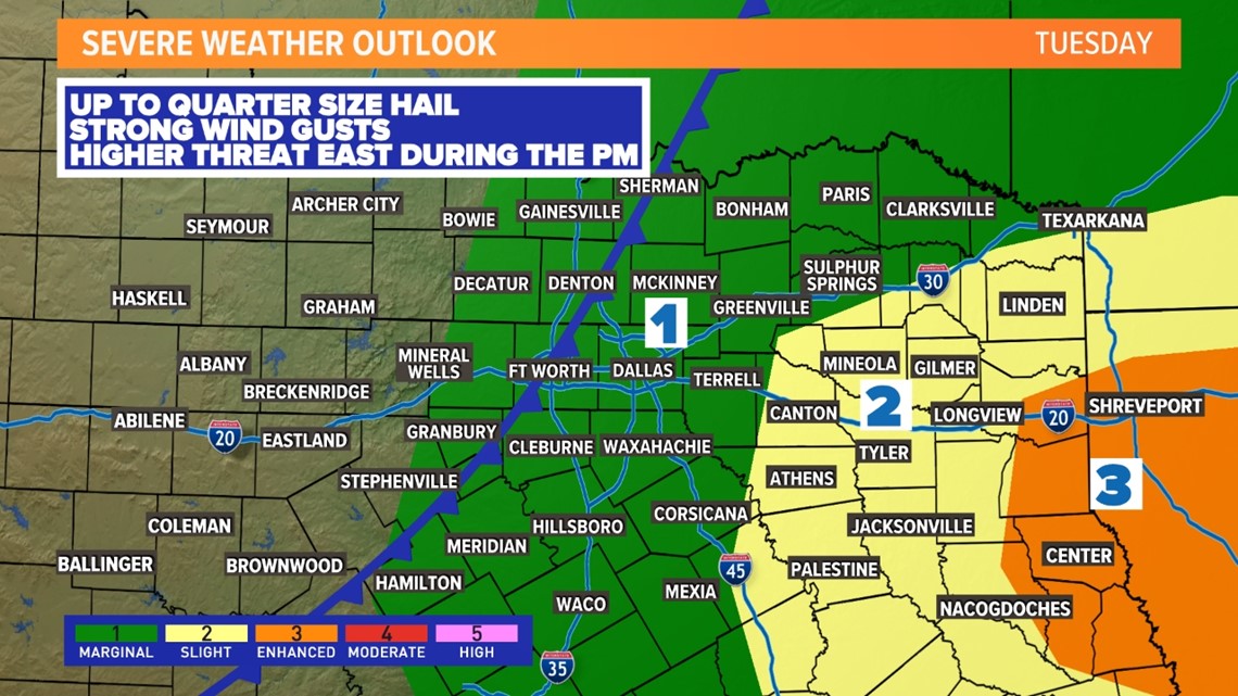
That front will first bring storms to western/northwestern North Texas late Monday night. There might be a couple storms that become severe with a wind and hail threat.

A line or broken line of storms will then move across the rest of North Texas arriving in D-FW Tuesday morning (6-11 a.m. give or take). Since storms will be arriving during the morning hours, that will lower the severe threat. It is not completely zero as a storm or two with some wind and hail is possible.
But the higher threat for severe weather will be in East Texas and over into Louisiana since that's where storms will be during the afternoon into evening.

The 10-day outlook looks cold!
The weather is finally looking drier and more settled the second half of next week into the following weekend. However, that settled weather looks to be chilly and back below normal with lows in the 30s and highs in the 40s.