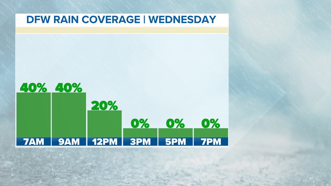
DALLAS — Light showers are moving northeast across the Dallas-Fort Worth area this Wednesday morning. This will bring slightly cooler temps.
It'll be sunny and warm later this afternoon. The high will be 75. No rain is expected on Thursday, but there is a chance for rain and some storms starting on Friday.
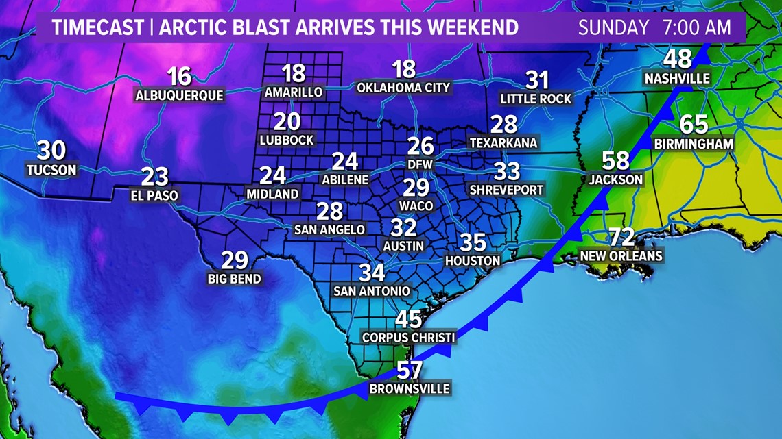
A cold front is expected Sunday morning.
Remember to download the WFAA app to check one of our dozens of local radars near you as well as the latest forecast, cameras and current conditions.
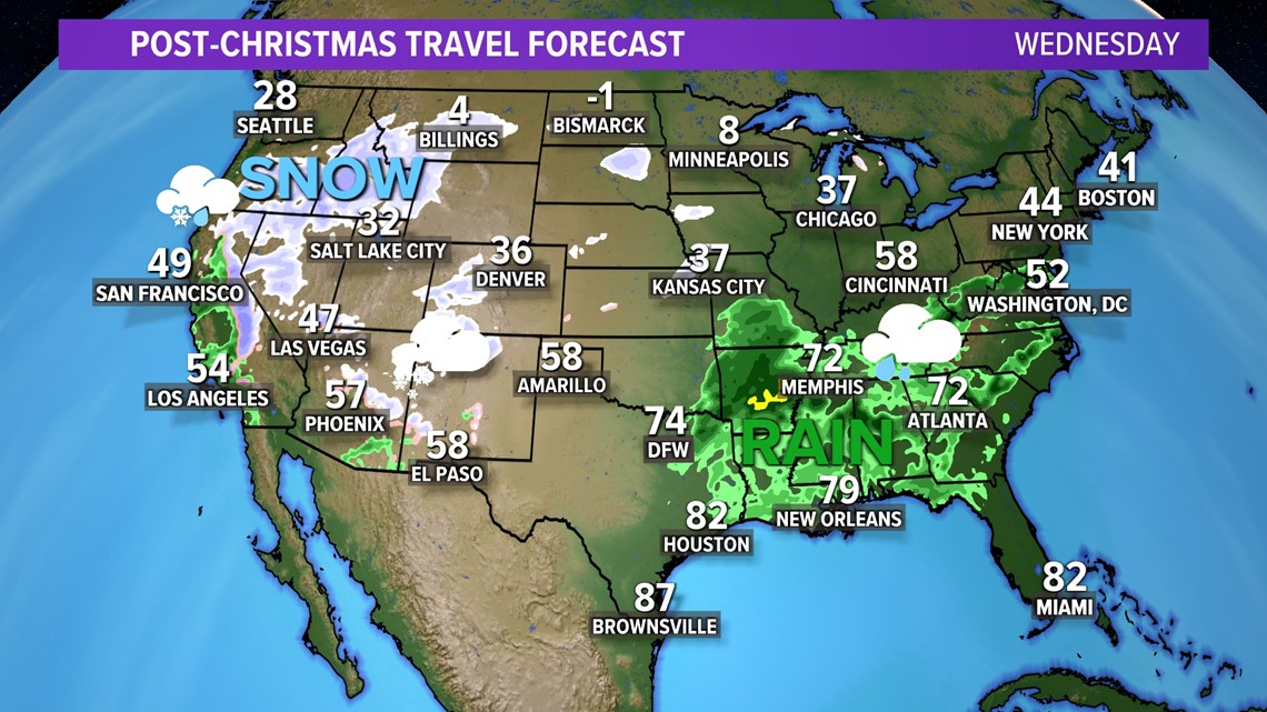
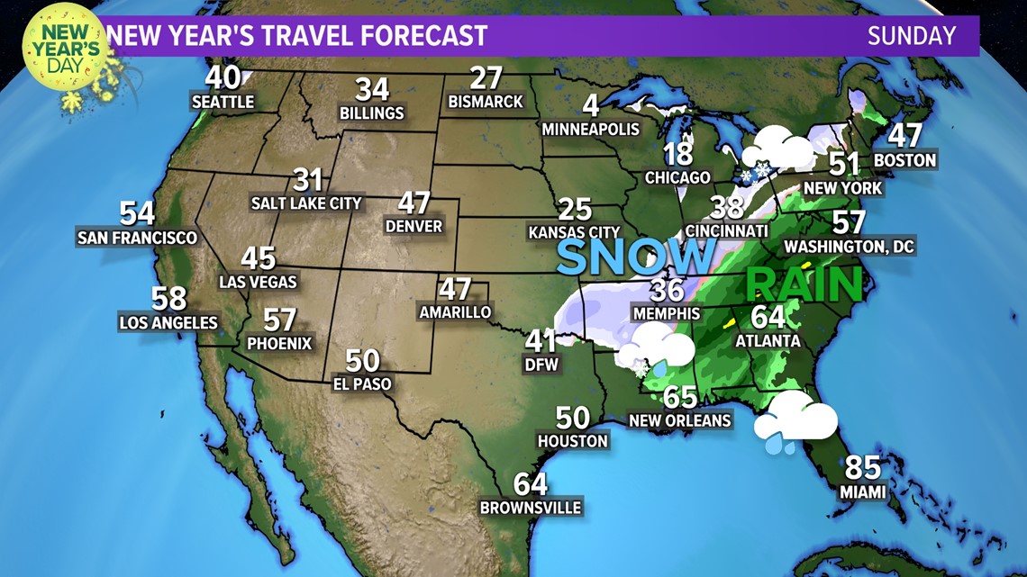
For those who are traveling for the holiday, here's what to expect through New Year's weekend:
Post-Christmas Travel
The western part of the country will continue to deal with rain and snow.
But a passing storm system or two will also bring rain and storms back to eastern parts of the country.
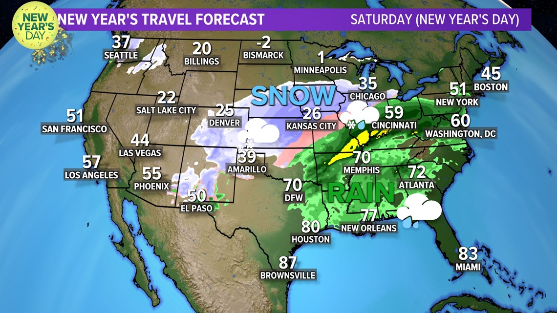
By New Year's Weekend, a much stronger cold front will bring a big cool-down and a chance for rain and snow to parts of the U.S. which have been mild and dry recently.


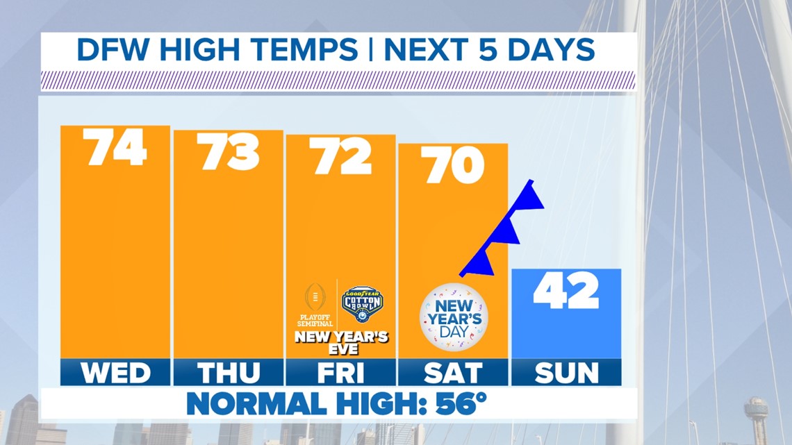
Rest of December in North TX
Above normal December temps continue.
Highs will range from the low 70s to the upper 70s all week. With the normal high being 56° this time of year, temps will continue to be well above normal all week long.
But big changes arrive by the New Year...

There is also a chance for some rain to start Wednesday morning in the form of passing showers or a few rumbles of thunder. Widespread, soaking rain is not likely, but passing showers are possible during the morning hours. Any rain will move east with sunshine breaking out by the afternoon.

New Year's Eve - New Year's Day
Temps will continue to be above normal
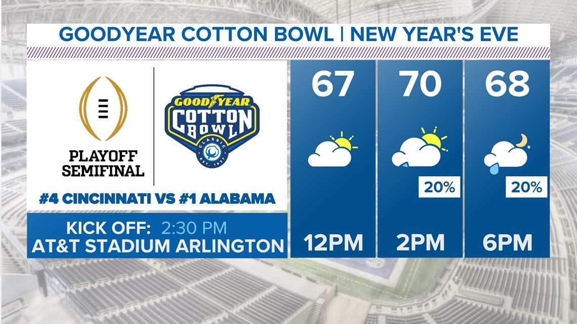
Thins are looking dry most of New Year's Eve day, but rain coverage and chances will increase heading into the evening and nighttime hours. If you have late day plans to ring in the new year, rain could be a part of your plans.
If you are heading to the Cotton Bowl at AT&T Stadium in Arlington, expect mild temps for any tailgating. A few showers could be around walking into the game or after it ends.

Coldest air of the season so far
Believe it or not, it has been cold at times so far this winter. It's just the cool-downs have not lasted long.
Our next shot of cold air does not look to last long either, but it does look to bring the coldest temps we've seen so far this season.
An Arctic cold front will arrive last Saturday night into Sunday. By Sunday, temps will be below freezing in the 20s for most of North Texas with a strong north wind. Wind chills Sunday morning look to be in the single digits and teens!
Highs on Sunday will then only hover in the 30s to low 40s with more freezing temps likely Sunday night into Monday morning. Both Saturday night and Sunday night will likely be a hard freeze, so make sure to protect your exterior pipes and sensitive vegetation!