DALLAS — It has been a busy few weeks with numerous warnings and large hail reports.
Unfortunately, a couple more chances of severe weather are possible this week.
A Tornado Watch was issued earlier for Delta, Fannin, Hopkins, Hunt and Lamar has been cancelled as of 8:30 a.m. Wednesday. The alert was originally issued to last until noon.
Wednesday morning
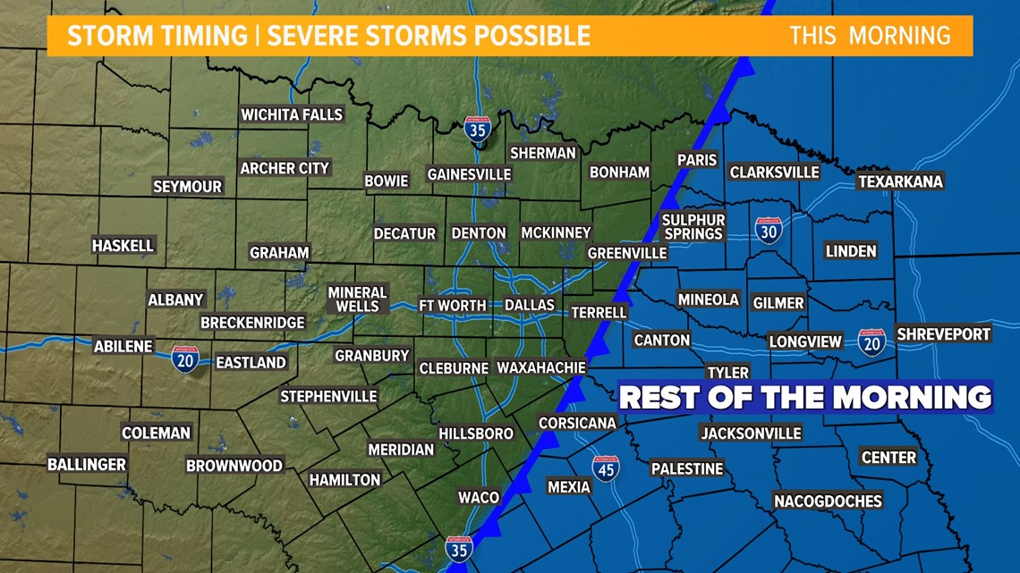
A round of t-storms formed in the D-FW area between 3 a.m. and 4 a.m. and then moved east through the early morning hours along a cold front.

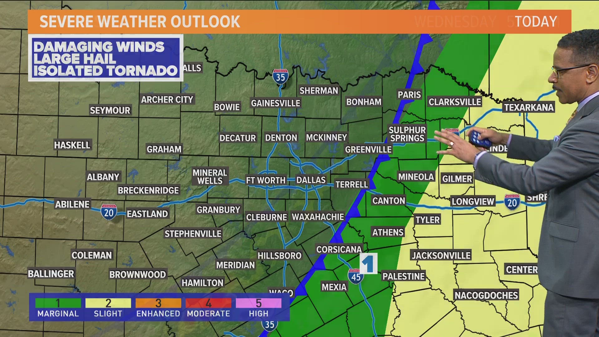
This round had the potential to be severe with a threat for large hail, damaging winds, and isolated tornadoes. The higher severe threat with this round was across Northeast Texas where the tornado watch has been issued.

Storms moved quickly east, with the severe threat done for North Texas by around 7-8 a.m. Wednesday morning.
Some lingering showers could occur through the morning hours on Wednesday with breezy and cooler weather behind the front.
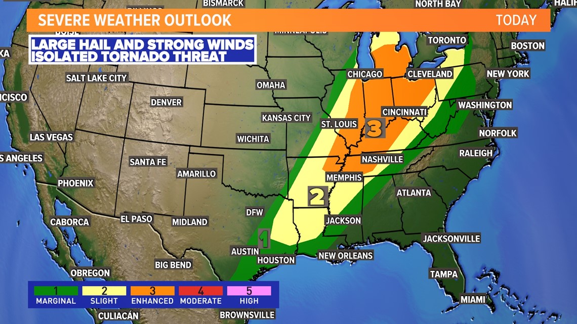
The threat for severe weather shifts to the east the rest of the day. Areas from the Great Lakes to Memphis will see the highest threat this afternoon.
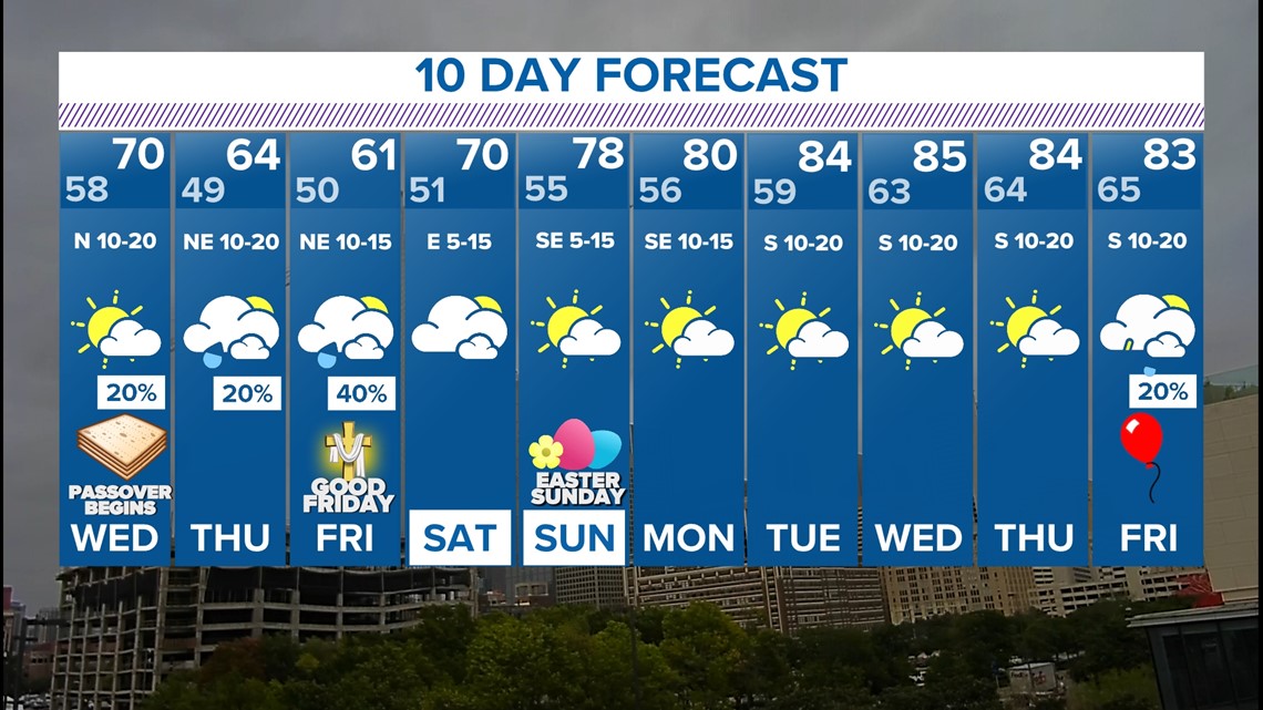
Next 10 days
Much cooler temps return!
After 90s to start the week, it will be much cooler for the second half of the week.
Some showers are possible Thursday and Friday but severe storms are highly unlikely.
Most of Easter Weekend is looking dry with temps warming back into the 70s.