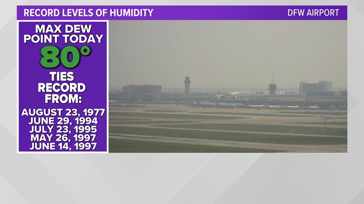
DALLAS — According to the National Weather Service, the Dallas-Fort Worth area reached a record-high dew point level (80) on Thursday, tying only five other instances dating back to 1947, when such data began being recorded.
According to the National Weather Service, the dew point is the temperature the air needs to be cooled to (at constant pressure) in order to achieve a relative humidity (RH) of 100%. The higher the dew point rises, the greater the amount of moisture in the air.
This directly affects how "comfortable" it will feel outside.
As a result of this high dew point, North Texas felt very humid on Thursday. The dew point conditions also created a very unstable airmass for potential severe weather.
The last time North Texas saw a dew point of 77 or higher was Sept. 5, 2022, according to the NWS.
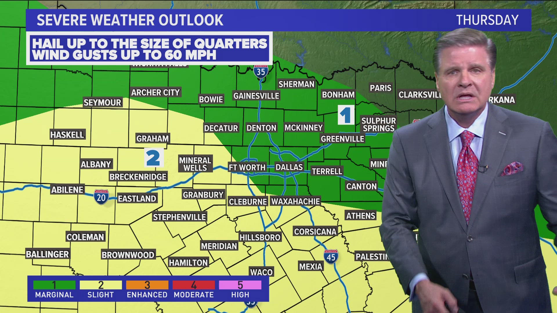
The National Weather Service announcement came ahead of yet another round of expected severe weather for the region. Dallas-Fort Worth was upgraded to an enhanced risk (level 3) for severe weather Thursday morning, with areas near the Red River under a moderate risk (level 4) that extends into Oklahoma.
The WFAA Weather team has reported that, like the last several days, any storms that pop will have a good chance of producing very large hail and damaging winds. The window for these storms will be between 4 p.m. and 9 p.m. You can check out more on the timing and what we're expecting in our weather forecast here.
Get your latest weather updates by visiting wfaa.com/weather or downloading the WFAA app.
More headlines from across Texas: