
DALLAS — Severe weather was still developing to the west of Dallas-Fort Worth on Wednesday night, but the overall risk for North Texas had lessened from earlier in the day.
We'll be providing updates here from around Dallas-Fort Worth as the storms move in.
Be sure to download the WFAA app to check radars for where you live.
Midnight/Early Thursday morning:
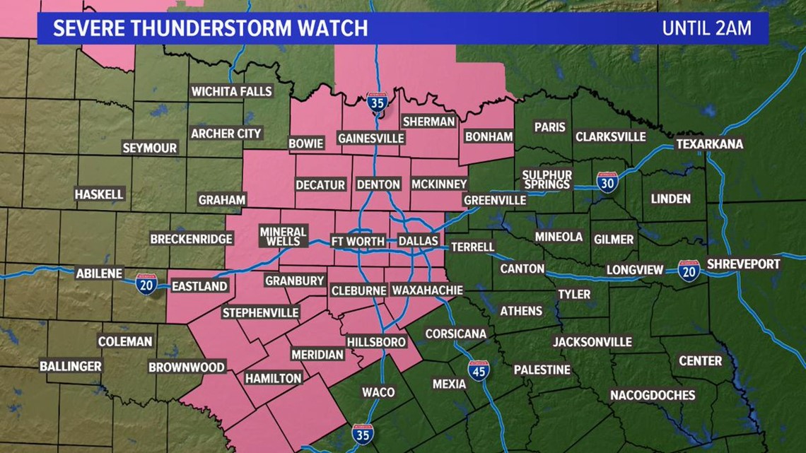
Several counties remain under severe thunderstorm watch until 2 .am., with some areas also under flash flood warnings.
At 11:44 p.m., the Denton Airport reported a wind gust of 74 mph. A damaging wind threat is increasing for the city of Denton, with wind gusts up to 80 mph possible on the leading edge of this storm.
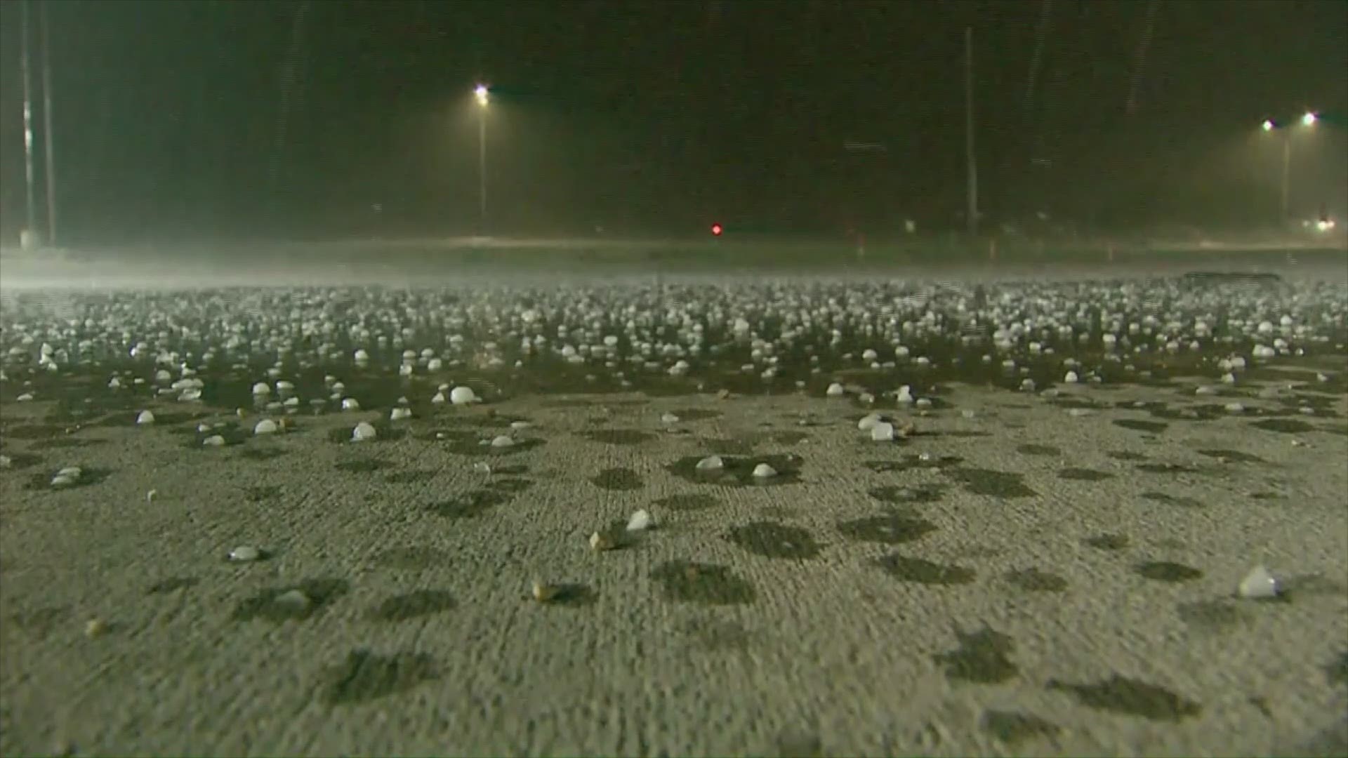
Heading into the early morning hours, a line of showers and storms will be tracking east toward the DFW area. So far, these storms have produced heavy rain, up to quarter size hail and 40-50 mph wind gusts. We do not anticipate these storms to intensify beyond that.
This line should clear Dallas and Collin counties by 1 a.m. to 2 a.m., moving into Rockwall and Kaufman counties and then into East Texas overnight into the early morning hours of Thursday.
10:30 p.m: Storm still moving through Wise County, northwest of DFW
Wise County, northwest of Fort Worth, was in a severe thunderstorm warning until 11:30 p.m., as storms bringing the threat of quarter-size hail and 60 mph continued moving west to east.
10 p.m: Severe thunderstorm warning for Cooke, Denton, Montague and Wise until 11 p.m.
Another warning as storms are still moving toward DFW. We're seeing plenty of lightning and rain, with some reports of hail, but most of the activity has been borderline severe.
When the storms reach DFW, they won't be as strong as they could have been, but quarter to half-dollar size hail could still be a threat, along with strong winds.
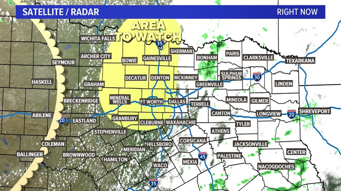
9:30 p.m: Storms still on track for DFW but risk lessened
With severe weather developing to the southwest, we're still on track to see storms here in DFW tonight. The storms should move into the area after 10 p.m., with large hail and wind gusts still a threat. The overall risk for severe weather has lessened.
9:00 p.m: Hail in Gainesville, severe thunderstorm warning for Erath, Eastland and Palo Pinto Counties
Check out the heavy hail and lightning that passed through Gainesville about 9 p.m:
In addition, a severe thunderstorm warning is in effect until 9:45 p.m. for Erath, Eastland and Palo Pinto counties. 65 mph winds and quarter size hail are possible.
There is also a severe thunderstorm warning for northeastern Wise County and northern Denton County until 10 p.m. Hail up to the size of quarters is possible as the storm moves east.
8:30 p.m: Wind and lightning in Gainesville
This is about an hour north of DFW, as storms continue to develop to the northwest and north of our area. Check out the video tweeted by WFAA's Jobin Panicker:
8:02 p.m.: Severe thunderstorm warnings continue for NW of DFW; hail expected
The National Weather Service has issued a severe thunderstorm warning for Cooke, Montague and Wise counties until 9 p.m. Tennis ball-sized hail is expected.
Watch a Facebook Live of storm footage from Alvord here:
7:43 p.m.: Continued severe thunderstorm warning issued for NW of DFW
Jack, Montague and Wise counties remain under a severe thunderstorm warning until 8:30 p.m.
7 p.m: Severe thunderstorms continue northwest of the DFW area.
Chief Meteorologist Pete Delkus recently did a Facebook Live talking the timing and what to expect the rest of the evening into tonight.
6:30 p.m: Severe thunderstorm warning issued northwest of DFW
With storms developing out west, a severe thunderstorm warning was just issued for Jack, Montague and Wise counties, until 7:30 p.m. This is northwest of DFW.
Here's a look from the ground in the Wise County area, from WFAA photographer Josh Stephen:


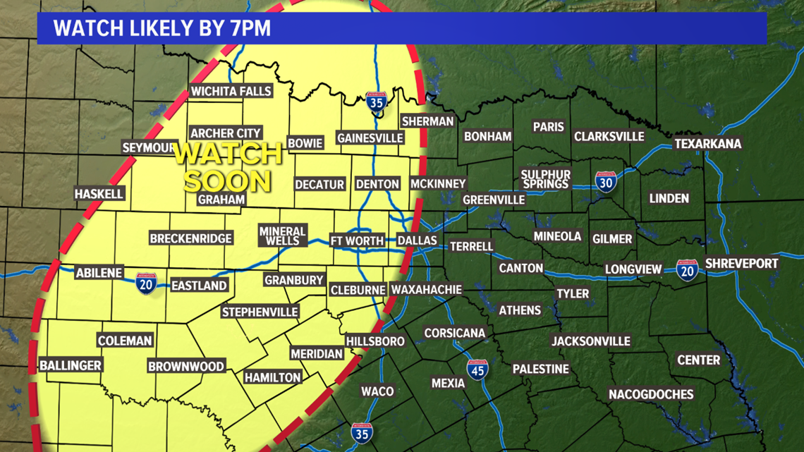
6:15 p.m: Severe Thunderstorm Watch issued until 2 a.m.
This is for most of North Texas, including Dallas, Tarrant, Collin, and Denton counties, along with western parts of North Texas.
Here's the coverage map:
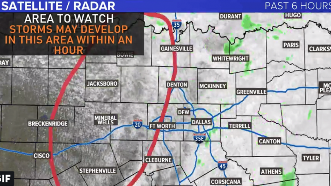
6 p.m: Thunderstorms will likely develop over the next 1-2 hours
A few storms have tried to form so far this evening, but have struggled. Now that more upper-level support is arriving, and the dryline is getting closer, thunderstorms will become more likely through the evening into nighttime hours. The circled area is an area that will likely become a Severe Thunderstorm Watch before 7 p.m. Timing for the DFW area still looks best from around 8 p.m. to midnight. Can't rule out an isolated thunderstorm before then, but that looks to be the most likely window.
5 p.m: Development west of DFW
Our weather team is monitoring towering cumulus clouds west of Dallas-Fort Worth, in the area of Palo Pinto and Jack counties. This is where we could see our first development of storms, which will quickly become severe and bring the threat of large hail.

4 p.m: Possible storm development in 1-2 hours
We knew the storms could develop in the western parts of North Texas after 5 p.m. – now we're seeing that on the radar. Below is the an area to watch for thunderstorm development, which could become severe between 5 p.m. and 6 p.m.

With storms forecasted to hit Dallas County this evening, Southwest Airlines announced it would be suspending all flights at Love Field from 6 p.m. to 10 p.m. The suspension would impact about 100 flights.
Fort Worth prepping emergency ops
The Fort Worth Fire Department on Wednesday afternoon was preparing to launch a "limited activation" of its emergency operations center downtown. The center coordinates emergency response across all city departments during severe weather.
When does hail become "severe"?
We're expecting large hail, potentially up to the size of baseballs. Last year, WFAA meteorologist Pete Delkus broke down the different degrees of severity with hail – and when things get bad:
A few delays, closings and cancellations were trickling in Wednesday afternoon. Check the link above for the latest closings submitted to our website.
We'll post others below as we see them.
UT Dallas: Classes canceled this afternoon and evening
TCU: Classes canceled and university closed at 3 p.m.