DALLAS —
Layer up
The mornings continue with the chilly trend the remainder of the week. We suggest adding the layers in the morning and losing a few for the afternoon.
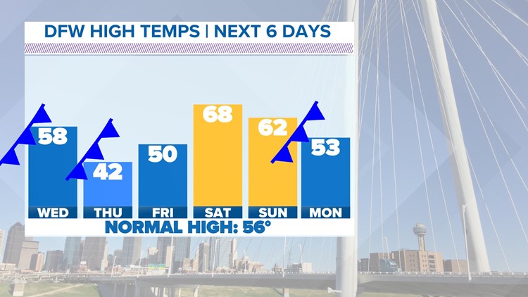
Wednesday morning brings a cold front to help bring down afternoon highs to the upper 50s. A strong north wind can also be expected.
Tuesday afternoons brought the warmest weather of the week so far with widespread 60s. A combination of strong winds, low relative humidity and dry fuels (or extremely dry vegetation) make for elevated fire danger along our western counties. Be sure to avoid any outdoor activities that lead to sparks.
Plenty of ups and downs with temperatures.
A series of fronts keep temperatures moving up and down. While a mild front brings slightly cooler weather for Wednesday, a much cooler, arctic air mass arrives Thursday morning. Temperatures will struggle to climb above the 40s during the day Thursday. The arctic air will bring another widespread freeze to North Texas come Friday morning.

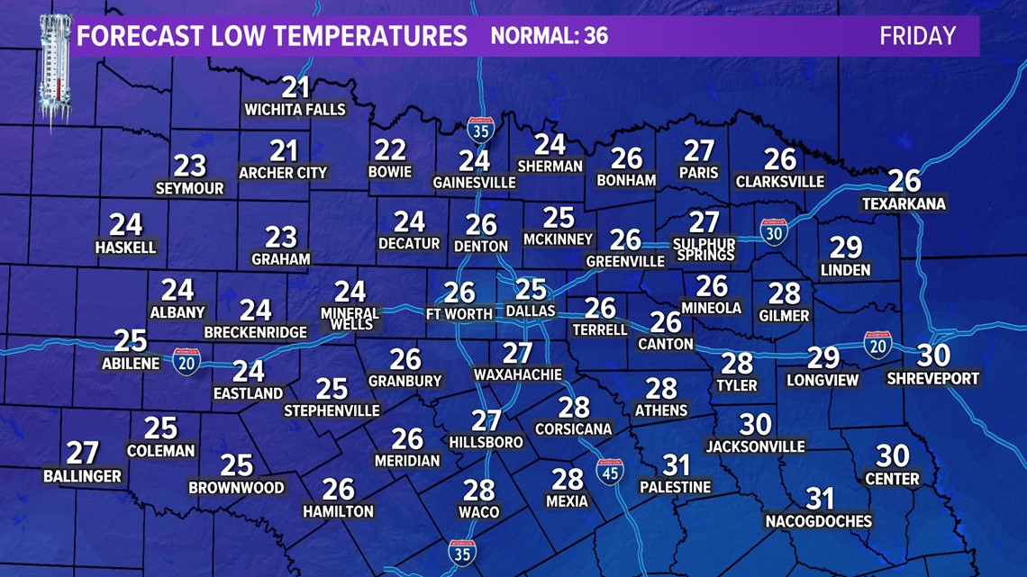
Wind chills will likely be in the teens for our western counties.
Remember the four P's - People, Pets, Plants, and Pipes.


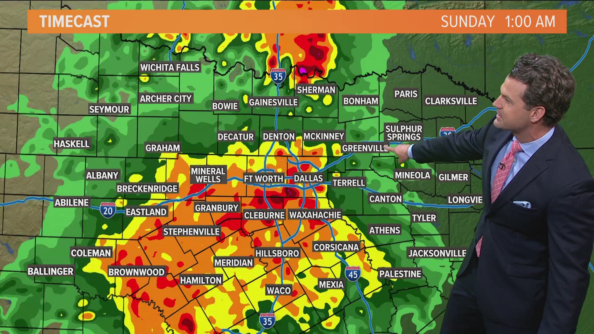
A southerly winds brings temperatures back to near seventy degrees on Saturday. Added cloud cover and moisture from the south may produce light rain for our far eastern counties on Saturday. Another front swings through late weekend to bring another cool down for the beginning of the next work week.