Monday (MLK Day)
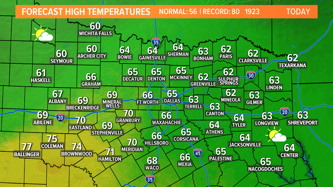
One last quiet and sunny day on Monday. It will be warmer too with afternoon highs climbing into the 60s for most places.

Rest of This Week
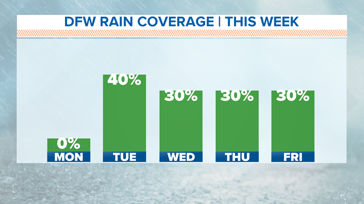
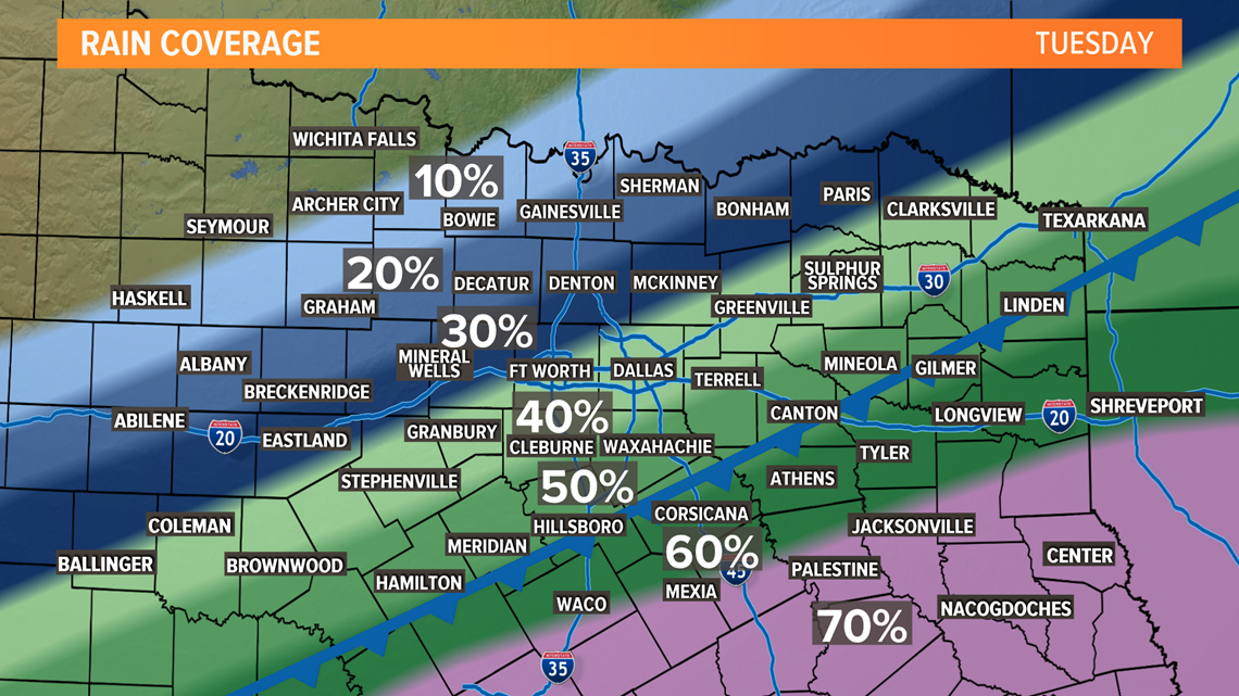
Clouds and rain chances return on Tuesday. A cold front will move into the area and scattered showers will be possible during the day along with cooler temps.
Best chance for rain on Tuesday will be across the southern half of North Texas. D-FW rain chances will be confined mainly to the morning, and an all day rain is very unlikely.

Then daily chances for rain will continue the rest of the week and perhaps even into this weekend and the early part of the following week.
North Texas gets stuck in a pattern where disturbances will move overhead, and each disturbance could bring rain to the area.
Will it rain all day, every day, everywhere, each day next week? No.


But somewhere in North Texas has a shot at rain each day starting Tuesday lasting through the end of the weekend.
As we move through the week, the timing of those disturbances will become more clear, and we will have a better idea of each day's rain coverage.
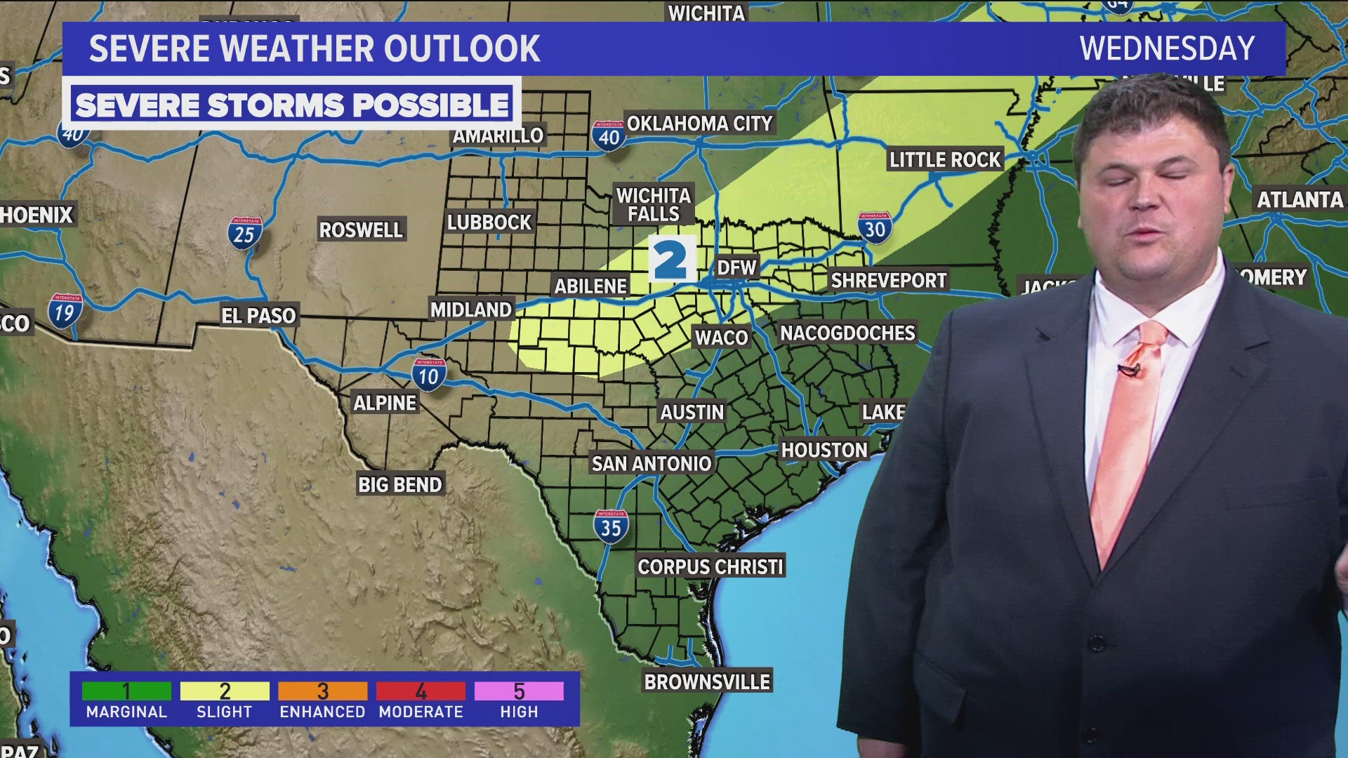
Wintry weather looks very unlikely and severe weather chances look very low as well. So it just looks to be a cool and rainy pattern for us.

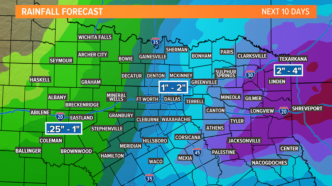
When it is all said and done, around 1" to 2" of rain is possible across the area with higher totals to the east and lower totals to the west. Of course, those totals will be fine-tuned as we get closer.
Keep checking back for updates!
Remember to download the WFAA app to check one of our dozens of local radars near you as well as the latest forecast, cameras and current conditions.