DALLAS — Some showers will linger through the morning hours on Sunday, but sunshine will return for most before the day is done!
Let's take a look at the timing.
Sunday Morning
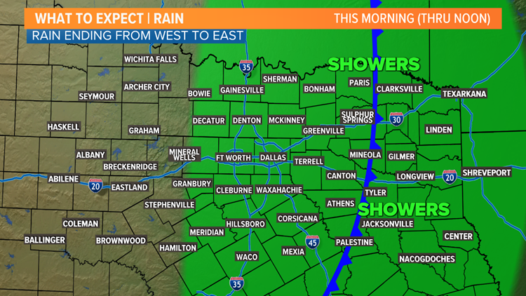
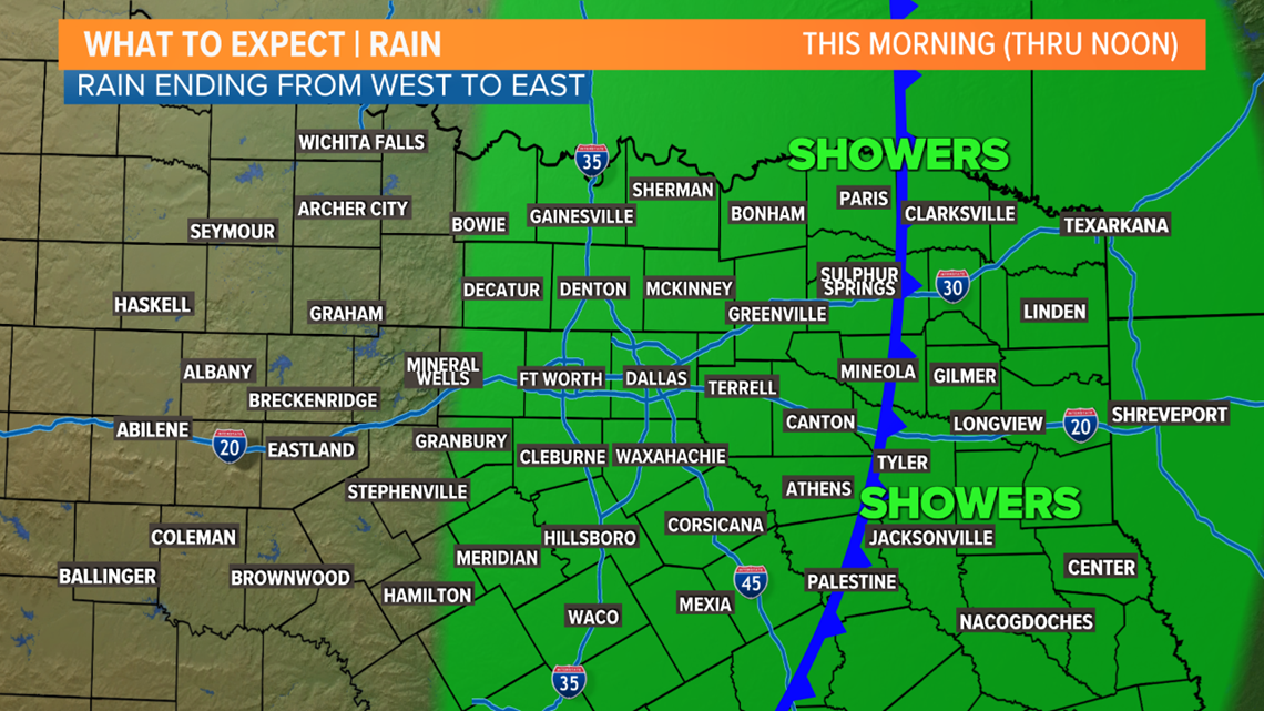
Lingering scattered showers are possible mainly from the Dallas-Fort Worth area to the east through Sunday morning.
Most rain will be in the form of showers, but can't rule out an isolated thunderstorm or two. Not everyone will see rain, but don't be surprised if you see a brief shower before the morning is done.
Showers will end from west to east through the morning with most places dry by midday into the early afternoon.

Sunday Afternoon
Any rain will continue to move east with sunshine breaking out from west to east across the area as well.
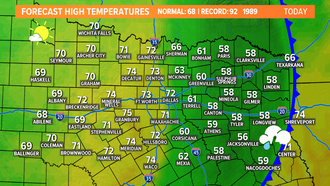
Western North Texas should see a good amount of sunshine during the afternoon with the D-FW area seeing sun from mid-afternoon onward.
The afternoon will be breezy and mild with high temps climbing into the 60s and low 70s if you see sun. Areas east of D-FW will likely not see much sun, so high temps may only be in the 50s to low 60s.

Monday morning
Finally a return to cool and less humid weather.
With clear skies overnight, temps will fall into the 40s to low 50s by Monday morning. Much more comfortable and seasonable for this point in the year.
The week ahead
Monday and Tuesday will both be warm with highs climbing into the upper 70s to low 80s both days. Monday will feature a good deal of sunshine, but clouds will return to North Texas on Tuesday.
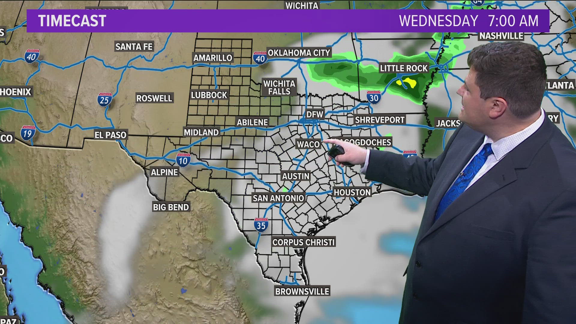
Those clouds set the stage for another chance for showers and thunderstorms mainly Tuesday night into Wednesday morning.
We'll be watching that round of thunderstorms because it is possible that a few storms could become strong to severe with a wind and hail threat.
A passing cold front will bring an end to any rain with cooler and even below normal temps returning late this week.


Remember to download the WFAA app to check one of our dozens of local radars near you as well as the latest forecast, cameras and current conditions.