LEWISVILLE, Texas — When I think of lake effect snow and some truly "Great Lakes," I don't think of Lake Erie, Lake Michigan or Lake Ontario. No. I think of Grapevine Lake, Ray Hubbard and Lake Lewisville!
But seriously, when lake effect snow ferociously blows off of Lake Erie and Lake Ontario, it can BURY Buffalo or Syracuse in FEET of snow. Meanwhile, here in North Texas, little flurries of glitter gently fall from the sky and softly land on the concrete jungle of the metroplex.
Some of those flurries turned into decent bursts of snow with totals well over 1in just south of our local lakes.
Officially DFW Airport picked up 1.3in of snow Sunday night into Monday morning. DFW Airport sits south of Lake Lewisville and lake-effect snow off of that lake likely contributed to higher totals and surrounding communities.
How does lake effect snow form?
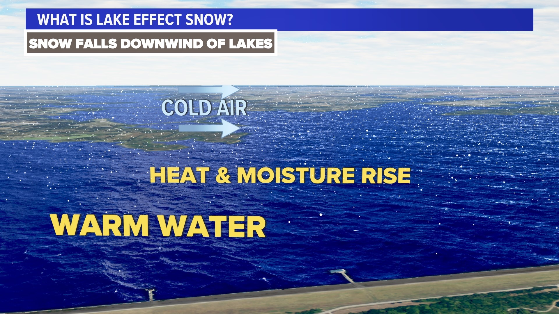
The key ingredient is a temperature contrast. When a frigid air mass (like the one we have in place) sweeps across the relatively warm waters of our lakes, the lower atmosphere undergoes a transformation. The cold air picks up moisture from the lake's surface and brings it upward. This motion, fueled by instability, is a crucial step in the formation of snow.
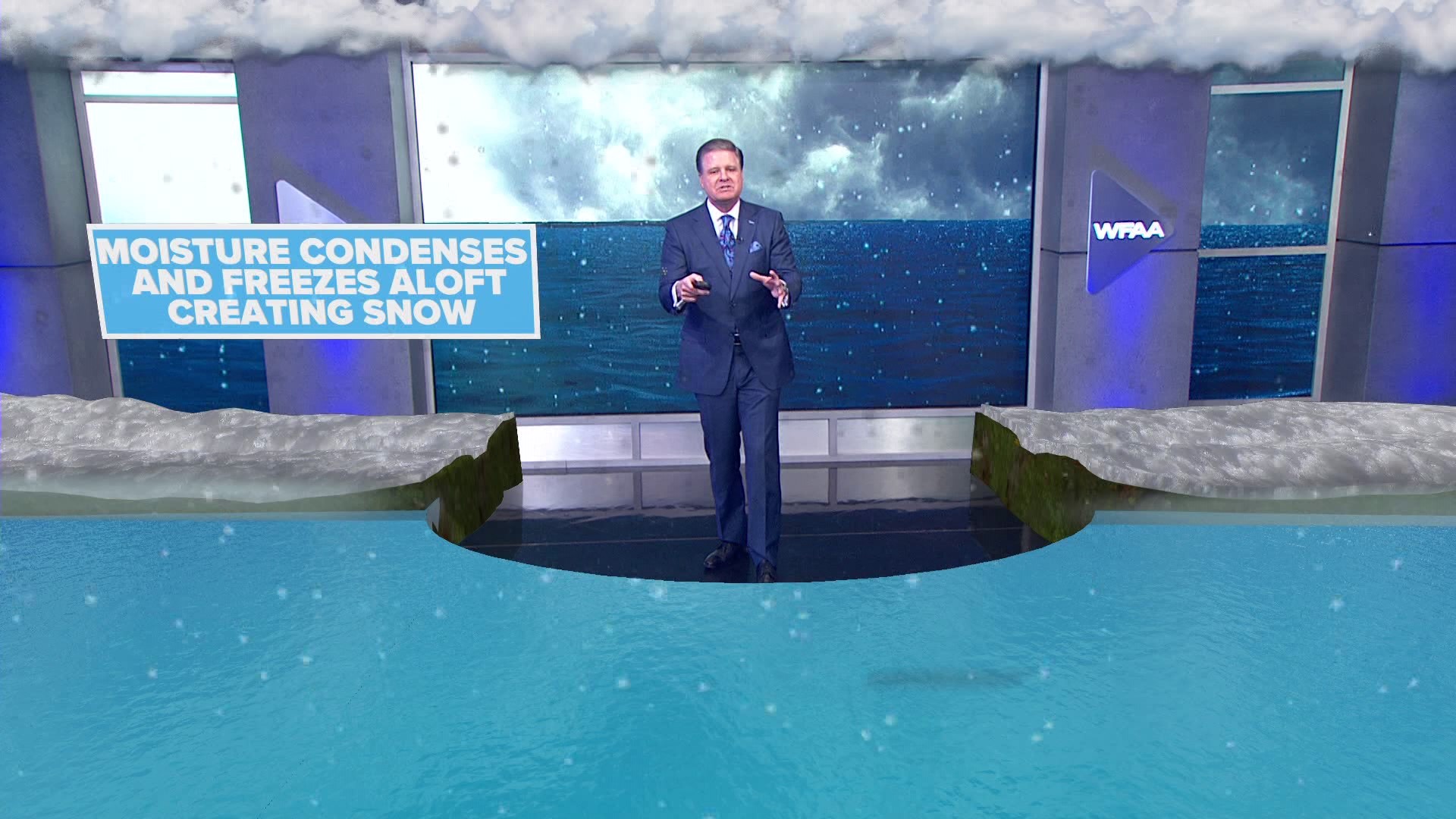
As the moist air ascends, it cools. This cooling condenses the water vapor into tiny droplets, which then freeze into ice crystals, forming the seeds of future snowflakes that blow with the winds sweeping across the lakes.
In North Texas, we had a decent breeze almost straight from the north. Lakes that are oriented mostly north to south were the most efficient lake-effect snow producers (Ray Hubbard, Eagle Mountain, Lavon, Lewisville, Joe Pool, etc.) since the wind traveled over those bodies of water for a longer amount of time.