
DALLAS — Be sure to download the WFAA app to track the latest forecast and get alerts from our team.
Here's a look at the forecast this week!
Versión en Español: Temperaturas récord esta semana. Algunas áreas podrían alcanzar los 90 grados en febrero.
Quick Facts:
- Warmer than normal rest of this week
- Storm chances at times, some could be severe
- Much cooler weekend
Staying warm for now
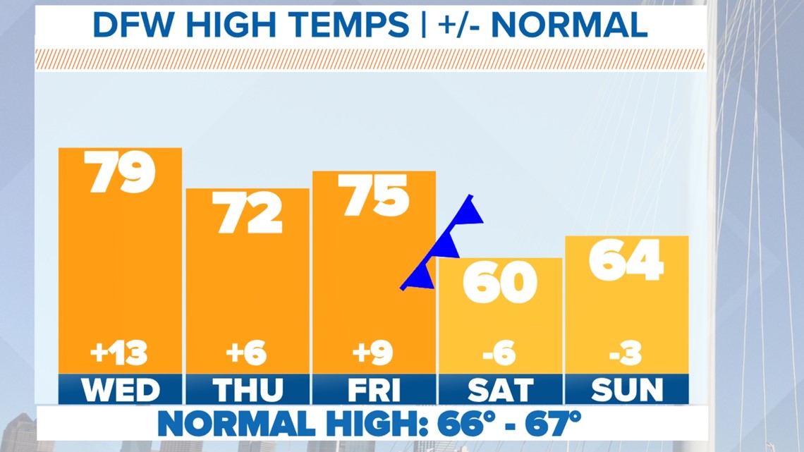
Temps stay very spring-like the rest of the workweek with highs above normal and in the 70s.
Changes arrive just in time for the weekend with highs back below normal Saturday and Sunday. Nothing frigid, but definitely cooler than this week.

Rain and severe weather chances
Wednesday - Wednesday night
The daytime hours will be dry on Wednesday and even the evening and early nighttime hours will be dry for most as well.
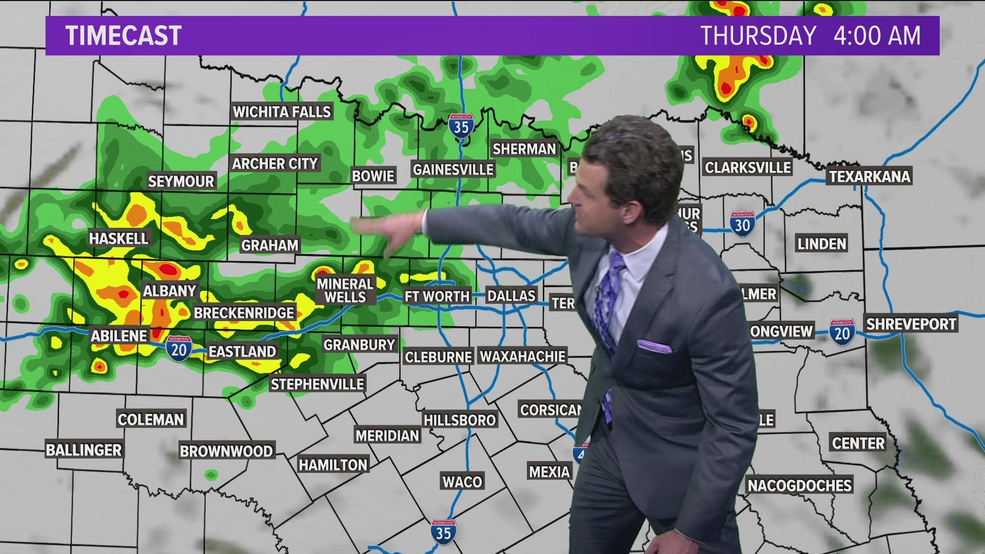
Isolated to scattered thunderstorms will develop southwest of DFW during the late afternoon into early evening hours. They will drift north/northeast during the evening into the nighttime hours with some potentially moving into the DFW during the late night hours Wednesday into Thursday (10 p.m. - 2 a.m.).
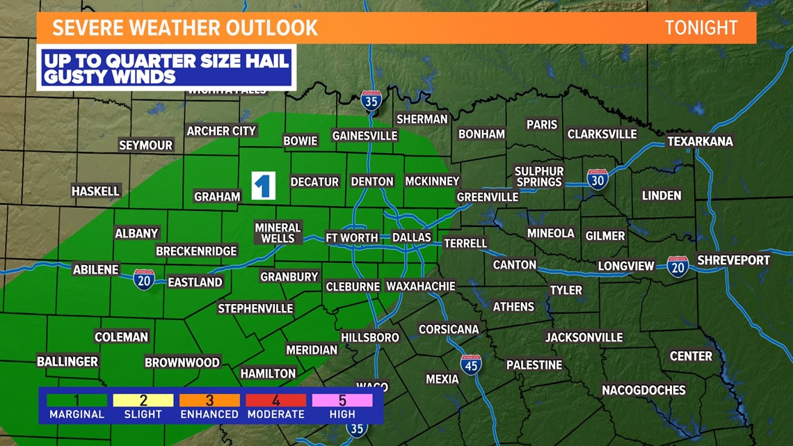
A storm or two could be strong to severe with up to quarter size hail and strong wind gusts, but the overall severe threat is low.


Thursday - Thursday night
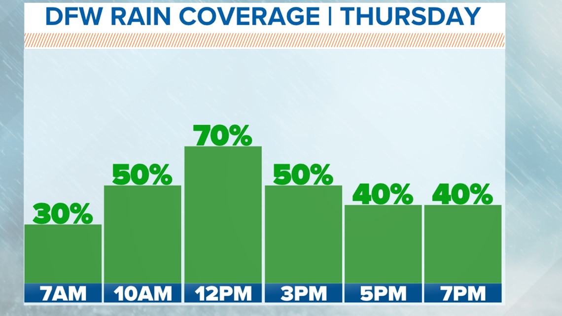
Scattered rain will be around to start Thursday, but the severe weather threat will be very low. On and off rain will be possible during the day Thursday. It won't rain all day long or constantly everywhere, but rain will be out there.
Another round of thunderstorms will develop west of DFW Thursday evening into Thursday night and those will move west to east across North Texas Thursday night. That round could have a better chance at being severe with up to quarter size hail and damaging wind gusts.


Friday
The day will start off with scattered rain, but the trend will be for rain to move east and out of North Texas during the day. Most places will be dry Friday evening into Friday night.
Before storms move out of North Texas Friday morning into early Friday afternoon, it is not impossible for a few to be severe with hail and wind. Better chances for severe weather will be east of North Texas during the afternoon into evening.


14-day forecast


A look back at the winter season...