DALLAS — The severe weather threat is over for now. But more is possible across North Texas later this week.
Versión en Español: Sol para empezar la semana, pero tormentas para el fin de semana
Quick facts:
- Dry overnight and quiet Monday
- Patchy dense fog possible Monday morning
- More storms possible later this week
It was a busy week last week, but we are getting a much-needed break to start the workweek.
The tornadoes
Updated Saturday (April 28th) evening The National Weather Service in Fort Worth was out surveying damage after Friday’s storms and says they preliminarily found evidence of at least ten tornadoes in Central Texas into North Texas.
- EF-0 (peak winds: 80mph) near Gholson
- EF-1 (peak winds: 95mph) near Gholson
- EF-2 (peak winds: 115mph) near Tours
- EF-0 (peak winds: 75mph) near Tours
- EF-1 (peak winds: 105mph) near Penelope
- EF-1 (peak winds: 110mph) near Navarro Mills Lake
- EF-1 (peak winds: 110mph) near Barry and Emhouse
- EF-1 (peak winds: 95mph) near Abbott
- EF-0 (peak winds: 75mph) near Rice
- EF-0 (peak winds: 80mph) near Frost


The rain
North Texas saw another serious soaking of rain. Some locations in between these observation sites, especially southeast of the metroplex, saw as much as 7"-8" of rain. This lead to instances of flooding.


Monday
Finally a break. The only thing that could cause issues on Monday is the patchy dense fog that's in the forecast Monday morning. After the sun comes up, we expect it all to burn off by late morning leading to a sunny and warm, and MOST importantly QUIET, Monday.


The rest of the week
More showers and thunderstorms are in the forecast as we get into the middle of the week. Our first shot will be as soon as Tuesday night and Wednesday. At this time, a few strong storms can't be ruled out on Wednesday, but the severe threat looks to be much lower than it has been recently. More showers and storms are in the forecast the rest of the workweek and possibly even into the weekend. Overall the severe threat looks lower, but stay updated on any changes.
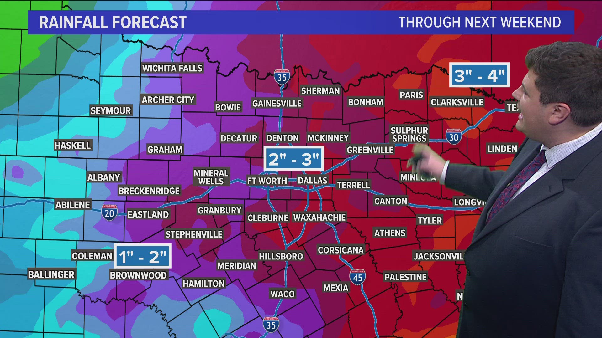
Outside of the severe risk we are expecting another decent soaking of rain for most of the area. Here's a look at projected totals though next weekend.


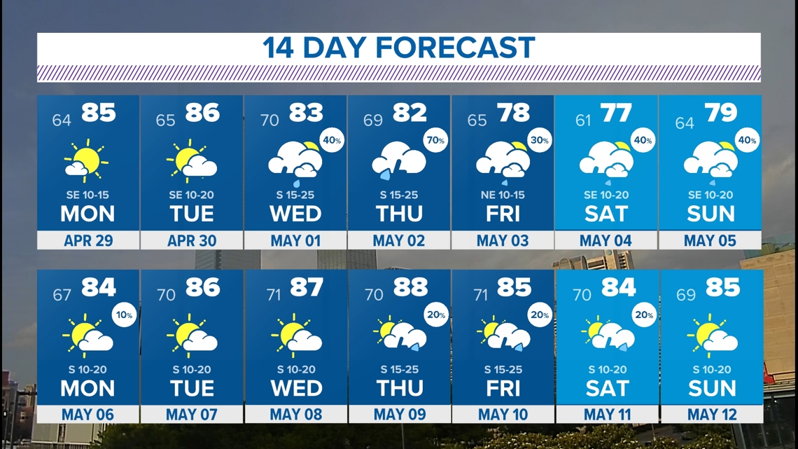
14 Day
You can see the unsettled weather return in the 14 day forecast.