DALLAS — It's a nice change, isn't it?
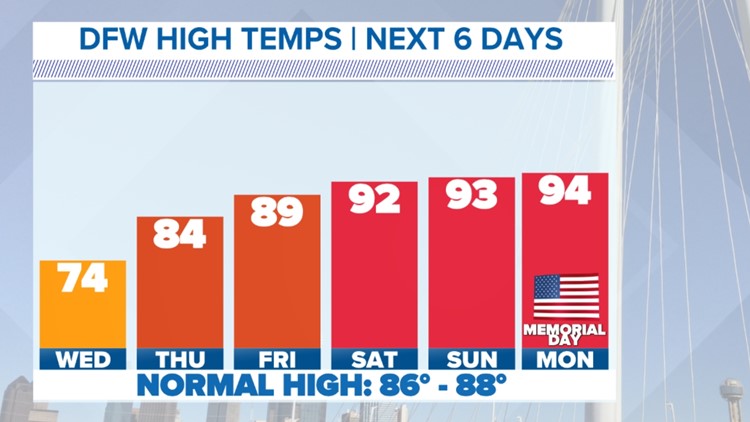
Temperatures over the next several days will be cooler than average across North Texas. After that early season heatwave, it's going to feel great. Highs will top out from the mid-70s to the 80s through the middle of this week. Memorial Day Weekend looks warmer with sunshine and highs in the low 90s.
El clima en español: Las probabilidades de lluvia han llegado: Esto es lo que esperamos para la semana
LIVE RADAR:
Rain Tuesday night, dry by Wednesday morning
Widespread rain will continue in North Texas through the late night hours Tuesday night. The severe threat is very minimal the rest of the night in North Texas.
Widespread rain will slowly end from west to east with most of North Texas dry by daybreak Wednesday morning.
Some lingering showers are possible in a few locations to start Wednesday but most will be dry.
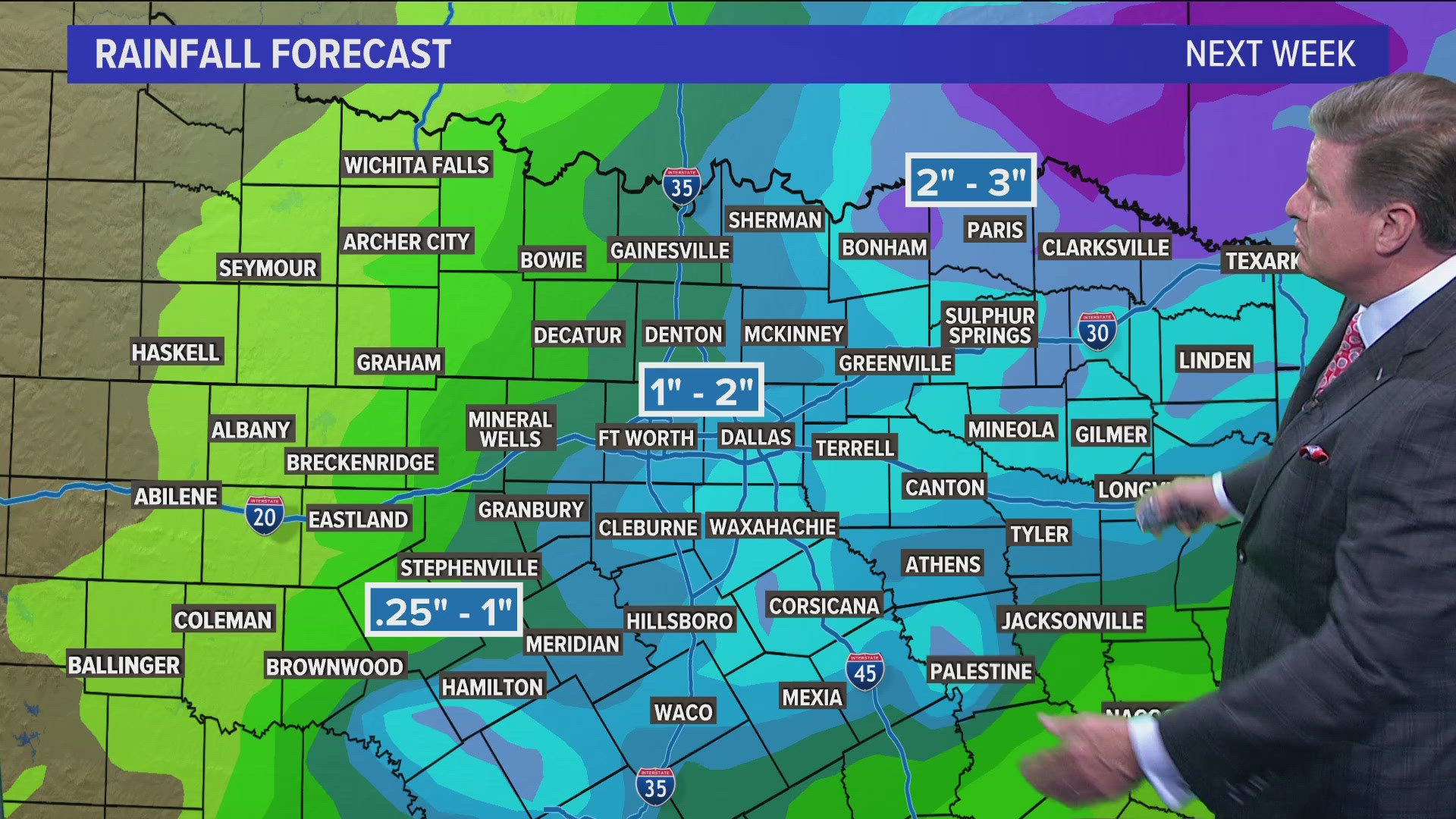
When all is said and done, widespread 1-3-inch amounts are possible across North Texas. Isolated higher totals are possible east of the metroplex.


Areas east of D-FW are under a Flood Watch because higher rain amounts are possible in those locations. Drought conditions are also not as bad in those locations as well, so that could cause isolated instances of flooding.