DALLAS — Be sure to download the WFAA app to track the latest forecast and get alerts from our team.
Versión en Español: Es possible queue see produzcan tormentas este fin de semana
Quick facts:
- Widespread rain for Mother's Day
- Low risk of severe storms
- More storm chances Monday with a threat of severe weather
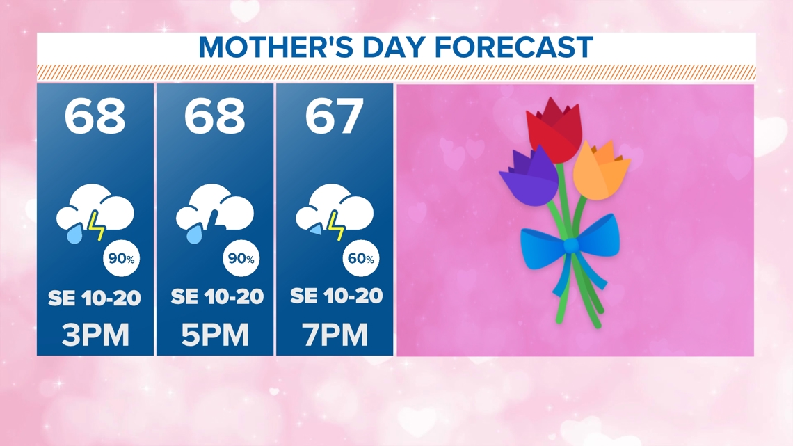
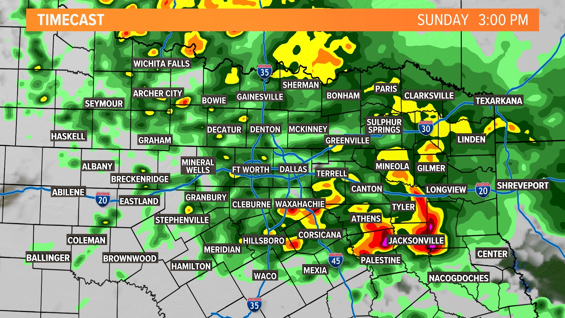
Mother's Day
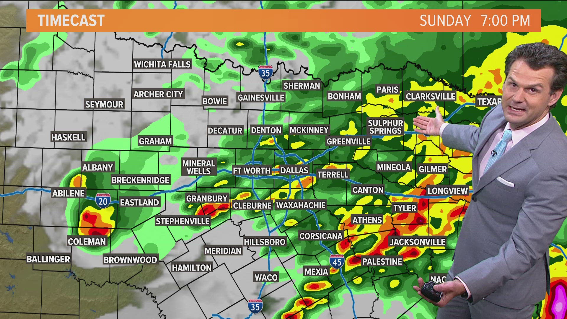
Rounds of rain will continue across North Texas the rest of Mother's Day. The highest coverage of rain during the day looks to be through early evening. Coverage will decrease as rain moves out or ends this evening into tonight. If you have any plans, make sure to have the umbrella and stay dry!

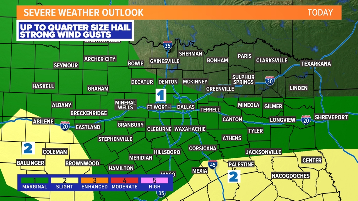
While thunderstorms are possible, most of North Texas will see a minimal severe weather threat. Can't rule out a few storms North Texas with a hail and wind threat, but severe weather is not a high concern at this time. Higher chances for storms with hail and wind will be across Central Texas into East Texas.
Rainfall could be heavy at times and that could cause localized flooding issues (see Flood Watch below) in places. At a minimum, standing water or ponding on roads is possible, but typical flood-prone locations could gather water as well. Be careful if out and about during heavy rain!

Rainfall and flooding threat
Totals of are likely for most of North Texas with totals of 2in to 3in possible for areas south of DFW. This is also where the most rain has fallen recently and these areas have also dealt with flooding as well. Therefore, a Flood Watch has been issued from now through Monday for the southern half of North Texas. It does include Dallas and Rockwall counties in the DFW area.
Rounds of rain on Sunday and more rain possible on Monday could cause flooding in these areas. Please never try to drive into or through flooded roadways!


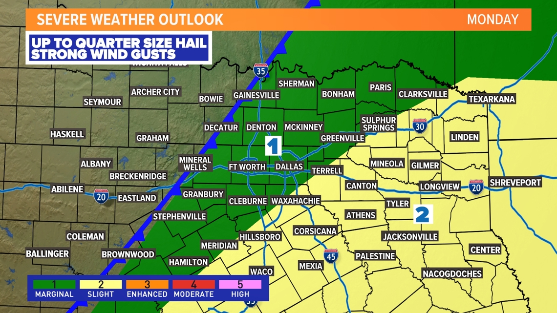
Monday Thunderstorms
Another round of storms is possible on Monday, but this round does not look to be as widespread as Sunday.
Storms may develop along a front moving into the area mainly in areas east and southeast of DFW. The timing looks to be from late morning through mid-afternoon for these areas. A few storms could from in and around the DFW area during that time but chances are low.
Any storms that form will have a chance to be severe with a threat for large hail and strong wind gusts. Once again, best chances for severe storms are across eastern North Texas. Any storms with heavy rain could continue to cause flooding areas that saw the most rain on Sunday.
Rain will clear to the east through the day with even some sunshine possible from DFW to the west during the afternoon into evening.

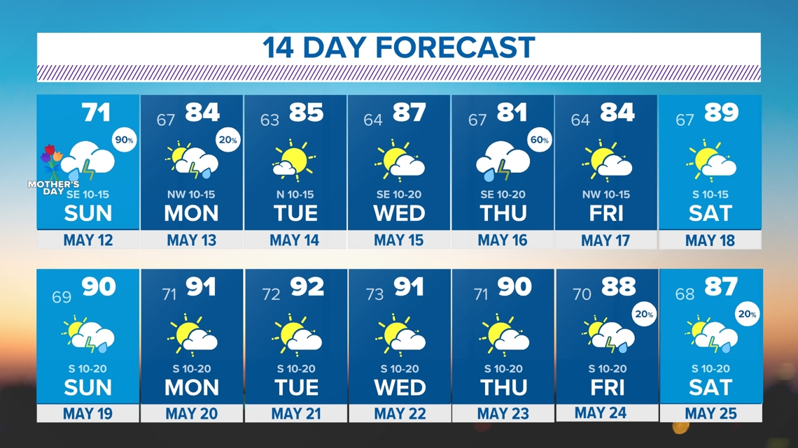
14 Day Forecast
The pattern may start to calm down in the second of the 14 day. BUT.... the warmth looks to crank up. Are you ready for more 90s?