DALLAS — Versión en Español: Aquí está el último pronóstico para la primera semana de otoño
Quick facts:
- Triple digits are gone, but above normal temps remain for now
- Big chances are coming
- First strong, fall cold-front and better rain chances in the forecast
The change many have waited for
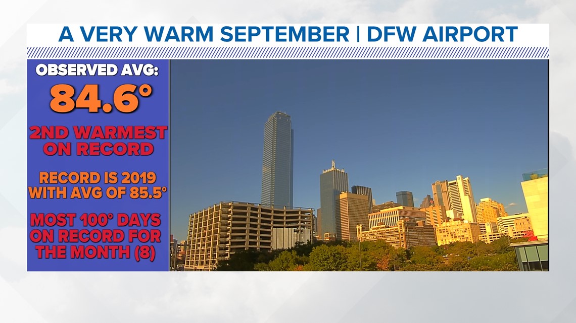
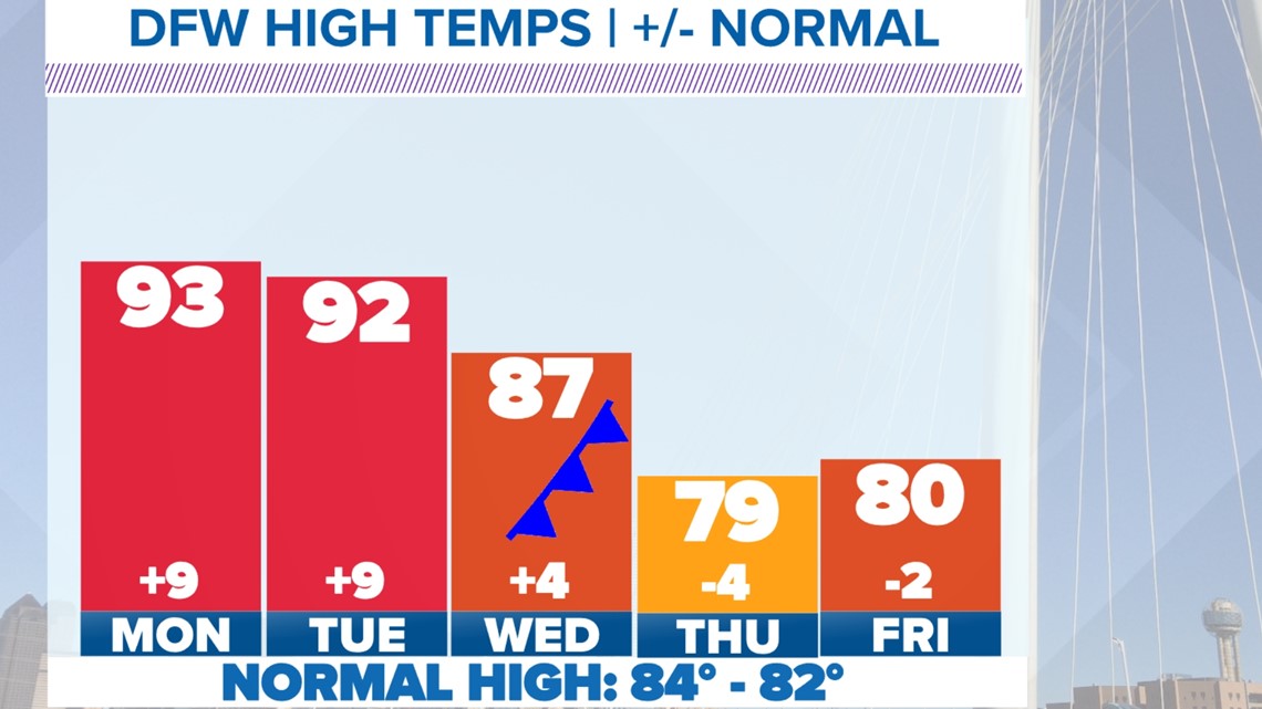
The summer was miserably hot: it was the third hottest on record. September was miserably hot, it was the 2nd warmest on record with eight triple-digit days. And that's the most ever! Needless to say, many are very ready for a real break, and that's on the way! As we take a look into the middle and end of the first week of October, a strong, fall cold front with decent rain chances is coming our way. Here's the outlook and early look at forecast rain totals.


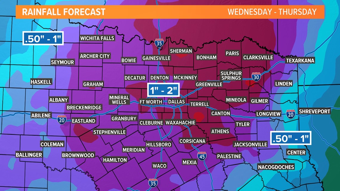
When?
Showers and storms look to return to the area this week. Timing for highest coverage looks to be later in the day Wednesday into Wednesday night. On Tuesday, a few showers or storms may move into western North Texas, but most places will be dry. Lingering showers and storms are possible to start the day on Thursday. As always, this far out, it's too soon for exact timing, coverage, and severe risk. But it does look like this is NOT a significant severe weather event. There's a chance of a few stronger storms with some wind and hail, but the way it looks now significant severe weather does not look likely.


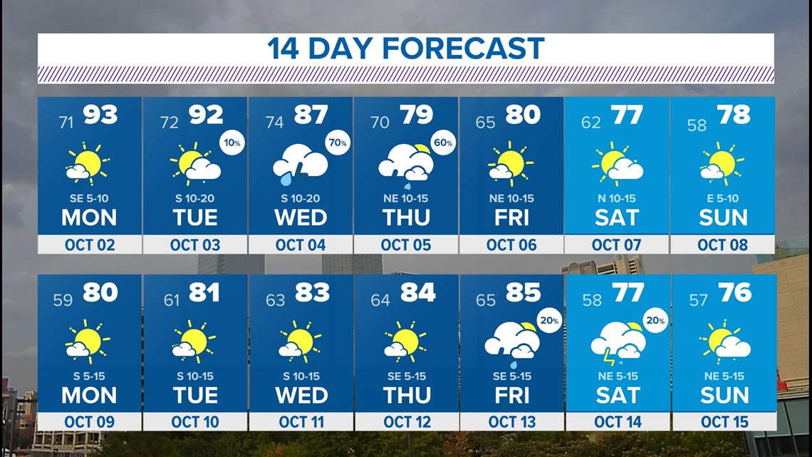
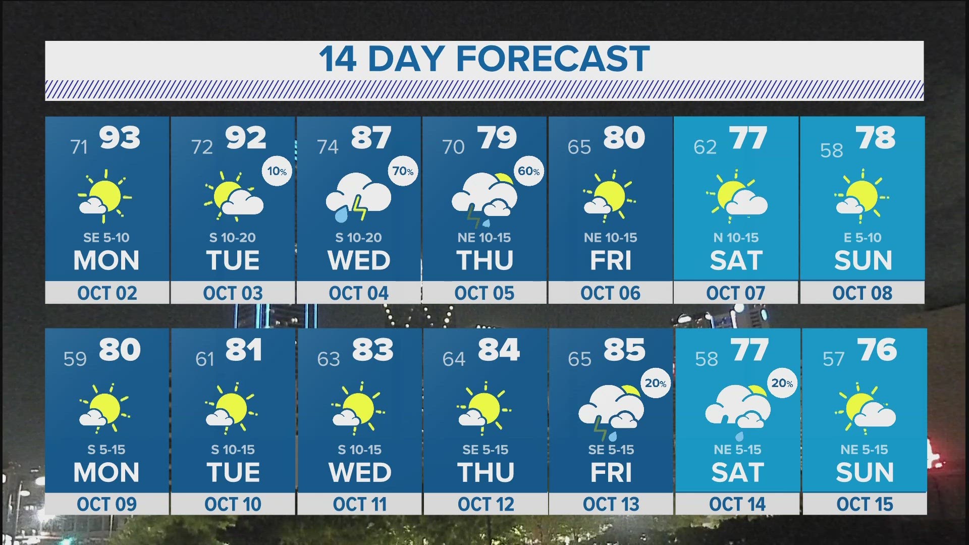
14 Day Forecast
You'll see the pattern change we just discussed reflected in the 14-day forecast. Great-looking highs in the 80s and even some 70s are possible late in the week into next week! Morning lows will likely be the coolest we've seen so far this fall especially by next weekend.