DALLAS — A HUGE change is on the way starting tonight and you need to be ready for it.
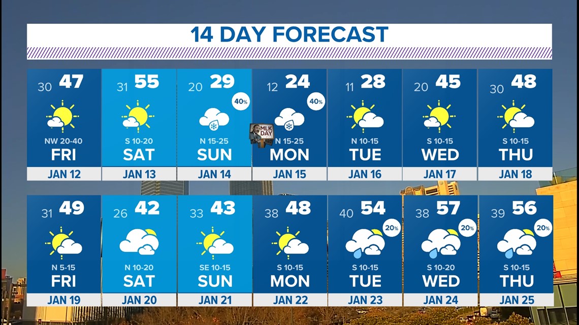
Here's a look at the forecast over the next week:
Quick Facts:
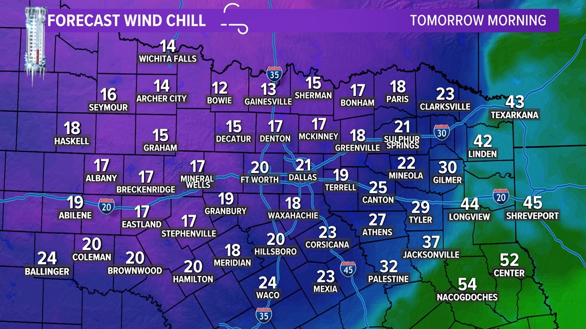
- Wind chills in the teens after overnight storms
- The coldest temps of the season arrive early next week
- Watching the potential for wintry weather Sunday into Monday
Cold Front #1
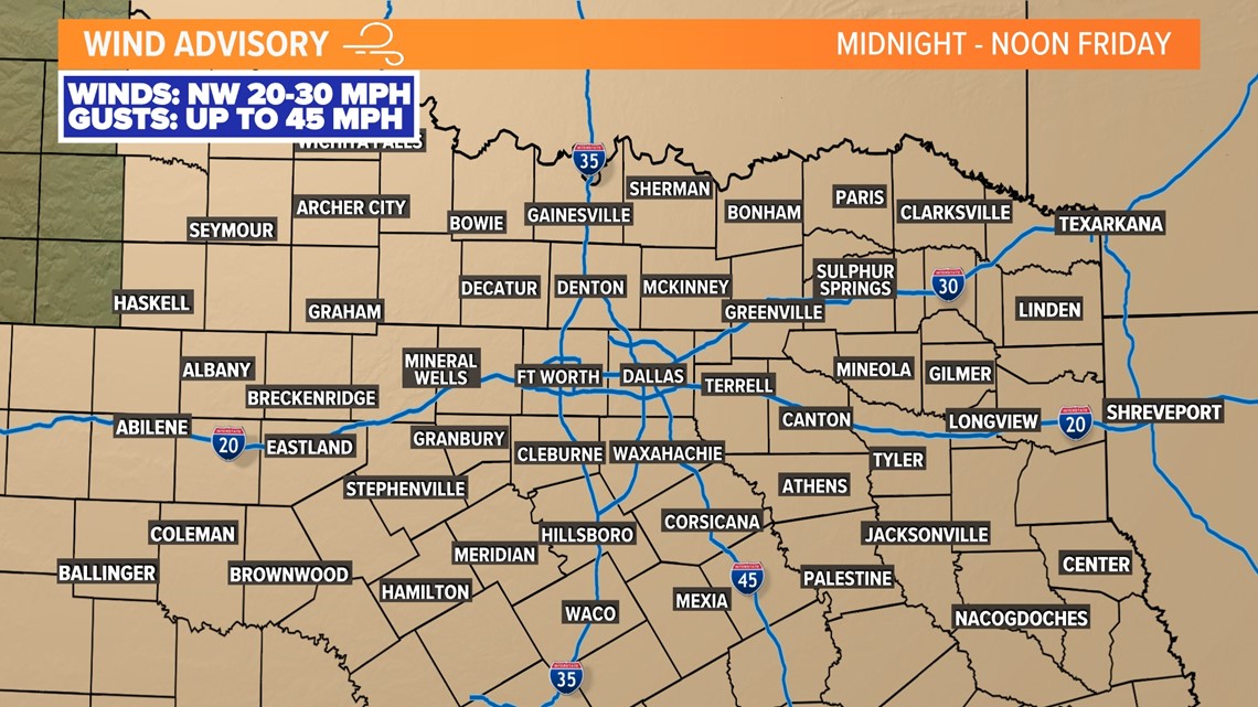
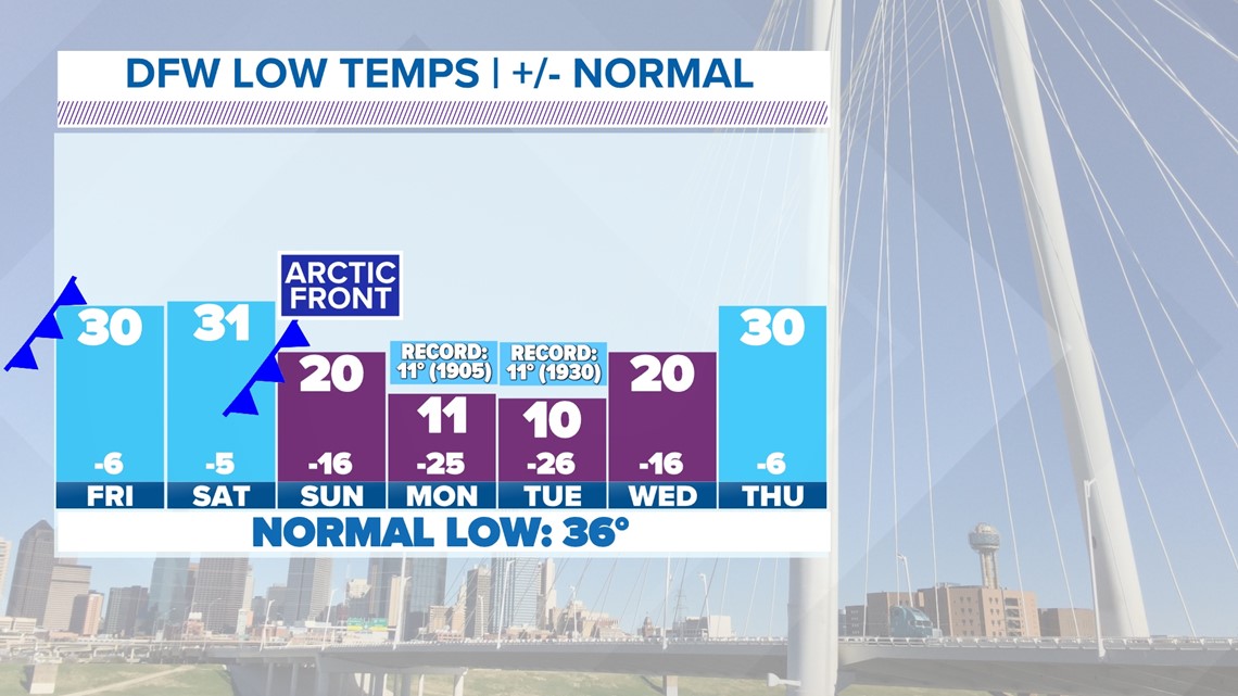
After overnight storms, the rain cleared early Friday morning and the rest of the day will be dry, colder, and breezy! Highs only reach the 40s Friday with morning lows in the 30s and 20s over the weekend. Wind chills in the morning will be in the teens. Don't get caught off guard!

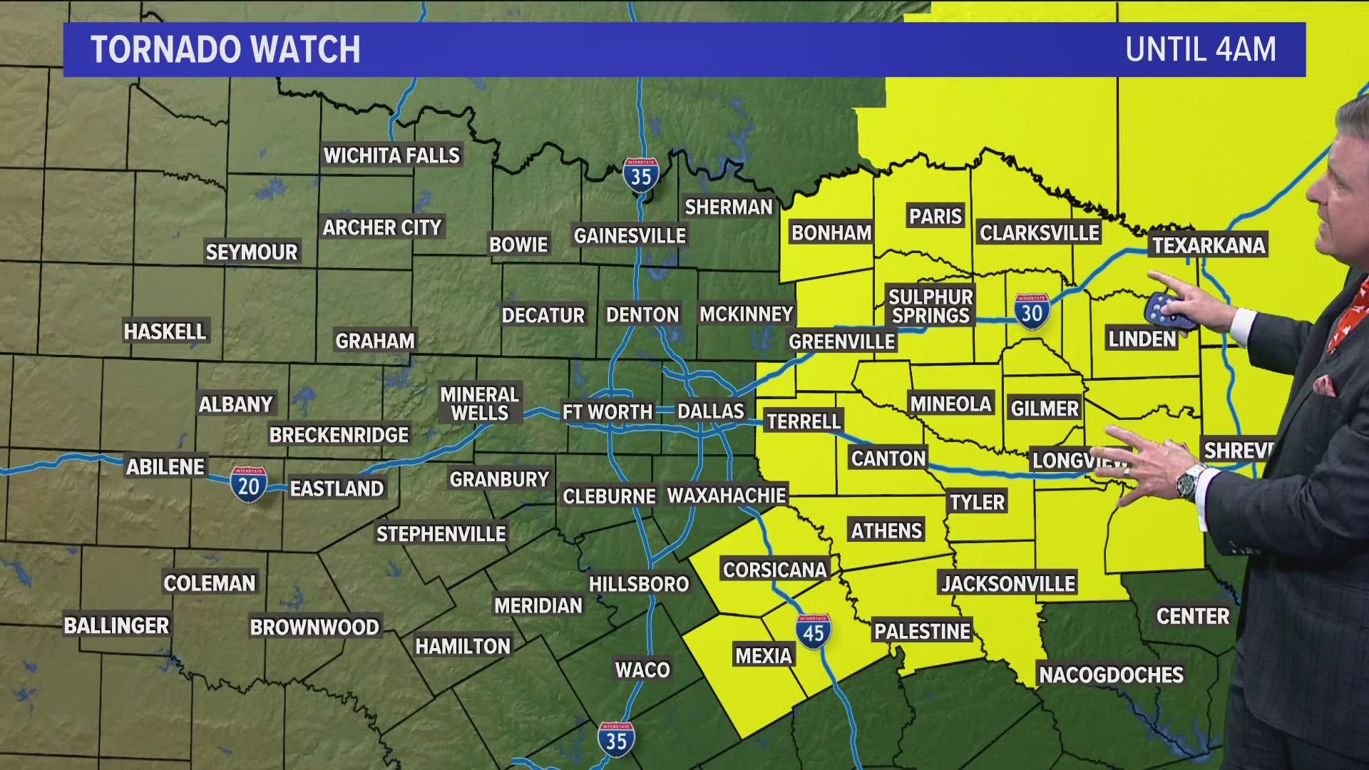
Severe Weather Outlook:


Cold Front #2 (Arctic front & wintry weather?)
This one is a bit more interesting and a lot colder. The arctic front is set to arrive Sunday afternoon into Monday. This is a much stronger push of cold air. Sunday will be cold and windy with even colder air Monday and Tuesday. Morning lows early next week could be in the teens to possibly even single digits. Highs on Monday will likely not make it above freezing.
One thing is for certain...it will be very cold to start next week.
Will it be as cold or will the cold last as long as February 2021? Very unlikely.
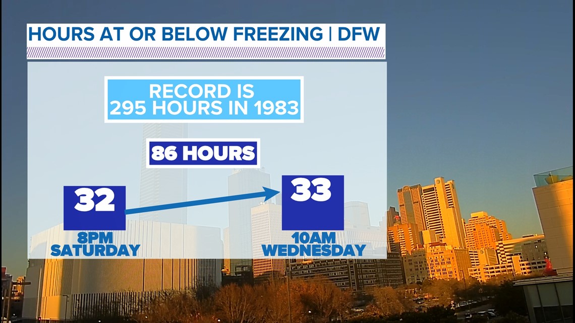
But it will be multiple hours well below freezing and you need to prepare for the cold. We expect it to be about 84 total hours below freezing.

This cold snap looks to be much more similar to the pre-Christmas cold from December 2022 if you remember that event.

Now what about wintry weather?
It's possible. But nowhere close to guaranteed for everyone at this point.
There are some computer model runs and some automated weather apps showing a very dire wintry weather situation for North Texas with multiple inches of snow and a significant amount of ice Sunday evening into Monday morning.
Guaranteeing any specifics at this point is very unwise, but the potential is there for at least some accumulation, the chances lean heavily in favor of them being light.
Right now, there's a chance for some wintry weather in parts of North Texas. There is a low chance for snow and/or ice for areas along and east of I-35/I-35W. We've broken down who has the best chance to see what Sunday night into Monday. Better chance for snow with accumulations will be along the Red River and down to US-380. Some snow and sleet along I-20 with better ice potential a little farther south. This will shift so please check back for the latest.


As we get closer the weather models will hopefully be in better agreement and a clearer picture of what to expect Sunday into Monday.
14-Day Forecast