
DALLAS — Here's a look at what we're expecting this week:
Quick facts:
- Another round of showers and storms Monday
- A few strong storms possible
- Coldest temps of the season so far by mid-January
Monday storms and rain
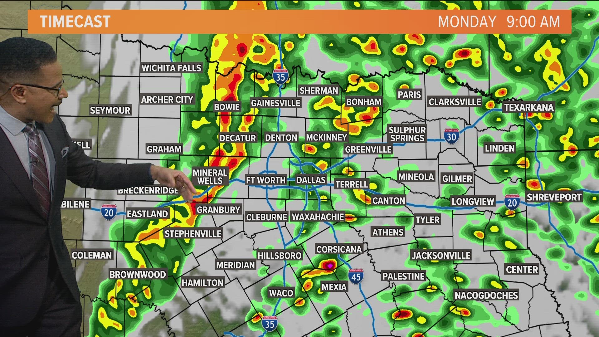
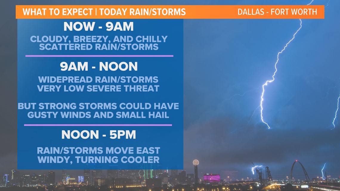
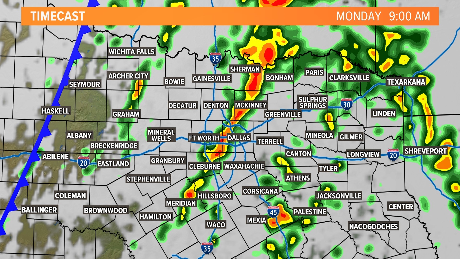
Our next storm system moves in on Monday bringing widespread rain and storms back to North Texas.
For most, rain coverage will be highest through the morning hours with decreasing coverage and mainly dry conditions through the afternoon into evening.
For DFW, the day will start with scattered showers and maybe a rumble of thunder. Rain and storms will increase from around 9 a.m. through noon. Then rain and storms will move east of DFW into the early to mid afternoon.
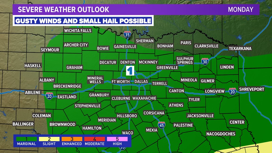
Severe storms are unlikely in North Texas on Monday, but some storms could have some small hail and gusty winds.

LIVE RADAR
Rain timeline:
Severe threat:

Rainfall forecast:


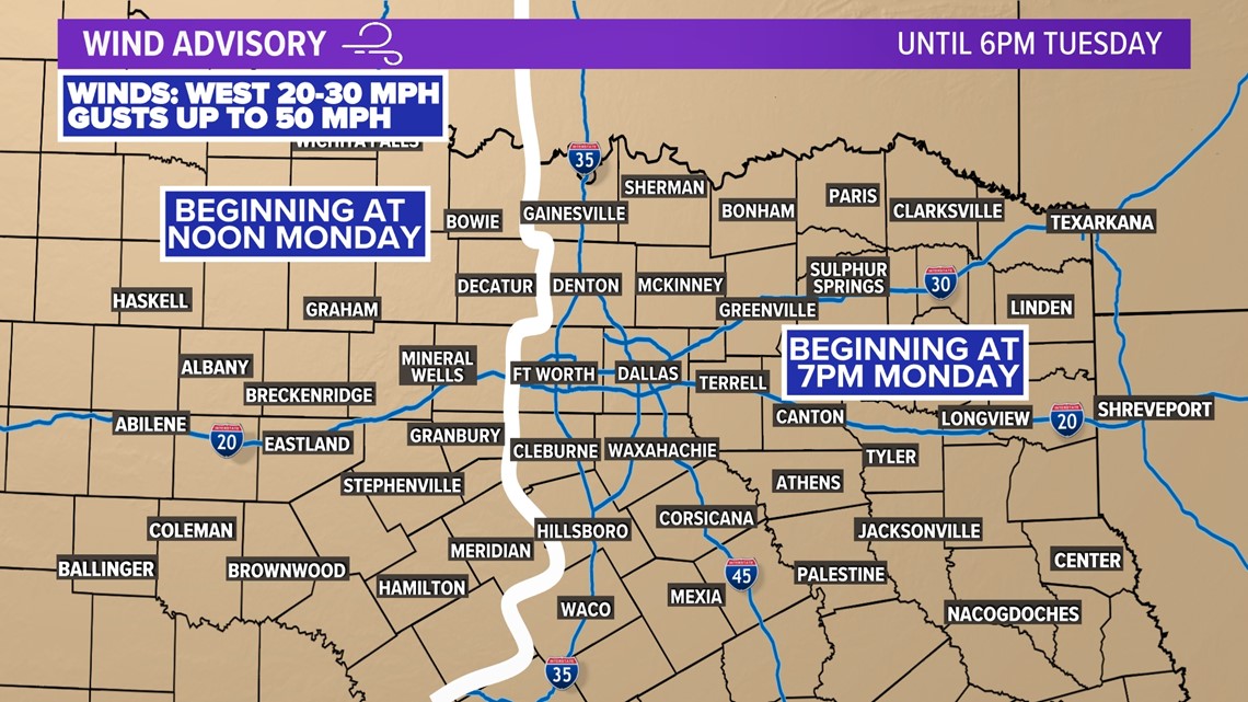
Windy behind the cold front
A wind advisory goes into effect Monday for all of North Texas. Areas west of the metroplex will be first in line for the wind gusts up to 50 mph which is why it begins sooner.

14-day forecast
Colder rain moves in after the rain exits. The cold air will be brief as temps climb back into the 60s for the middle part of next week. Another round of rain is possible on Friday as a stronger front moves into the area.
That front looks to bring the coldest air of the season so far with multiple days with lows below freezing and highs in the 40s (possibly 30s in some places). Right now, the air doesn't look extreme or record-breaking. Just cold. It's winter!
Wintry weather looks to stay out of North Texas as of now, but we'll continue to monitor for any changes.

