
DALLAS — Be sure to download the WFAA app to track the latest forecast and get alerts from our team.
Here's the latest forecast for North Texas this weekend and next week:
Quick facts:
- Storm chances and severe threat Thursday afternoon-evening
- Higher rain chances and much cooler temps this weekend
- Entire weekend will not be a washout
Live radar:
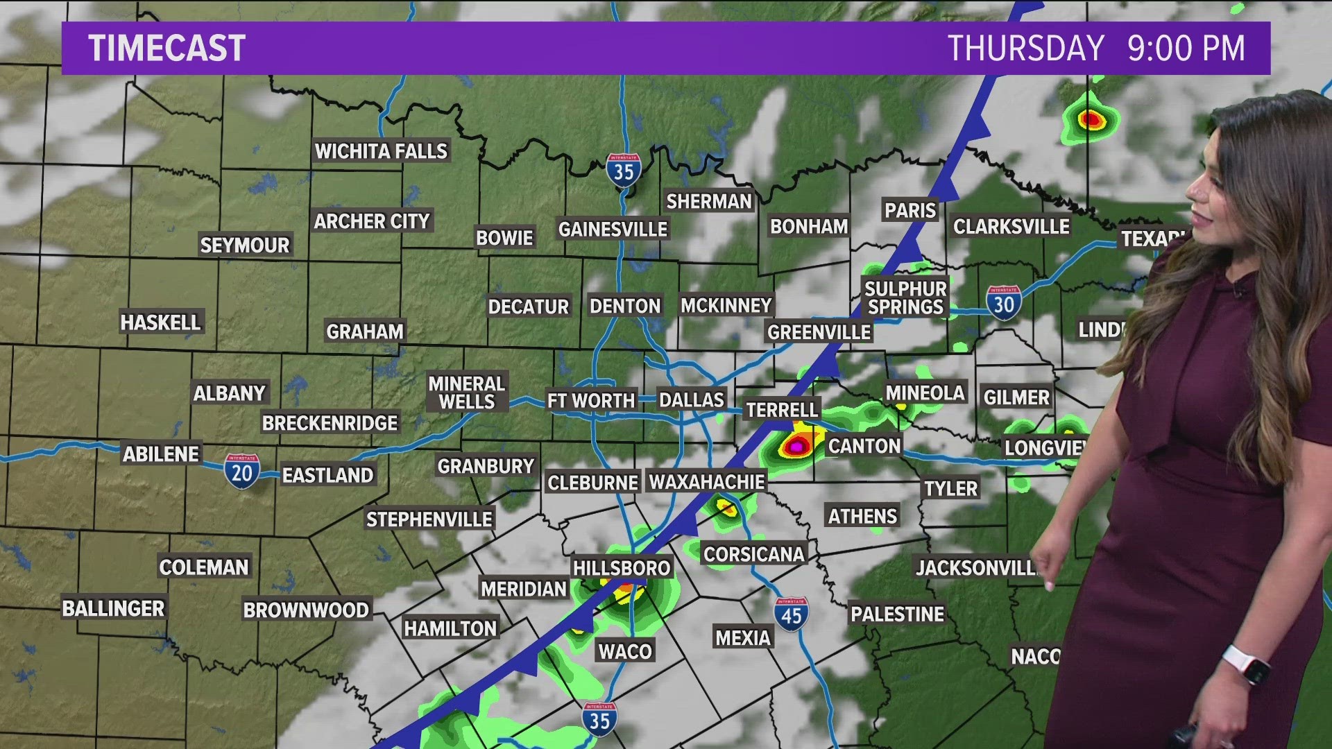
Thursday storm chances
7:30 p.m. Update - The Severe Thunderstorm Watch has been cancelled for Dallas, Collin, and Fannin counties. The threat for severe storms has ended for these areas. The watch still does continue for areas east and south of DFW until 11 p.m.


A strong cap has limited thunderstorm development in North Texas Thursday evening, but isolated thunderstorms are still possible for areas east and south of DFW into the early nighttime hours Thursday.
Any storms that do form will be capable of large hail and damaging wind gusts. The tornado threat is much lower, but not completely zero. Not everyone will see storms or severe weather, but we still expect there to be a few out there through Thursday evening.


Weekend rain
More rain chances arrive this weekend, but the entire weekend will not be a washout. Saturday into Saturday night looks to be the best chance for rain.
On Friday, it is not impossible for a stray shower or storm, but most will be dry. However, rain and storm chances will increase Friday night into Saturday morning
Saturday will see rounds of rain across the area. It may not rain constantly everywhere all day long, but rain will be falling somewhere in North Texas at any point during the day. The severe threat looks very low, but we'll have to watch for the potential of some flooding issues in areas that see the most rain.
Some lingering rain is possible Sunday morning, but looks like anything will move out quickly with a mainly dry Sunday afternoon and evening.


14 Day Forecast

