
DALLAS — An Excessive Heat Warning is in place through this weekend and Red Flag Warnings continue for high fire danger.
Quick facts
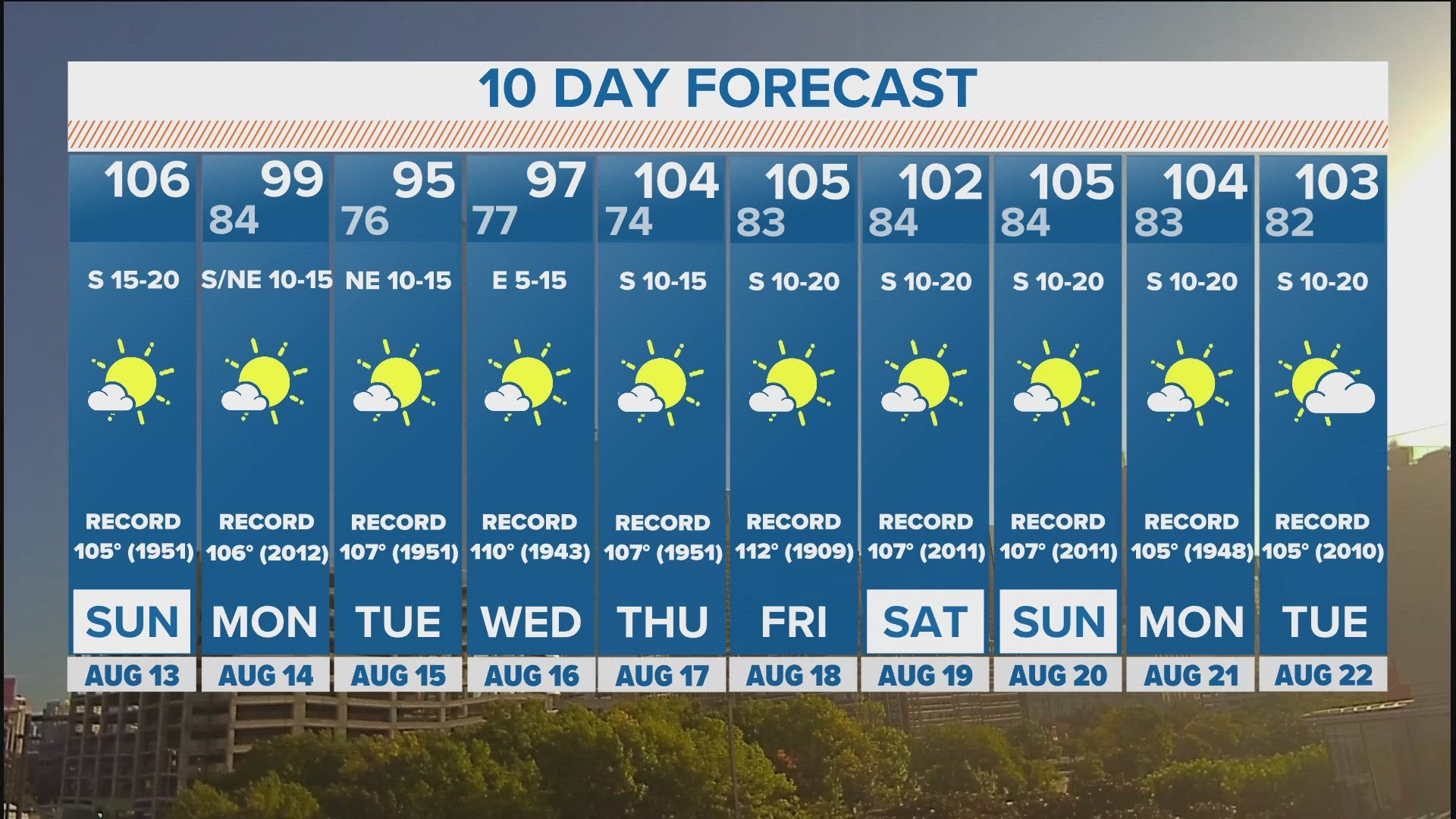
- Record heat possible on Sunday
- High fire threat continues for the foreseeable future
- Brief cool-down arrives early next week
This weekend
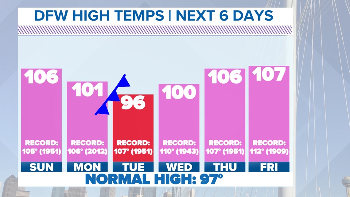
An Excessive Heat Warning will continue for all of North Texas through the weekend. High temps or heat index values will be 105° to 115°.
The record high is 105° on Sunday in DFW set back in 1951. Right now, the forecast high is 106° so record heat is possible.
Continue to practice heat safety as heat like this can be dangerous if the proper precautions are not taken.


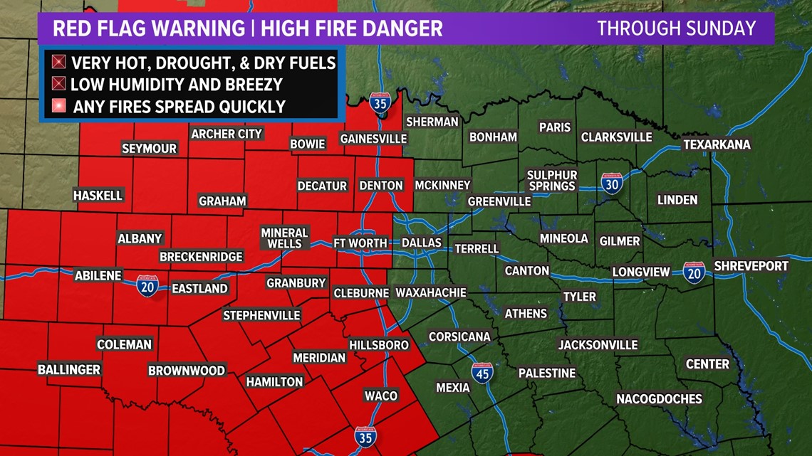
High Fire Danger
Because of drought and dry conditions, most North Texas counties are under burn bans. Always check with your county for the latest information.


Fire danger will continue to stay high this week for areas along and west of I-35. These areas are under a Red Flag Warning. Elsewhere, fire danger is not zero, but it is lower. Continue to practice fire safety all across North Texas!

Cool-down!
Finally! But it will be brief.
A "cold" front will move into North Texas on Monday, but looks like temps will still hit 100°. But the cooler air behind the front will drop temps into the 90s for highs on Tuesday.
Unfortunately, it doesn't look like this front will have a lot of moisture to work with, so rain chances are slim to none as it moves through.

10-Day Forecast

Other weather news: