Might as well bring back JNCO jeans, beanie babies, and The Macarena because the 90s are back!
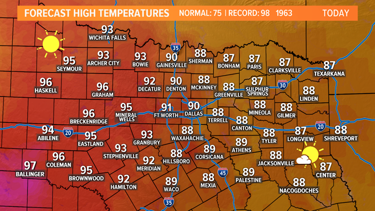
Highs for Wednesday will climb into the upper 80s and low to mid-90s area-wide. It will likely be the warmest day of the year so far, and the first 90° day since early October of last year. Stay cool!
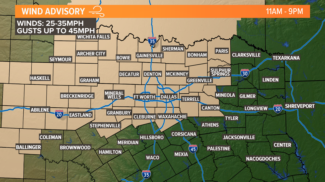
The other thing we will have to deal with Wednesday is the wind. Winds will be gusty from the south especially this afternoon. Sustained winds of 25 to 35 mph are likely with gusts up to 45 mph possible. A Wind Advisory is in place from 11 a.m. to 9 p.m. for most of North Texas.
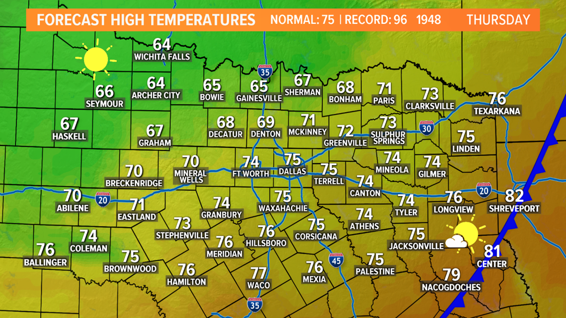
Unfortunately, these warm temps won't last long as a strong cold front arrives by Thursday. This will drop temps by around 15° - 25° in North Texas. This means highs in the upper 60s and low to mid 70s.

THIS WEEKEND
Yep, another weekend with rain. However, the entire weekend will not be a washout. Widespread showers and storms are likely on Saturday, but it will be dry and cool for Sunday. The overall severe threat this weekend is low, but not zero. Late Friday night into Saturday morning, scattered thunderstorms will move into North Texas, which could contain some hail. Isolated instances of hail up to quarter size are possible.
Showers and storms increase in coverage during the day on Saturday with a soggy Saturday in store. The severe threat on Saturday shifts mainly into East Texas. We can't rule out a few strong to severe storms east of the DFW area, but the most favored area will be across East Texas into Louisiana. In those locations, all types of severe weather will be possible.
Any showers or storms clear out Saturday night into Sunday morning with dry and cool weather around for Sunday.