
Do you remember this time last year? If not, let me refresh your memory...
108°, 108°, 109°, and 109°
Four days in a row of record heat.
Thankfully, we will continue to be nowhere close to that over the next couple of days. In fact, this heat is pretty typical for this time of year. Today and Monday feature highs in the upper 90s with heat index values in the low triple digits.
Yes, it's hot, but not THAT bad. Now let's talk about a cool-down!
A decent summertime cold front will arrive Monday evening, so Monday will still be warm to hot, but things will be much cooler by Tuesday.
Ok, so don't go find the winter jacket, but highs will likely only be in the 80s Tuesday and Wednesday. Enjoy the cool-down and the lower humidity that will come with it as well!
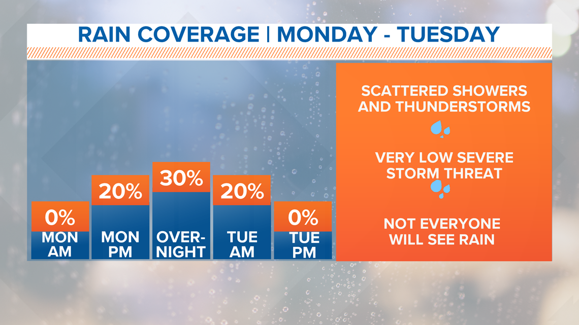
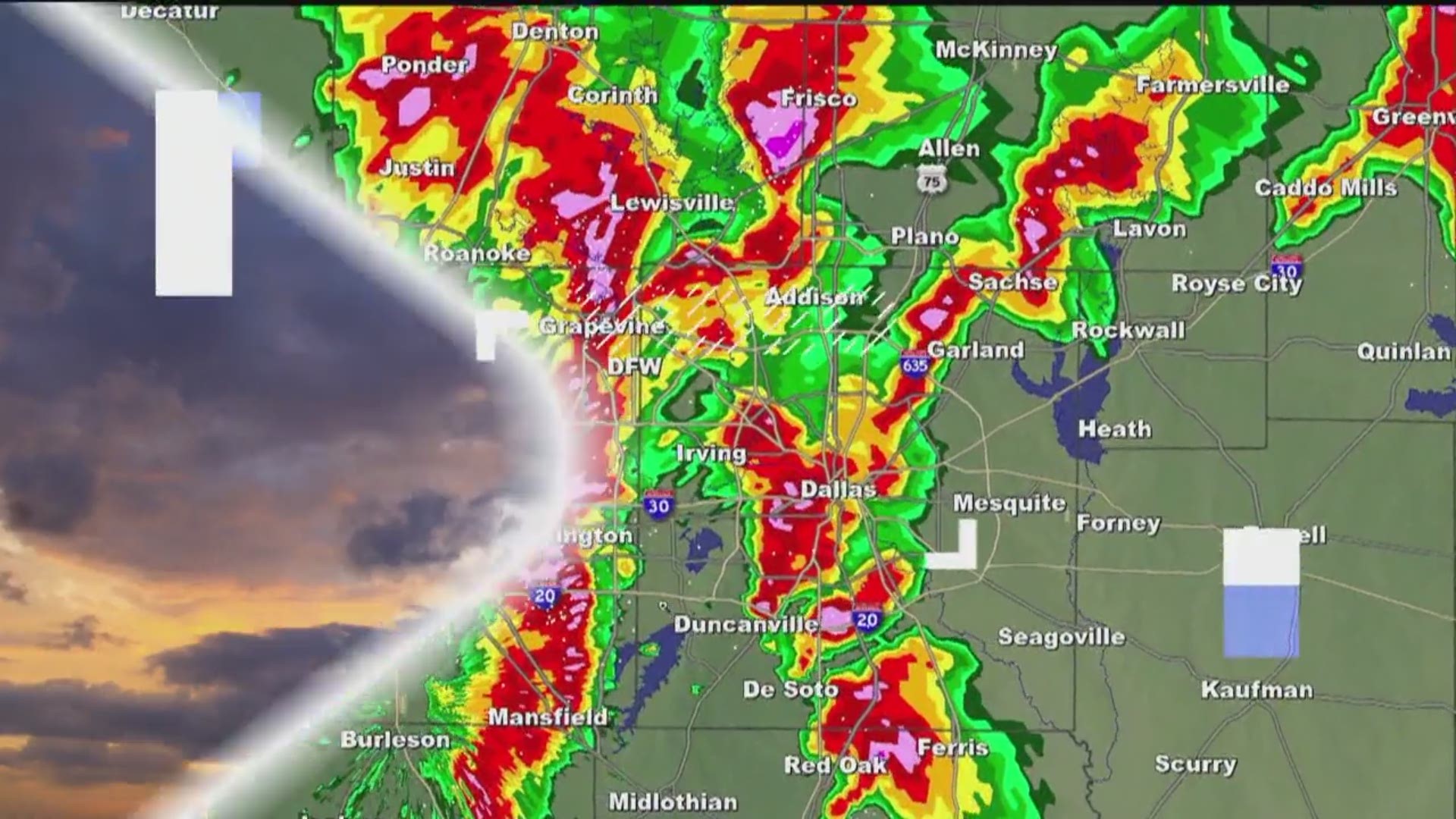
This summertime front will also bring back a chance for showers or thunderstorms. Right now, it doesn't look like a soaker or a washout, but some scattered showers or thunderstorms are possible Monday evening into Monday night. Some spotty rain may even last into first thing Tuesday morning.
Have a good rest of the weekend!
TODAY: Mostly sunny and hot. Winds: S 10-15. High: 98.
TONIGHT: Mainly clear and mild. Winds: S 10-15. Low: 78.
MONDAY: Partly Cloudy and hot. A few storms possible late (30%) Winds: S 10-15. High: 99.
TUESDAY: A few morning showers possible, otherwise partly cloudy and cooler, Winds: NE 5-15. High: 89.
Remember to download the WFAA app to check one of our dozens of local radars near you as well as the latest forecast, cameras and current conditions.
Check Weather Alerts here.