DALLAS — A round of thunderstorms moved west to east across North Texas late Monday afternoon and into Monday night. The storms had cleared out of the area by around 3 a.m., but they left several reports of damage, including from a radar-confirmed tornado in Johnson County.
Here's a recap, from our live updates, of how the storms unfolded in real-time:
2:45 a.m. Tuesday
No active warnings or watches in North Texas.
2:06 a.m. Tuesday
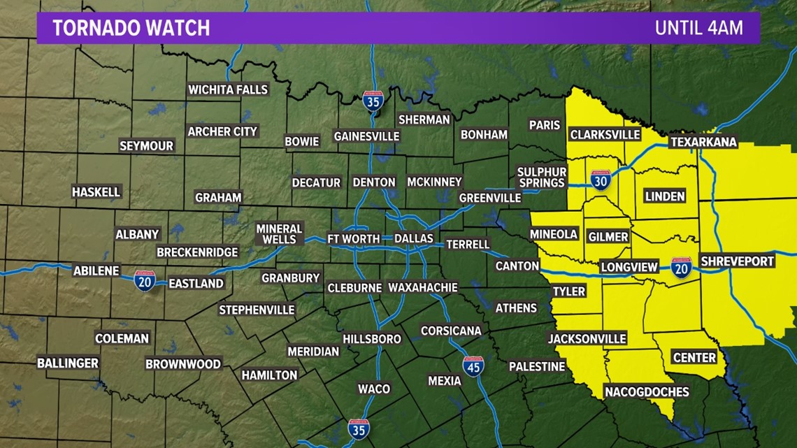
Tornado watch has expired for North Texas. Other than residual flooding, the threat for severe weather is over tonight. A few counties in east Texas remain under the watch until 4 a.m.

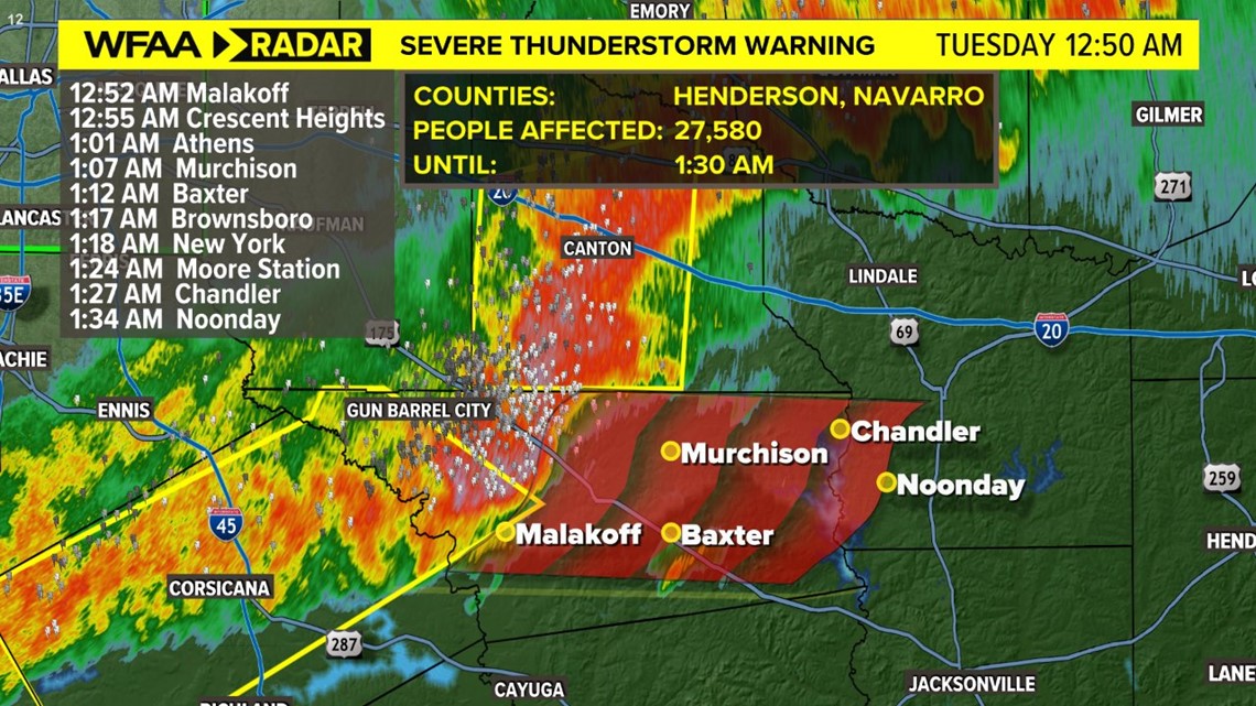
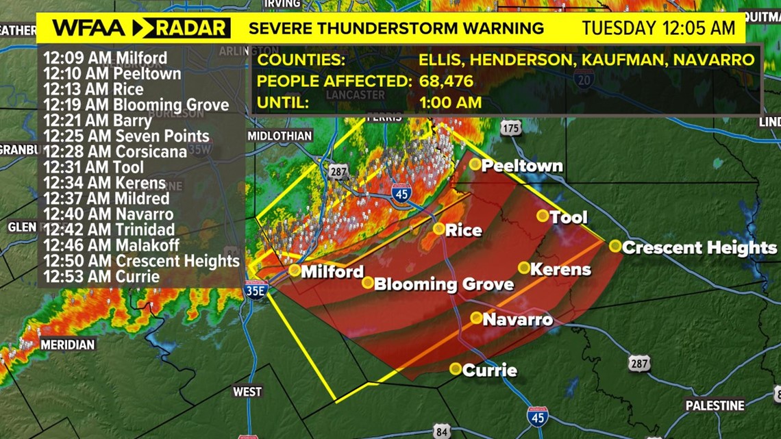
12:50 a.m. Tuesday
Severe Thunderstorm Warning issued for parts of Henderson and Navarro counties until 1:30 a.m. Damaging winds up to 60 mph and quarter-size hail possible.

12:10 a.m. Tuesday
Severe Thunderstorm Warning for Ellis, Henderson, Hill, Kaufman and Navarro counties until 1:00 a.m. The risks remain the same: 60 mph winds and hail up to the size of quarters.

11:50 p.m. Monday
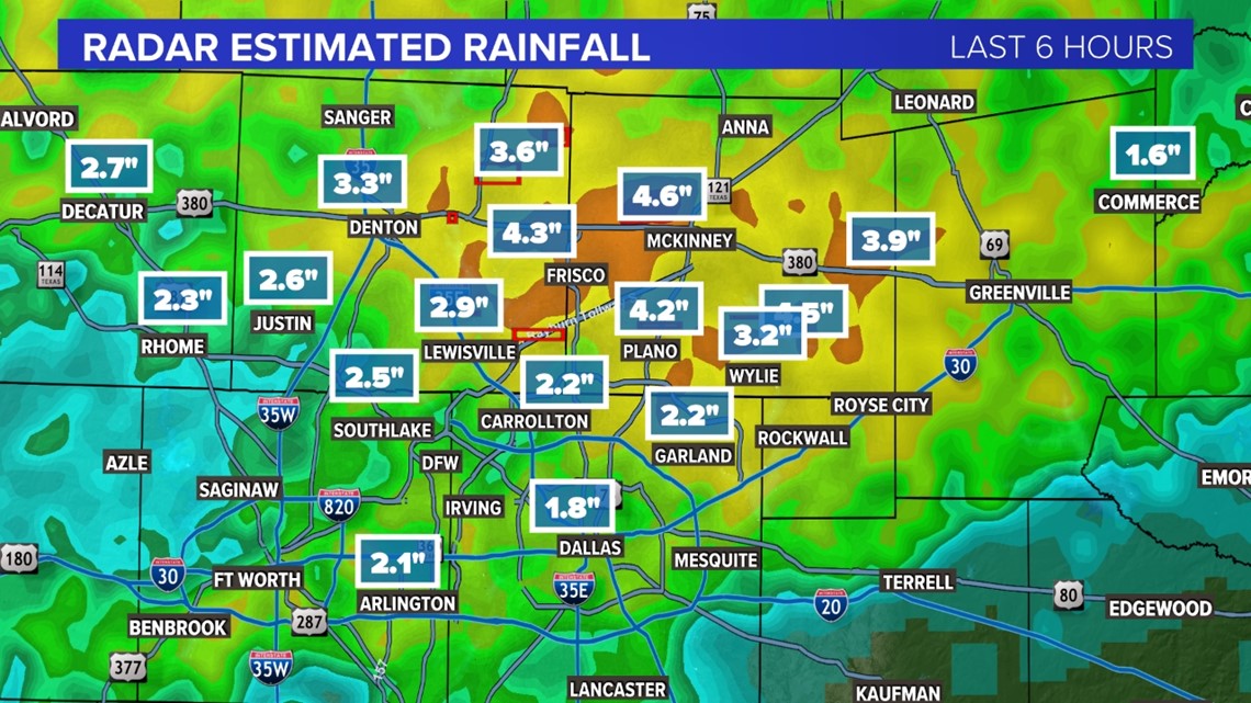
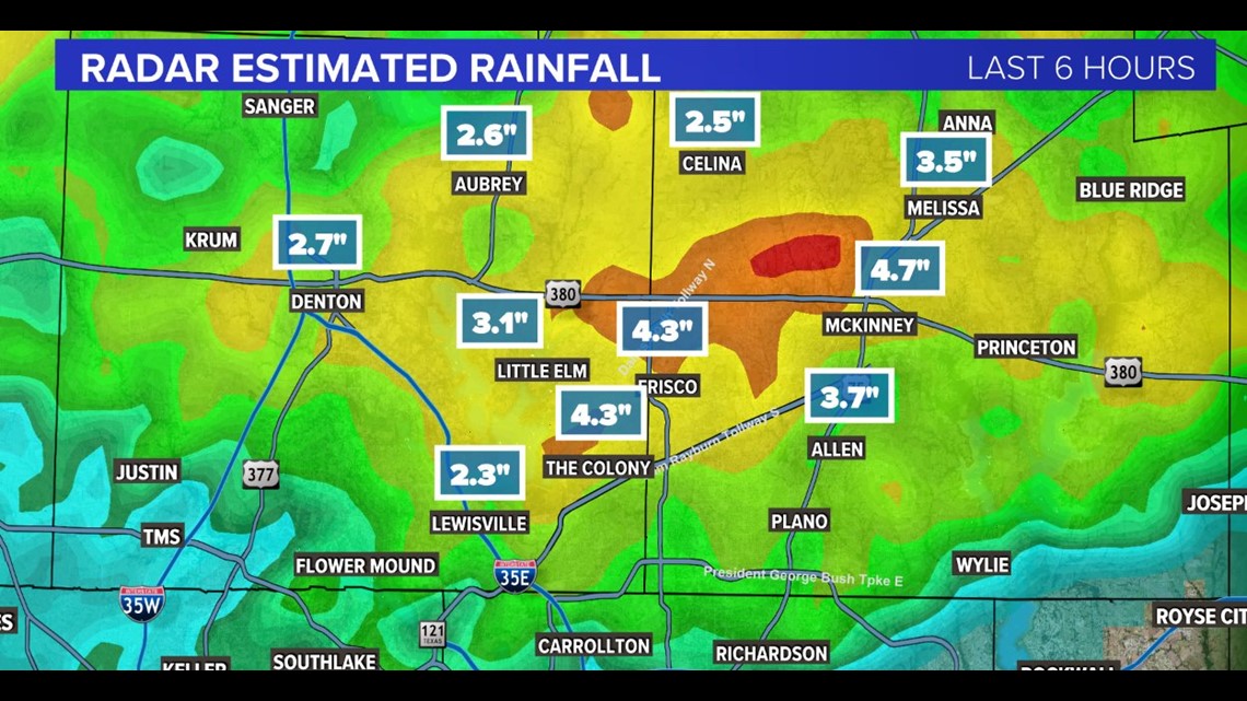
Most of the North Texas area north of Dallas has seen at least 2 inches or more of rainfall, according to radar estimates.
The most (over 4 inches) was seen in Collin County near Frisco, McKinney and Plano.

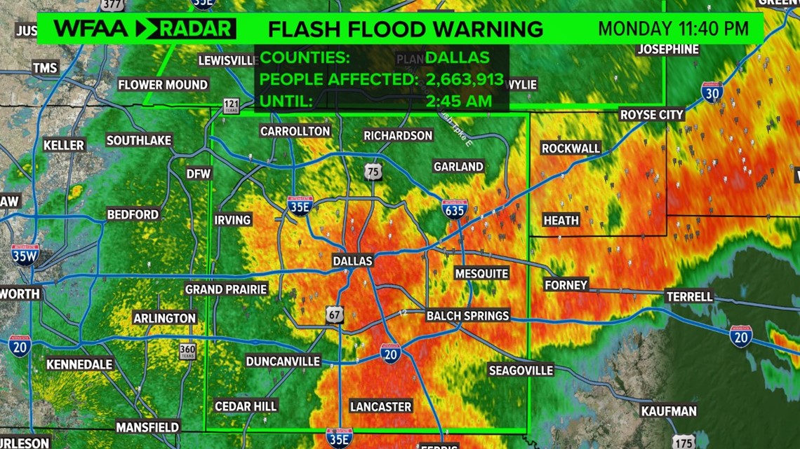
11:45 p.m. Monday
A flash flood warning has been issued for all of Dallas County until 2:45 a.m.

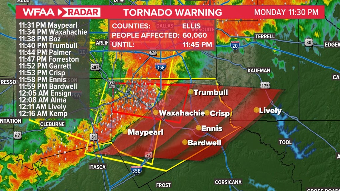
11:30 p.m. Monday
Severe thunderstorm warning for Ellis, Hill and Johnson counties until 12:15 a.m. Damaging wind gusts up to 65 mph and quarter size hail expected.

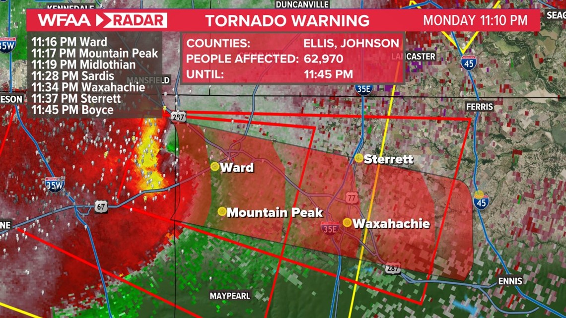
11:10 p.m. Monday
The tornado warning for Johnson and Ellis counties has been extended until 11:45 p.m.
This is a radar-confirmed tornado. Seek shelter now if you are in this warning.

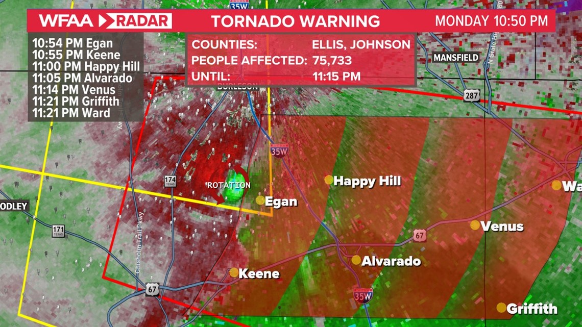
11:00 p.m. Monday
A radar-confirmed tornado has been reported in Johnson County near Joshua and Alvarado. Debris was observed on radar.
The tornado warning continues until 11:15 p.m.
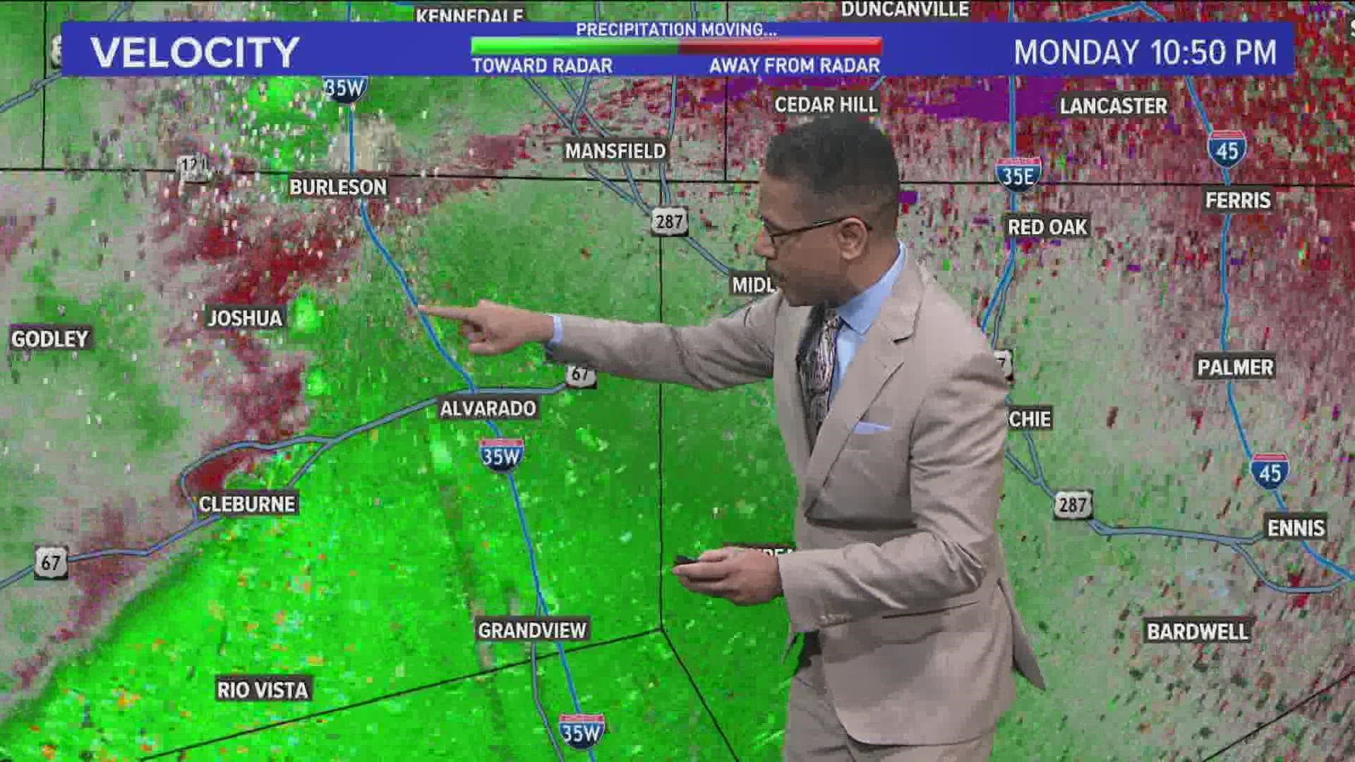
10:50 p.m. Monday
Tornado Warning issued for Johnson and Ellis counties until 11:15 p.m.
Strong rotation being picked. This will be crossing I-35W shortly. If you are in this tornado warning, seek shelter now.

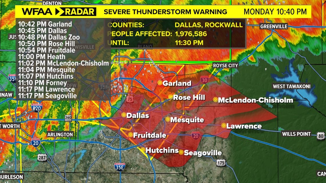
10:45 p.m. Monday
Severe Thunderstorm Warning for Dallas and Rockwall counties until 11:30 p.m. Damaging winds up to 60 mph, large hail up to the size of quarters and flash flooding possible with this cluster of storms.

10:20 p.m. Monday
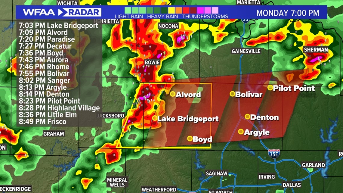
Rainfall totals have been estimated as high as 4 inches just northwest of McKinney and from 3 to 3.8 inches near Celina, Frisco and McKinney in Collin County.

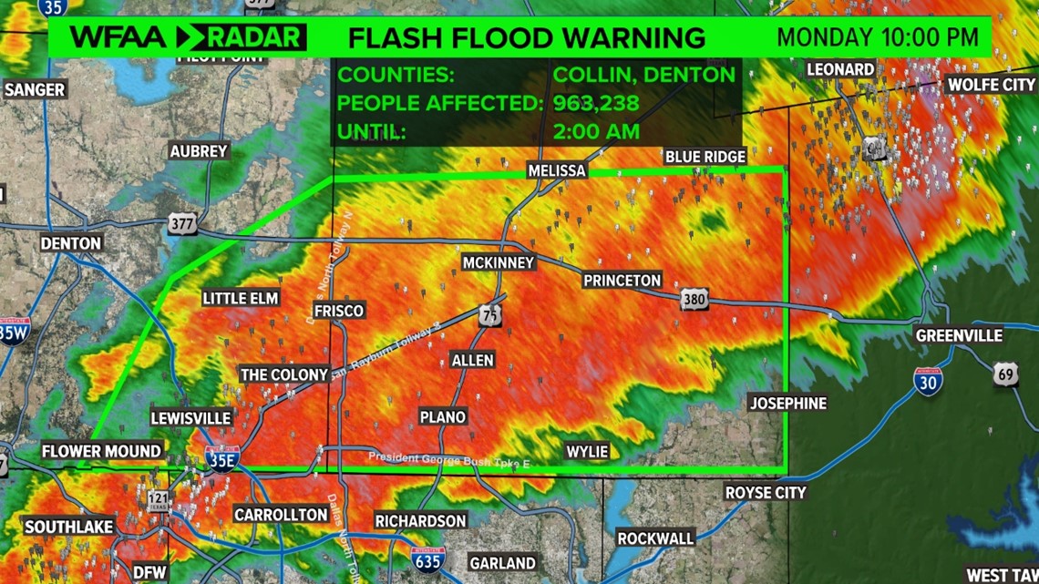
10 p.m. Monday
A Flash Flood Warning has been issued for parts of Denton and Collin Counties until 2 a.m. Tuesday.
Very heavy rain continues to fall in these areas and flooding is possible.

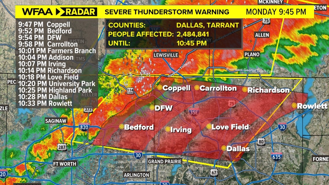
9:48 p.m. Monday
Severe Thunderstorm Warning issued for parts of Tarrant and Dallas Counties. Hail could be up to the size of quarters and winds up to 60 mph.

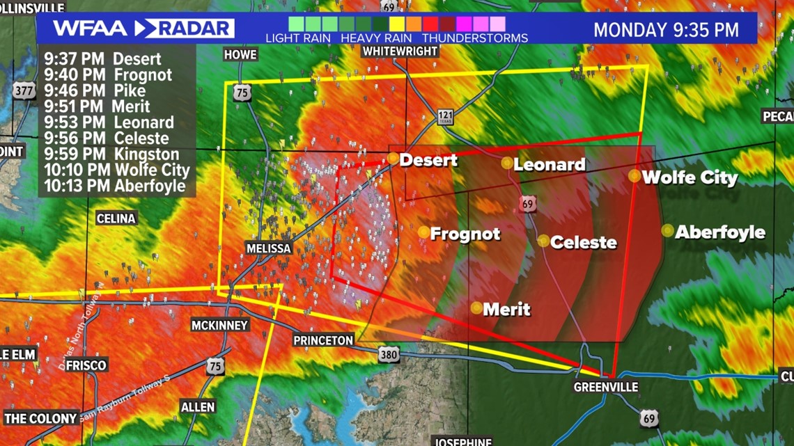
9:37 p.m. Monday
Tornado Warning has been issued for eastern parts of Collin County into Hunt County. Circulation is near Blue Ridge and moving east.

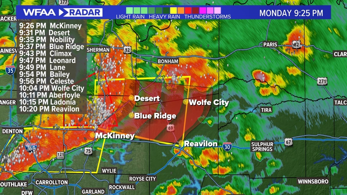
9:25 p.m. Monday
Tornado Warning for Collin County will end at 9:30 p.m.
Severe Thunderstorms continue for northern parts of the DFW area. Hail could be up to size of quarters and wind gusts could be as strong as 60 mph.
Heavy rain and lightning are a given. Heavy rain could cause ponding on area roadways.

9 p.m. Monday
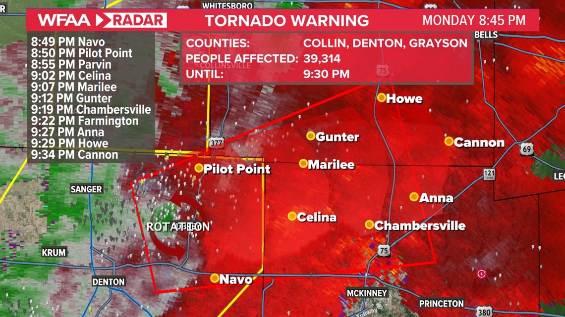
Strongest circulation in the Tornado Warning is near Celina and moving east.
Prosper has sounded their outdoor warnings sirens.
Reports of people hearing sirens in Frisco, but Frisco is not under the Tornado Warning.
8:50 p.m. Monday
A Tornado Warning has been issued for northern Denton County into northern Collin County. An area of strong rotation could produce a tornado at any time.
If you are in the warning, please seek shelter!

8:30 p.m. Monday
Hail up to size of tennis balls is possible with this hail core moving into Denton County.

7:55 p.m. Monday
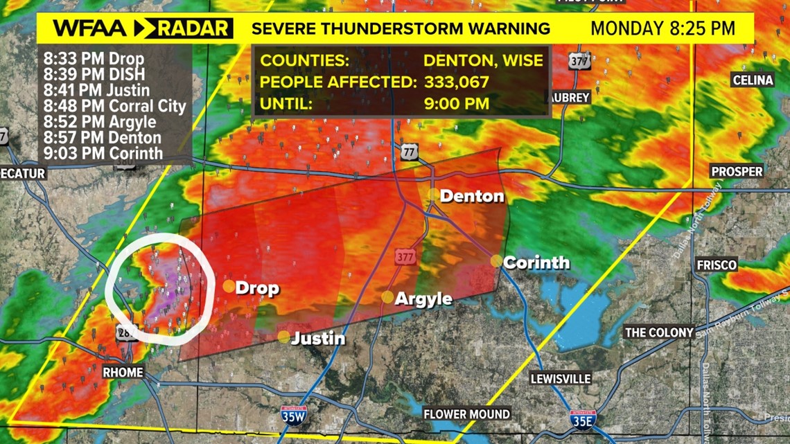
A Severe Thunderstorm Warning has been issued for eastern Wise County and all of Denton County.
Winds of up to 60 mph and hail up to the size of quarters are possible as the storm moves through. We are also watching some rotation in the storm as well.

7:20 p.m. Monday
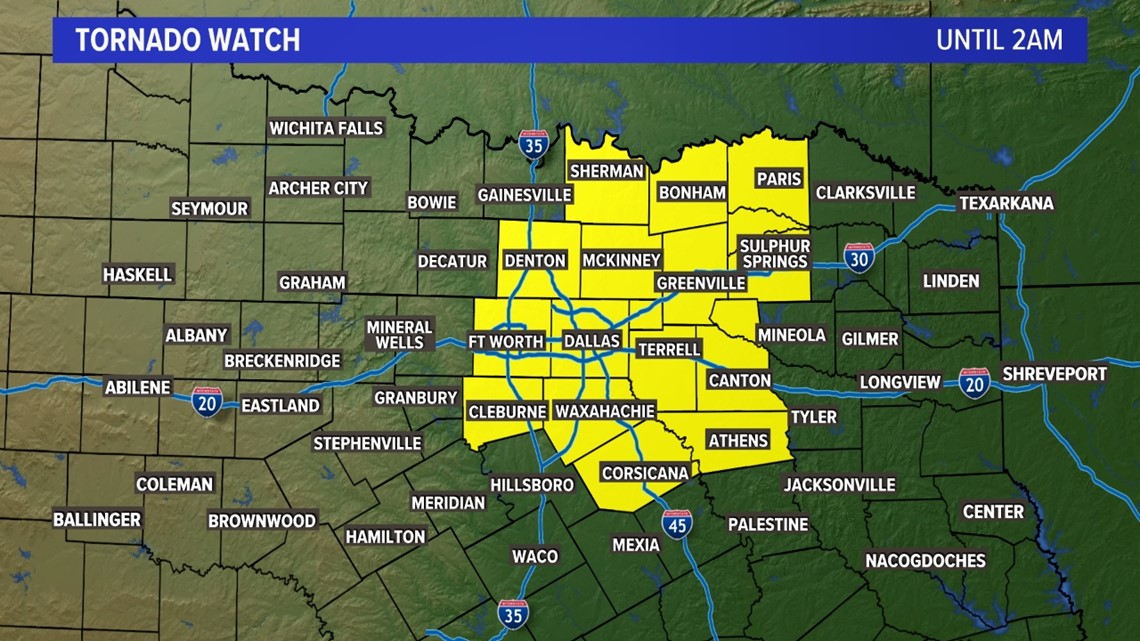
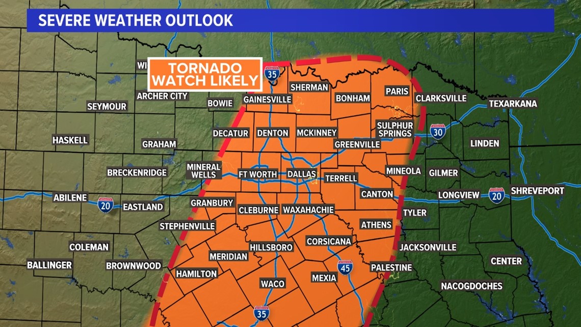
A Tornado Watch has been issued for DFW and surrounding parts of North Texas until 2 a.m.

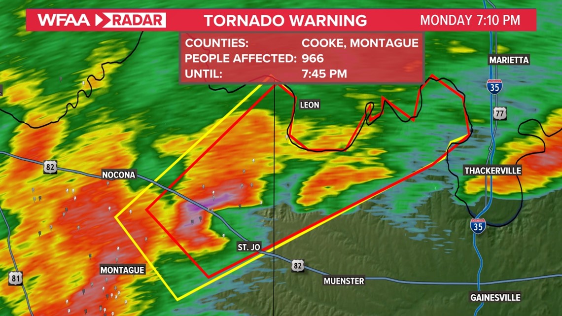
7:10 p.m. Monday
A Tornado Warning has been issued for far northern Cooke and Montague counties.
Storm has increased rotation and could produce a tornado at any time. Storm is moving north and will cross the Red River into Oklahoma in the next 30 minutes or so.

7:00 p.m. Monday
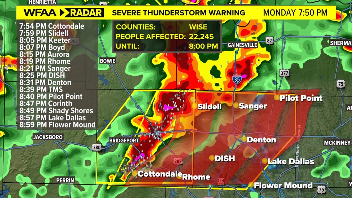
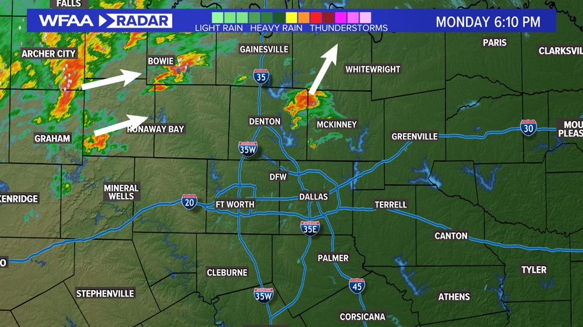
Our first Severe Thunderstorm Warning of the evening has been issued for Wise County until 8 p.m.
Main concerns are for strong winds up to 60 mph. Storm is also producing very heavy rain and lightning.

6:55 p.m. Monday
A Tornado Watch will likely be issued for DFW and areas to the north and east.
Primary concern continues to be damaging winds. But since the tornado threat is not zero, a Tornado Watch will be issued for these areas.

6:15 p.m. Monday
A few showers and storms have popped up in northern parts of DFW. These are not severe and will continue quickly moving north.
For DFW, can't rule out a passing shower or storm over the next couple hours, but the main round is still due to arrive later this evening into tonight.

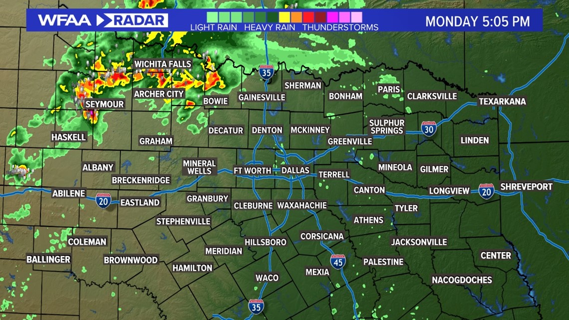
5:10 p.m. Monday
Majority of North Texas is quiet, but a few storms are starting to move into areas along the Red River in northern/northwestern North Texas.
Still do not expect storms in or around DFW until 9 p.m. or later.

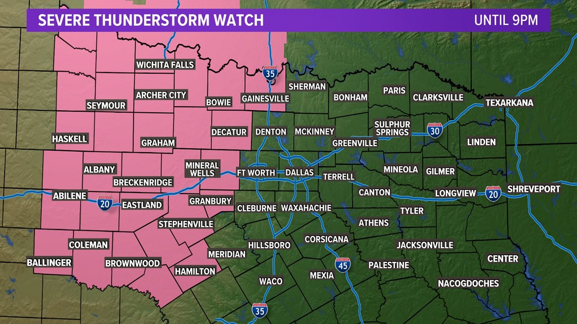
3:30 p.m. Monday
A severe thunderstorm watch has been issued for areas west of DFW until 9 p.m. Areas under the watch have the best chance for storms through 9 p.m.
The main severe threat for areas in the watch is large hail. Perhaps golf ball-size or larger. Strongest storms could have damaging winds or an isolated tornado as well.

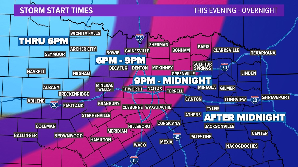
Latest timing
Here's the latest thunderstorm timing. Thunderstorms are becoming more widespread well northwest of the Metroplex.
These will eventually form a strong line and move southeast into the rest of North Texas. Damaging wind gusts are expected.