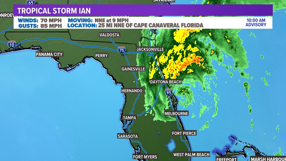
DALLAS — Ian has been downgraded to a tropical storm, but it is still bringing tropical storm strength winds along the eastern Florida coastline as well as heavy rain along Interstate 95 between Jacksonville and Daytona Beach. The center of Ian has pushed off of the coastline.

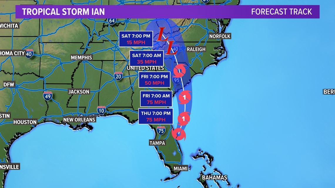
With the center of Ian pushing off of the coast, it'll likely strengthen. The latest forecast track keeps Ian over open water through the afternoon, giving it enough time to strengthen to Category 1 status. It'll keep its strength through landfall along the South Carolina coastline Friday morning.
Weakening is expected through the weekend, but not before a few impacts along the Carolina coast lines.

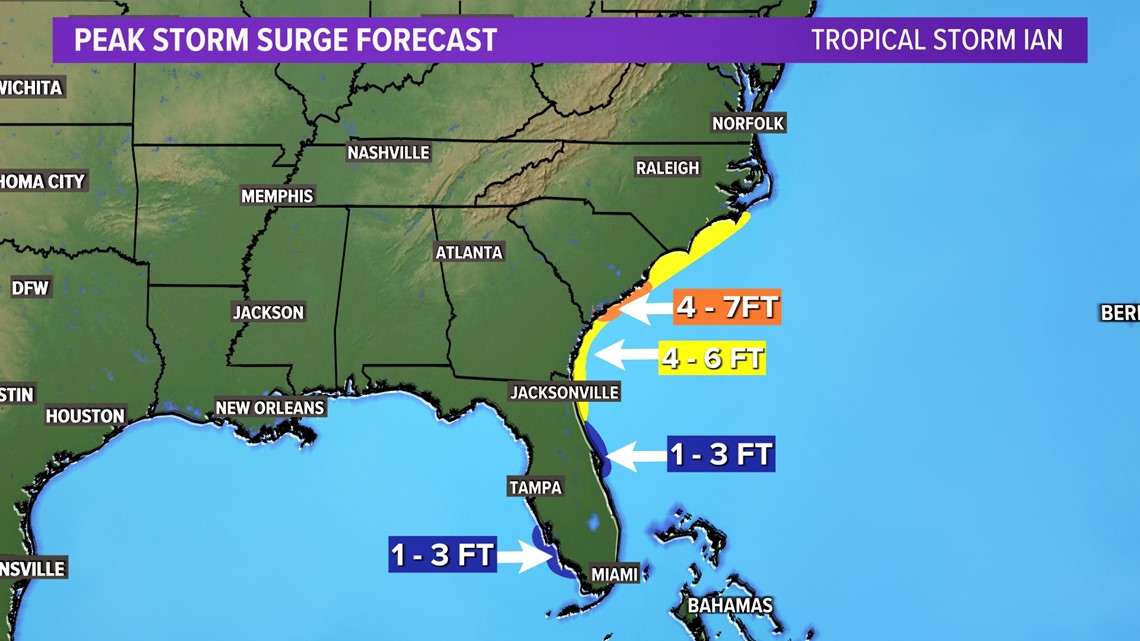
Storm surge will be likely across several states in the east. The peak storm surge looks to happen along the South Carolina coastline where landfall is expected.
Tropical storm and hurricane warnings remain in place from North Carolina coast to the Florida east coast.

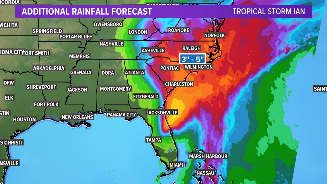
Along with surge and strong winds, heavy rain is still expected.
The coasts can expect three to five inches of rain, while the higher totals are expected in northeastern Florida. Rain potential decreases from east to west. While it is not as much rain as what Central Florida is left dealing with, it is still enough to be dangerous.