
Updated at 10:40 a.m. Friday with the latest forecast.
FRIDAY
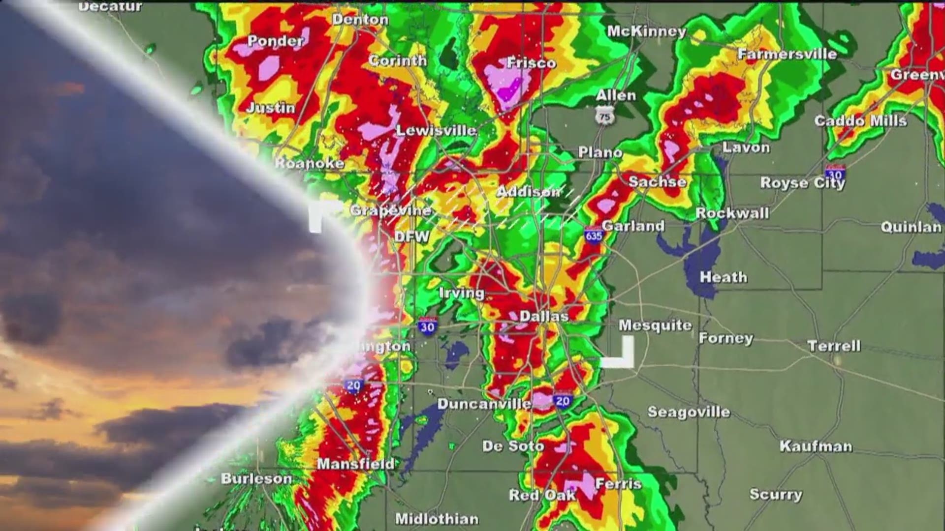
Another round of showers and thunderstorms are moving north into the area. Scattered showers with a few pockets of heavy rainfall are possible throughout the day. Flash flooding will once again be a concern for some.

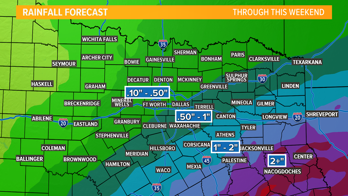
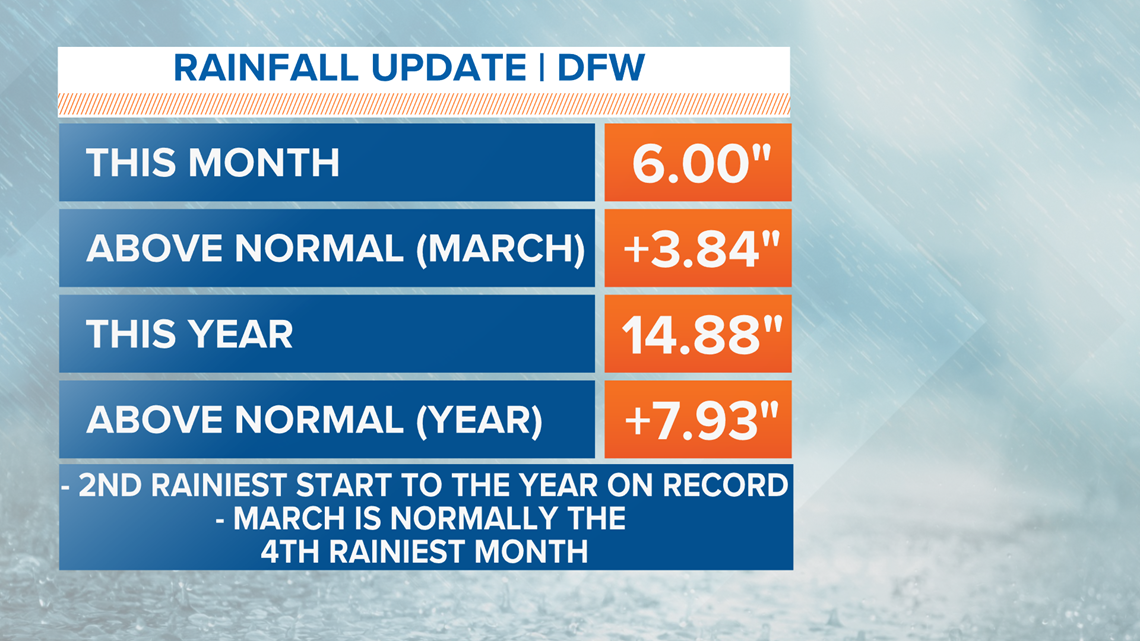
The highest totals will be southeast of Dallas throughout the weekend, but we are already so far above normal in many locations that flash flooding will be a concern. The image below is an update on where we are for the month and the year for rainfall.

The reason we are still seeing the chance for rain is because of a frontal boundary that is sliding south through North Texas. This will continue throughout the day and we will see activity along this boundary until it clears the area tonight.

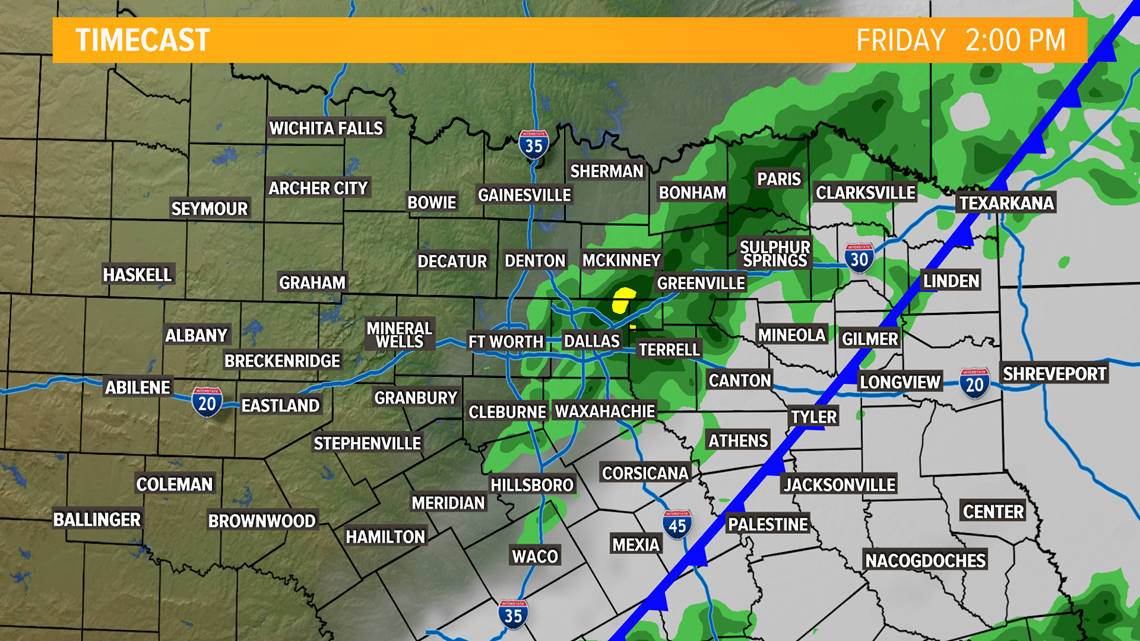
The rain will mainly stay from Dallas and Fort Worth to the southeast throughout the day. It will begin to clear the Metroplex after lunch hour today mainly impact east Texas this evening.
TEMPERATURES
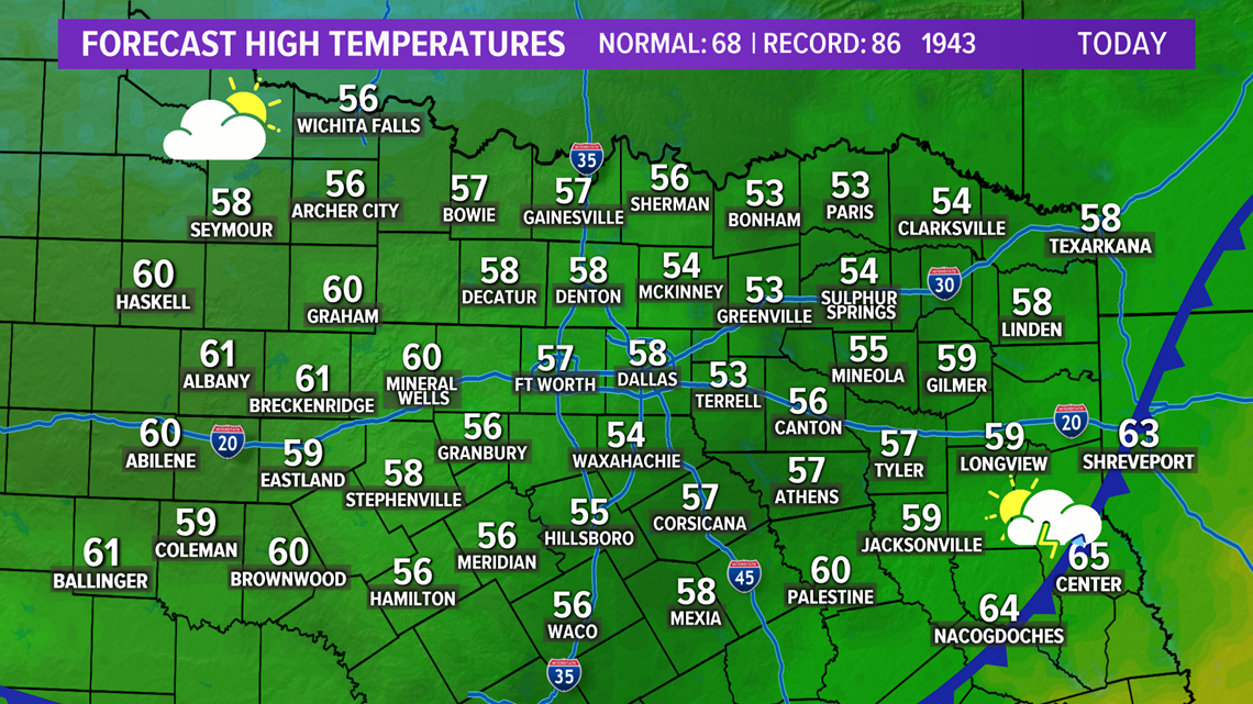
This morning you will notice a big cool down!
The afternoon will be a lot cooler behind the cold front. Highs will only be in the 50s with a breezy wind from the north as well.

Remember to download the WFAA app to check one of our dozens of local radars near you as well as the latest forecast, cameras and current conditions.
Check Weather Alerts here.