

The National Weather Service confirmed a tornado in Hill County on Saturday as heavy storms with rotation moved east through southern parts of North Texas.
Most of the strong storms had cleared out of North Texas, passing through Henderson County, by 4:30 p.m. Previous tornado warnings in Ellis, Hill and Navarro counties had expired.
Earlier Saturday afternoon, the Texas Department of Public Safety reported a tornado west of Interstate 35 and U.S. 287 in Ellis County, according to the weather service.
A storm with rotation had passed through Waxahachie, leaving damage at Waxahachie High School, where light poles were knocked down and a bus was overturned, according to photos provided by storm spotter Scott Farris. Classes are still set to resume Tuesday after a previously scheduled Fair Day on Monday, school district officials said.

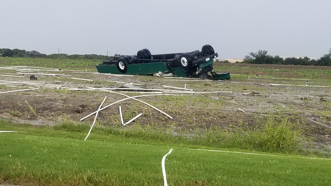
The tornado in Hill County was confirmed northeast of Bynum, according to the weather service. Radar was showing a "debris signature," in which debris carried by a storm can be seen on radar, the weather service tweeted.
While the heaviest storms were hitting southern parts of North Texas, torrential downpours were passing through most of the DFW area on Saturday.
Flooding threat will be the main issue for DFW to the north the rest of Saturday.
Remember to download the WFAA app to check one of our dozens of local radars near you as well as the latest forecast, cameras and current conditions.
Check Weather Alerts here
SATURDAY NIGHT
Overnight will be fairly dry rain-wise, but patchy fog is possible along with just damp conditions due to recent rain.

SUNDAY-WEDNESDAY
Sunday looks to start out dry besides some spotty showers, and most of Sunday looks dry as well.
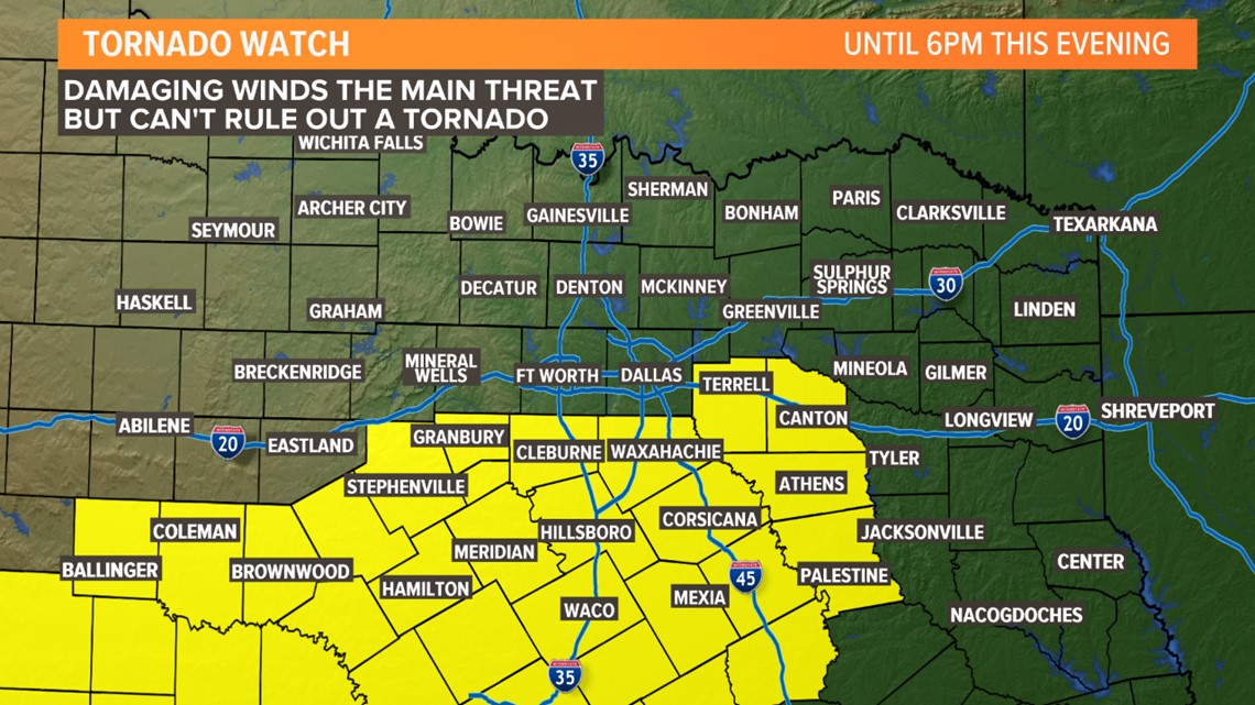
However, BIG changes arrive by late Sunday afternoon into Sunday evening. A strong cold front will work its way across North Texas from northwest to southeast starting Sunday afternoon. Temps will fall quickly behind this front with a brisk northerly wind.
As that front moves into North Texas, scattered t-storms are possible during the afternoon and evening hours. A few storms could be strong to severe with damaging winds and hail up to quarter size the main threats. After the front passes, severe weather threat will lower, but rounds of showers and storms will continue Sunday evening, Sunday night, and even into Monday.
As mentioned above, temps will fall quickly behind the front ending up in the 40s by Monday morning! Highs on Monday won't warm much either with highs in the 40s to low 50s in North Texas. It'll be a wet, chilly, breezy, and all around not-so-nice Monday.
Much of the same will be around Tuesday before rain tapers off by Wednesday. By the time we are looking back at all this activity on Wednesday, 6in to 8in of rainfall is possible. This means more flooding will be possible starting Sunday night through Tuesday.