
Sunday night through Monday
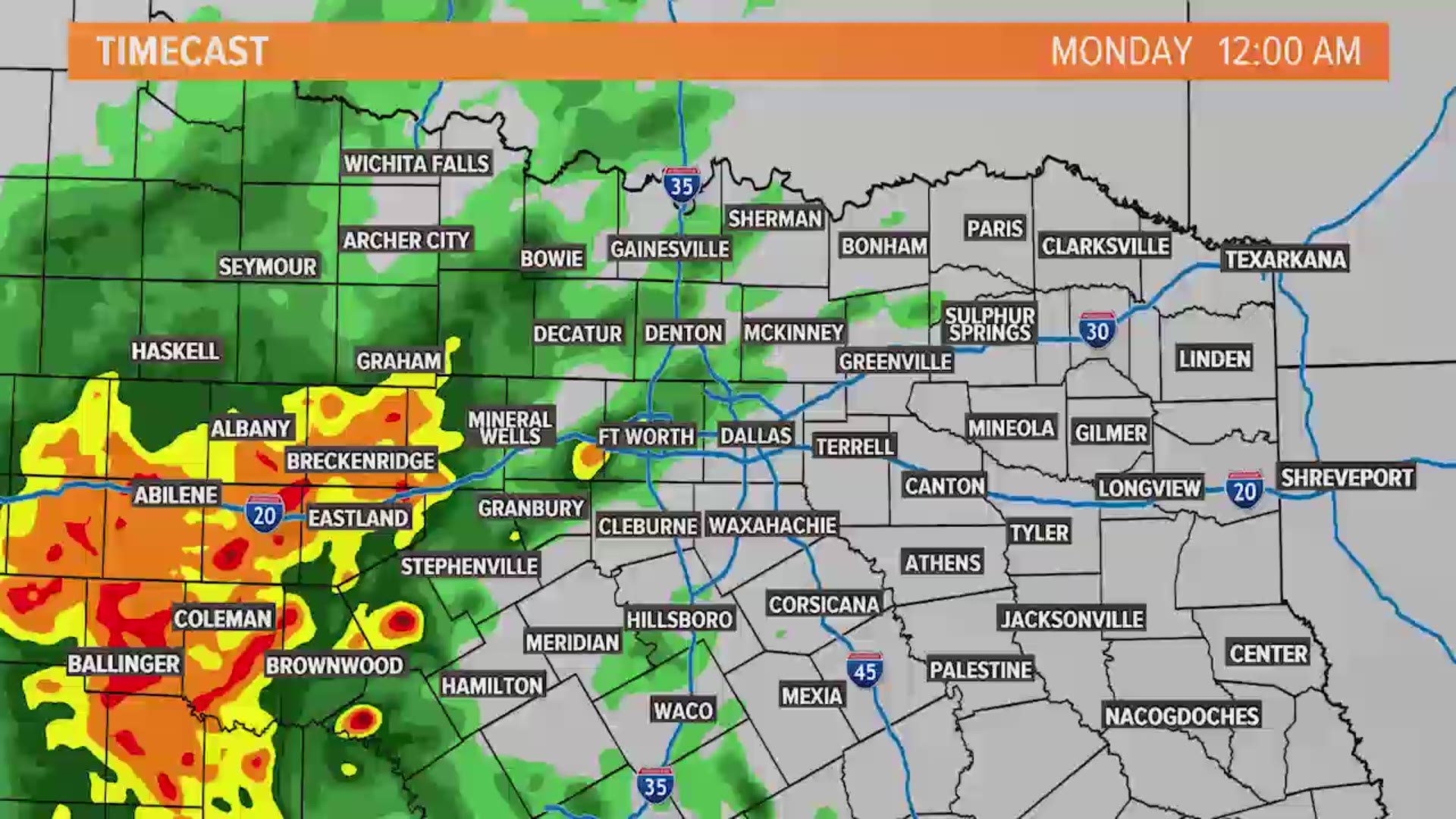
This is our most likely timeframe for another round of widespread rain. Late Sunday night into Monday morning, showers and storms will increase across western North Texas, then move across the entire area.
Severe storms are not likely, but lightning and brief, heavy rain is possible underneath thunderstorms.
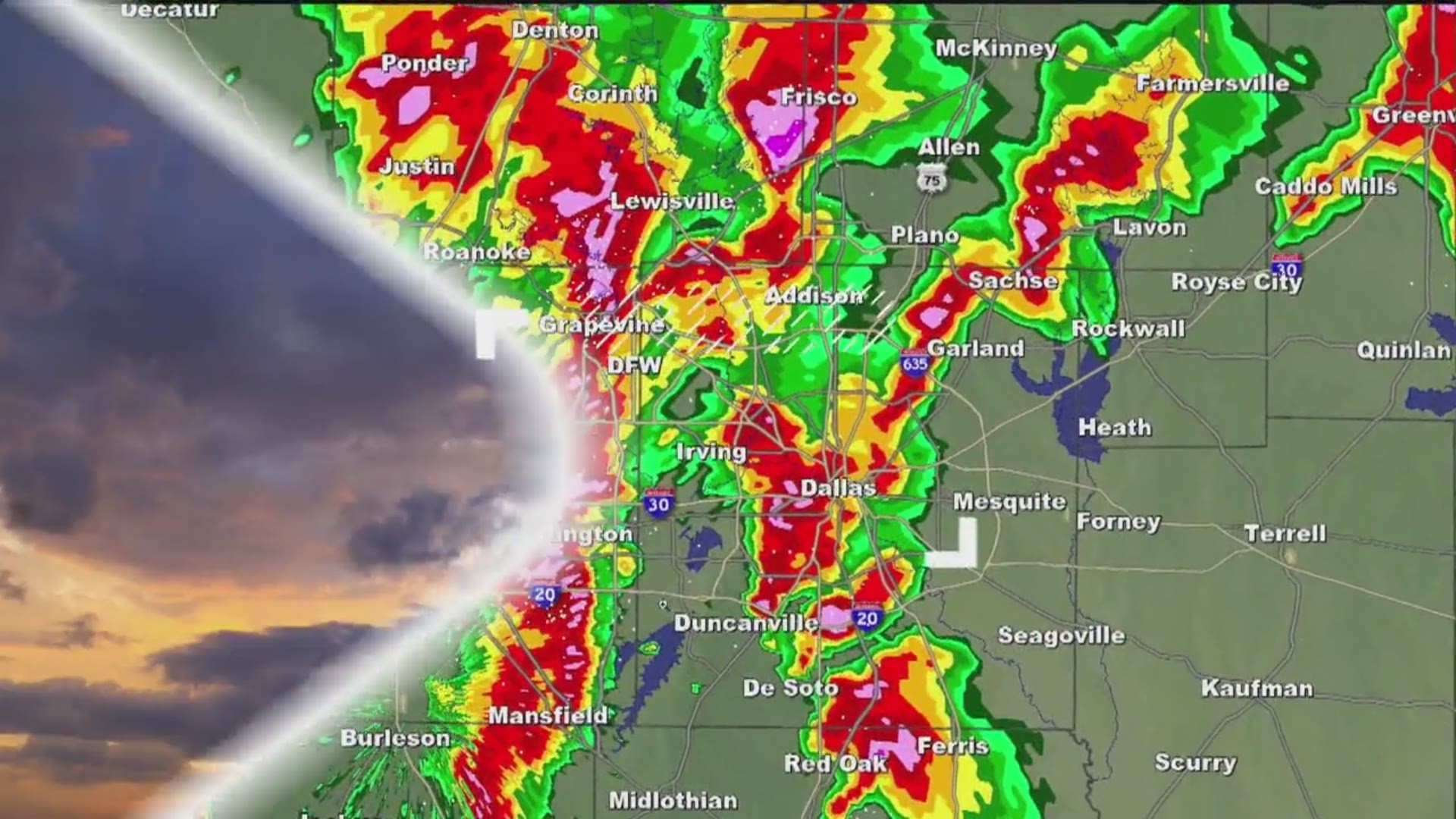
Here's a look at what the radar could look like overnight through Monday:
Rain will be possible first thing Monday morning before moving east through the morning hours. So, not all of Monday will be a washout. In fact, the midday into afternoon hours should be fairly dry, besides some lingering spotty showers.
Rainy week ahead
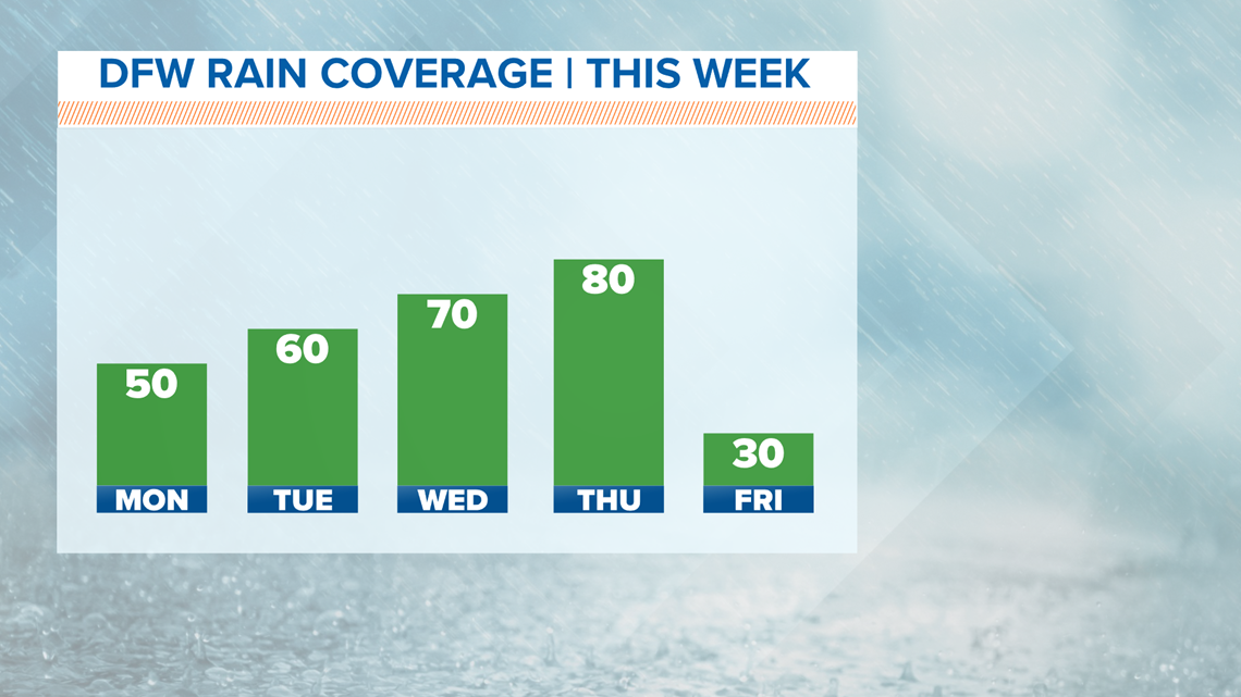
The week ahead will continue to be unsettled. Rounds of rain will move across North Texas with daily rain chances.
While it will not rain all-day long every day, each day will feature rain somewhere in North Texas.
The severe threat looks low most of next week, but it's not zero. Can't rule out a few storms with hail and gusty winds at times.

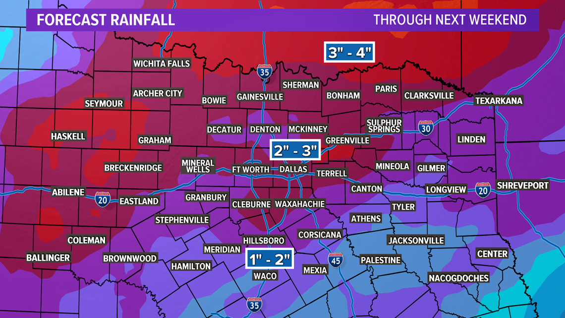
The bigger concern will be for chances of localized flooding with the repeated rounds of rain. It has been a rainy start to the year, and rainfall totals will only increase over the next seven days.
Rain MAY even last into next weekend as this unsettled pattern may not break any time soon. By the end of next weekend, rainfall totals of 3" to 5" across North Texas look possible.

Remember to download the WFAA app to check one of our dozens of local radars near you as well as the latest forecast, cameras and current conditions.
Check Weather Alerts here.