WFAA will have up-to-the-minute coverage of this storm on WFAA.com and the WFAA app.
A line of showers and thunderstorms passed through North Texas on Thursday morning, but the line didn't bring any severe weather to the area. Still, temperatures are expected to tumble behind the front.
Here's a look at the latest timing -- and what to expect throughout the day:
Timeline
Thursday morning
(9 am) Colder air filters in across North Texas for the remainder of the day. Expect temperatures in the 30s/40s for much of the afternoon.
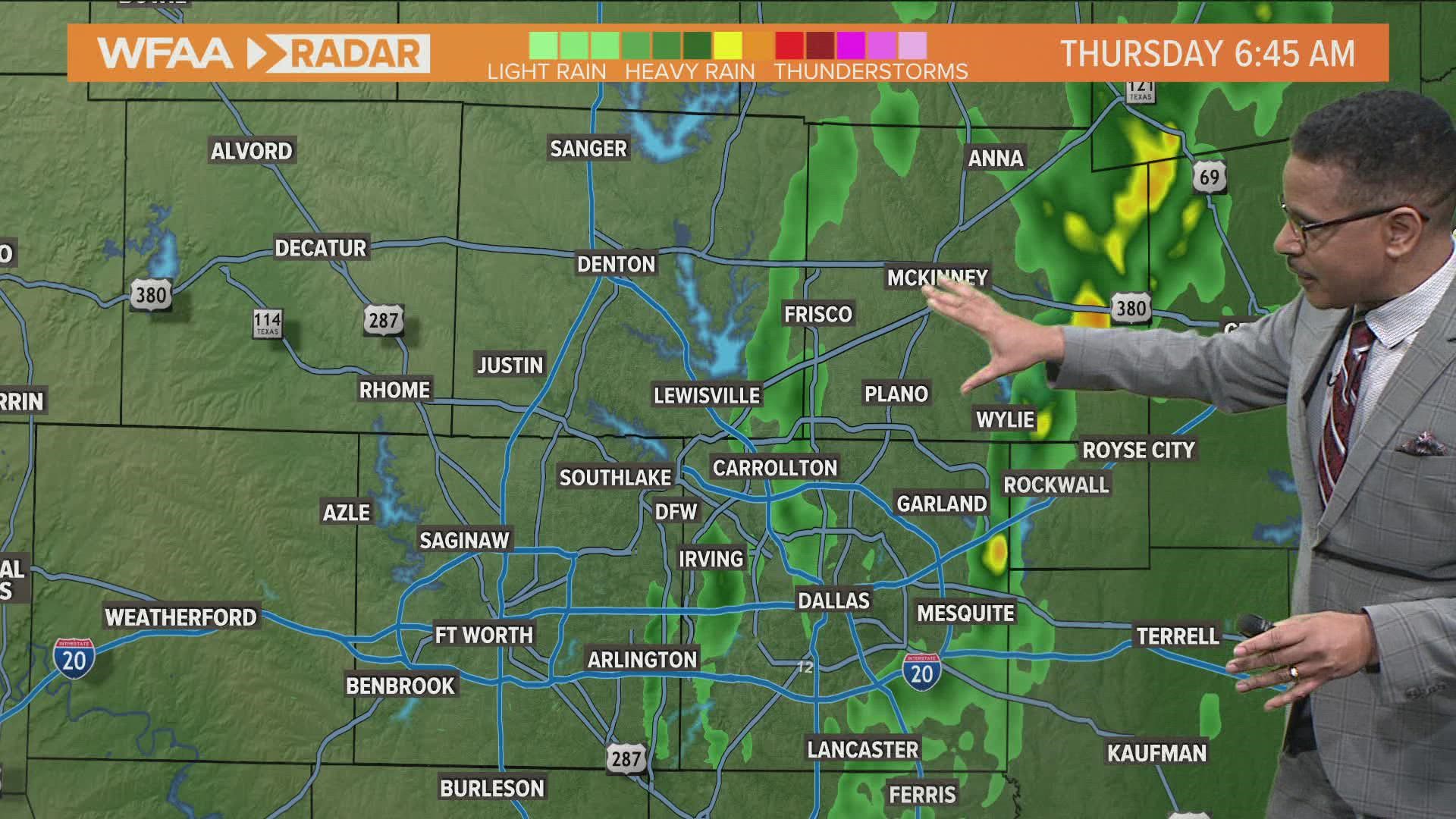
(8:45 am) - rain has cleared the Metroplex! Just some clouds hanging out as cooler, drier air filters in.
(7 a.m.) Rain continues to clear from west to east. Temperatures in the 50s across the Metroplex now, but dropping the remainder of the day. Light rain still spotted in Collin/Dallas counties and east. It stays windy! North wind at 10-20, gusting close to 30.
(6:15 a.m.) Dallas county continues to see pockets of heavy, non-severe rain. Careful on the roads!
(6:00 a.m.) As rain moves out, cold air moves in. A strong north wind at 10-30 mph brings a temperature drop through the day. Wind chill will be in the freezing territory most of the afternoon.
(5:45 a.m.) Light to moderate rain continues to move east. It continues to taper off from west to east over the next couple of hours. Winds are shifting to out of the north from 10-30 mph.
(5 a.m.) Radar update - Threat for severe weather is over. Moderate to light rain continues across North Texas along with 10-20 mph winds & wind gusts close to 30 mph. Temperatures continue to fall from west to east as a cold front pushes through.
(4:35 a.m.) Rain coat by morning, jacket by the afternoon. Temperatures continue to tumble behind our cold front. The good news? Our atmosphere is stabilizing meaning a lower severe weather threat.
4:05 a.m. radar update - line of storms approaching the Metroplex has become a broken line of storms. Severe thunderstorm watch has been expired for North Texas. Storms may contain 40 mph winds as they move east.
3:30 a.m. wind gusts - overall wind gusts have stayed under 30 mph. The exception is near the line of storms. This is where winds can gust close to 50 mph.
3:20 a.m. - No active warnings as storms approach Denton County. Strongest storms are north of I-20 and west of I-35. Storms are generally moving east close to 45 mph. Current hazards - strong wind gusts and lightning.
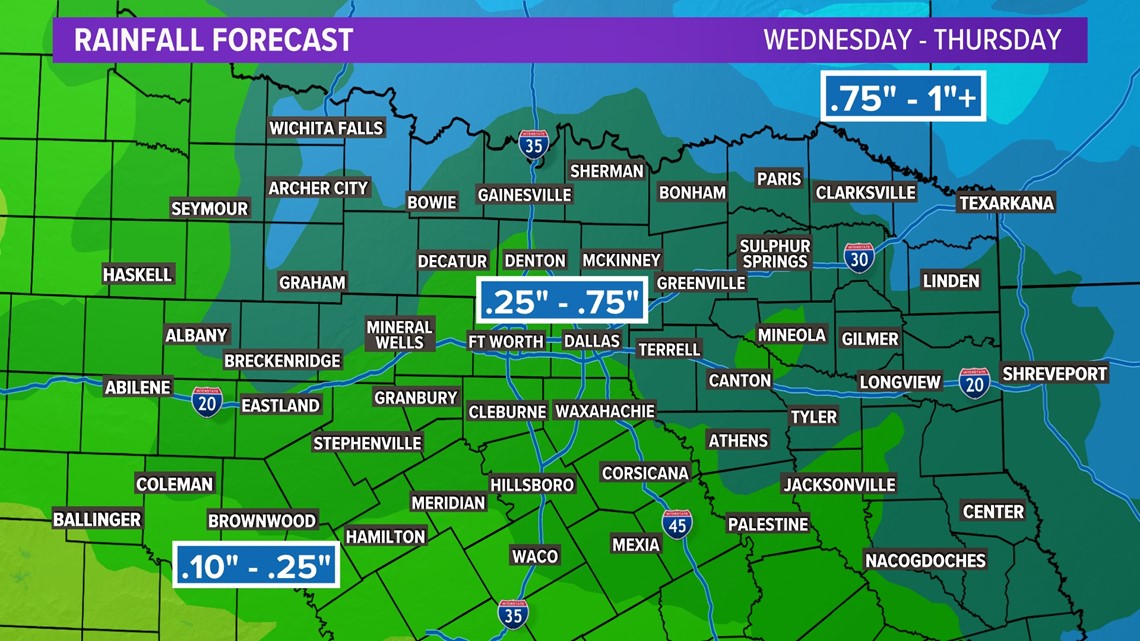
Rainfall forecast
Unfortunately, this does not look to be a drought-buster for us, but we will take whatever rain we can get.
Rain totals look to be around 0.25" to 0.75" for most. Some isolated higher amounts possible mainly in northeastern North Texas.
Totals look to be less for southern North Texas.
Remember, we need about 3" to 6" of rain to get out of the drought.