
Big changes are coming to our weather in North Texas! Here's what you need to know:
THURSDAY
Very warm and humid. Increasing clouds will hold temperatures in the low 90s for afternoon highs. A few showers and storms will develop, mainly south and west of DFW.
THURSDAY NIGHT
Mostly cloudy skies with temperatures falling into the mid-70s. Scattered showers and storms should remain west of the Metroplex overnight.

FRIDAY
Showers and storms increase in coverage during the day. Some locally heavy rain will be possible by late afternoon and evening. Highs reach the mid-upper 80s.
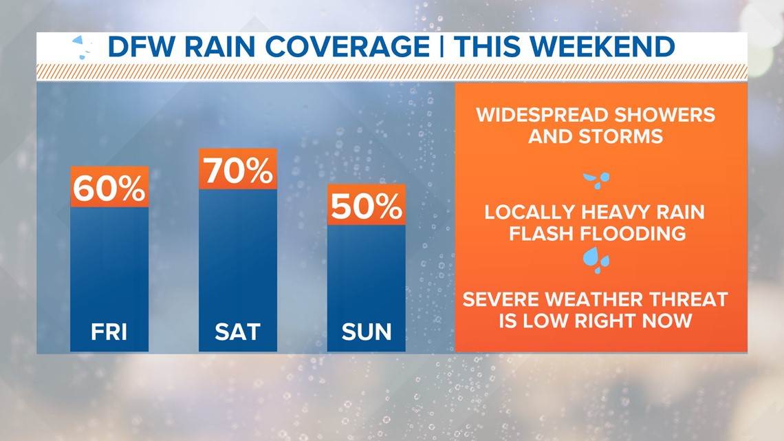
SATURDAY & SUNDAY
Widespread rain and storms are likely. Locally heavy rain could produce some flash flooding. The severe weather threat is low right not but, something we’ll keep an eye on for Saturday afternoon. Rain continues into Sunday and tapers off during the day. Highs may not get out of the 70s on Saturday with lower 80s expected on Sunday.
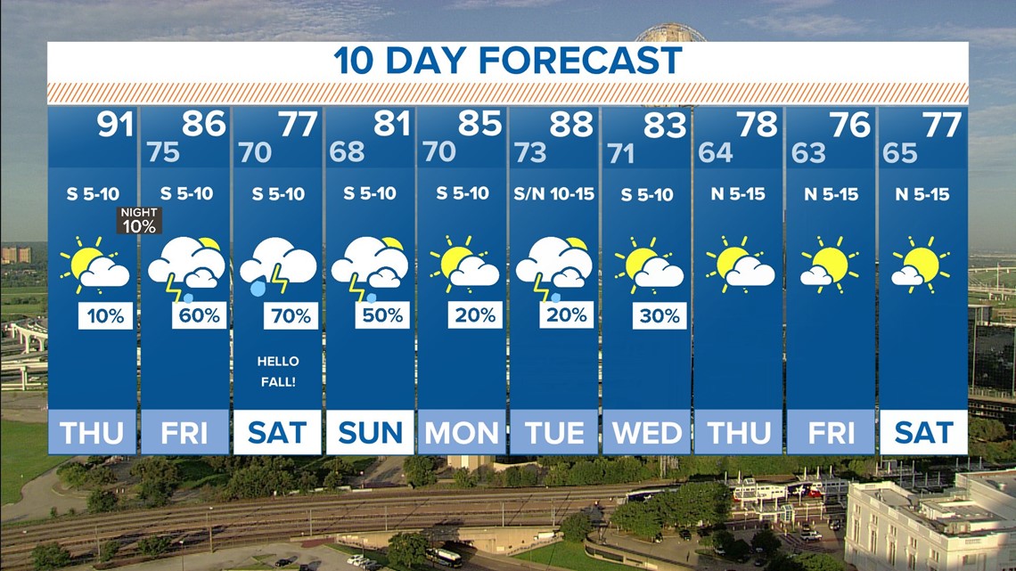
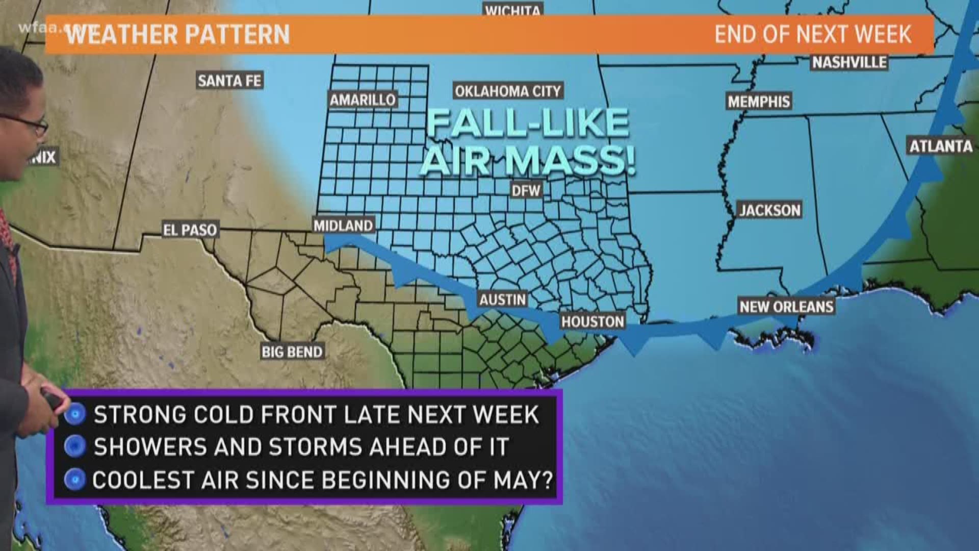
NEXT WEEK
A taste of Fall blows through North Texas as a cold front drops temperatures by late in the week. By Thursday, afternoon highs will drop into the 70s with lows in the 60s. More to come on next week's forecast!
Be sure to download the WFAA app for the latest weather conditions. It's packed with dozens of local radars, cameras and the latest current conditions near you.