
A slow-moving, but strong cold front will lead to a COMPLICATED forecast over the next 24 hours in North Texas.
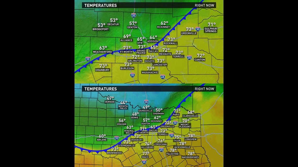
Temperatures began dipping into the 50s for northern parts of the area around mid-afternoon Sunday. Here's what it felt like out there at 3:30 p.m:

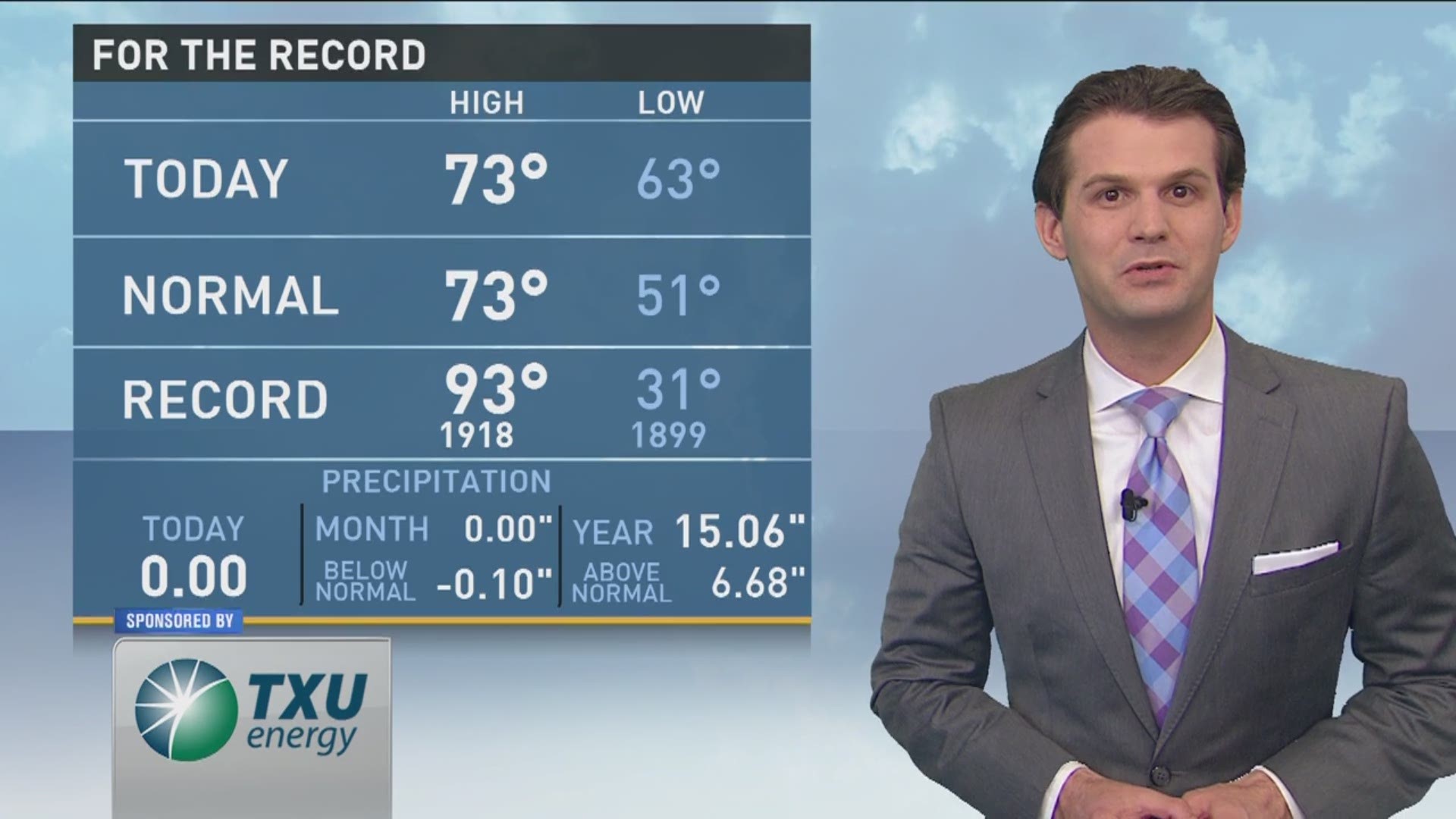
DFW and most of North Texas was mild and muggy today with temps reaching the 70s for most of the afternoon.
But as the front continued moving through the area, temps were going to keep falling through the evening in DFW, possibly ending up in the 50s by mid to late evening. Temps will keep falling overnight with most of North Texas waking up a lot cooler tomorrow.
Morning temps will be in the 40s for most with some 30s possible in western and northern North Texas.
As if what was written above wasn't complicated enough, the forecast gets even more complicated Monday. The cold front that brought cooler temps will lift back north as a warm front during the day. How far north it moves and how quickly will very much determine your weather on Monday.
As it looks now, the front will be slow to move north, which means most of North Texas stays cool on Monday. Highs only in the 50s and low 60s. Far southern areas will likely be a little warmer with 70s possible. BUT if the front moves more quickly or slowly, those forecasted temps could easily be incorrect. In fact, our forecast models can't get anywhere close to agreeing on what the temperature will be tomorrow afternoon. Some are saying 50s while others are saying upper 70s.

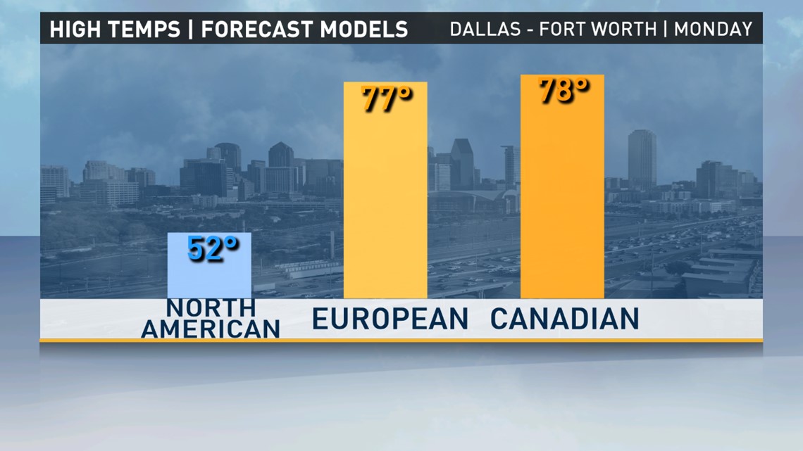
Who says being a meteorologist is easy!?
It will definitely be warmer Tuesday with highs in the upper 70s. Another strong front will arrive Tuesday afternoon into evening which will bring our next chance for thunderstorms. Storms will form along the front and move south and east with the front. Best chance for storms will be from DFW to the east. Some of those storms could become strong to severe with large hail and damaging winds. Best chances for severe storms will be east of DFW into East Texas.
The front that brings those storms will cause Wednesday to be well below normal for the first part of spring. Lows on Wednesday will be in the 40s with highs in the 60s. Don't worry, 70s return before the week is finished!