
DALLAS — After a mostly quiet first month of the Atlantic hurricane season, the tropics are ramping up.
As of Thursday afternoon, the National Hurricane Center had two areas of interest to monitor for potential development.
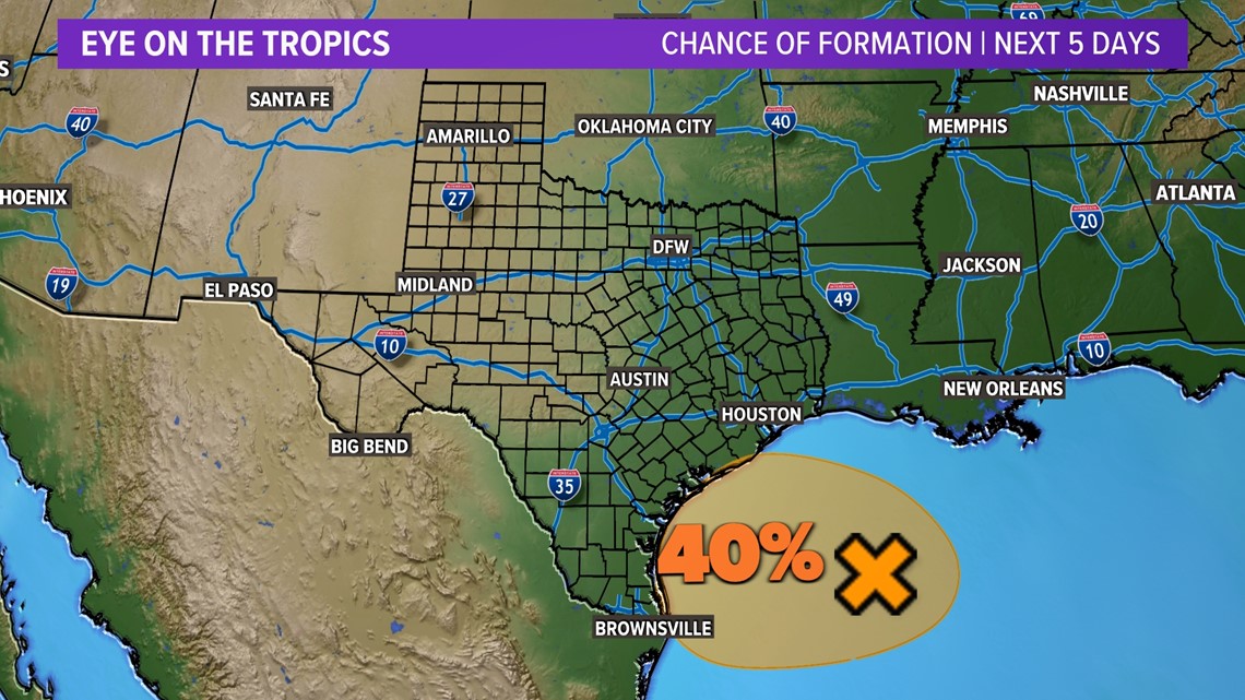
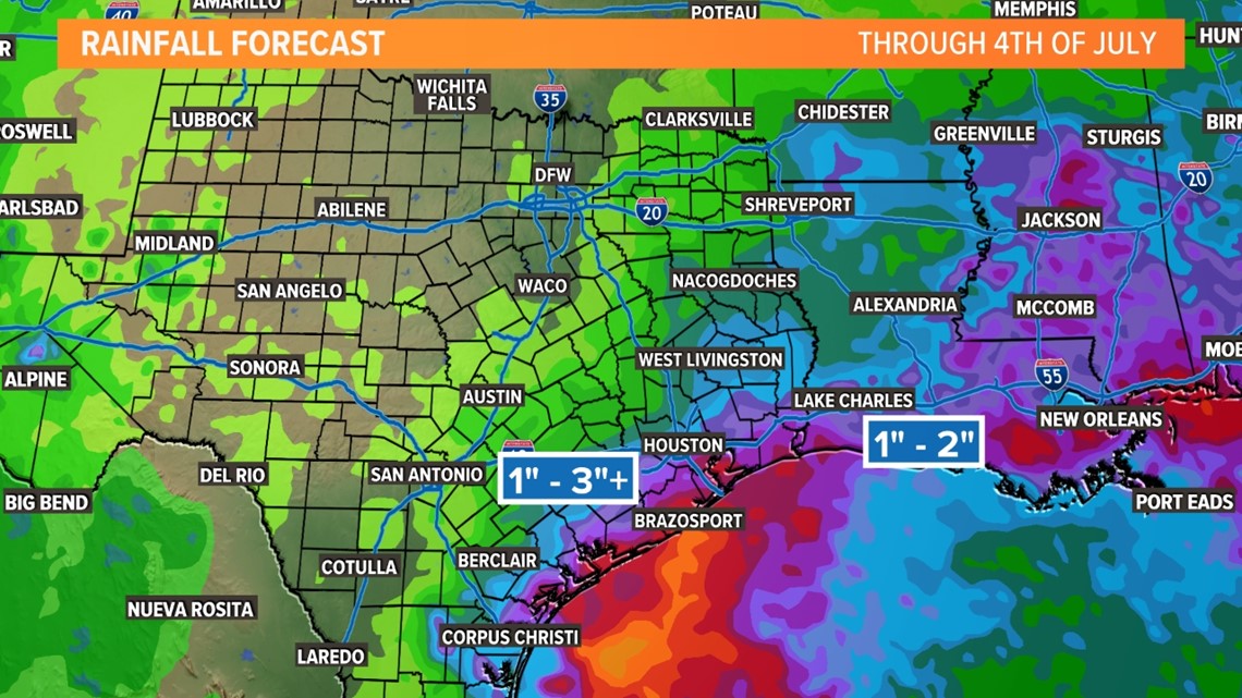
One of those areas is in the western Gulf of Mexico off of the Texas coastline. This could bring parts of Texas much needed rain!
The area of low pressure can easily be seen accompanied by shower and thunderstorm activity.
With sea surface temperatures over 90° and low wind shear, we could see some additional development into a tropical depression over the next couple of days.

So what is the deal for North Texas?
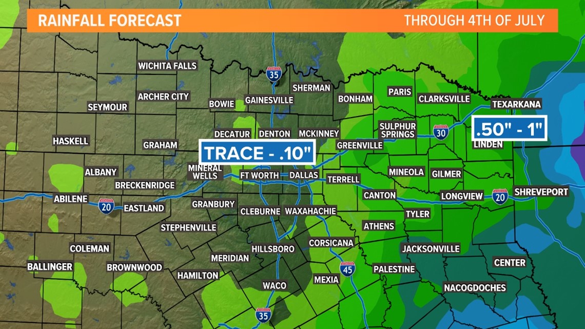
Even if this does not form into an organized, named system, North Texas could benefit from it's track. The area of low pressure will likely drift north late this week and into the weekend.
Depending on how well it holds together, areas east of I-35 could see some beneficial rainfall. This will not be a consistent rain for everyone during the whole weekend.
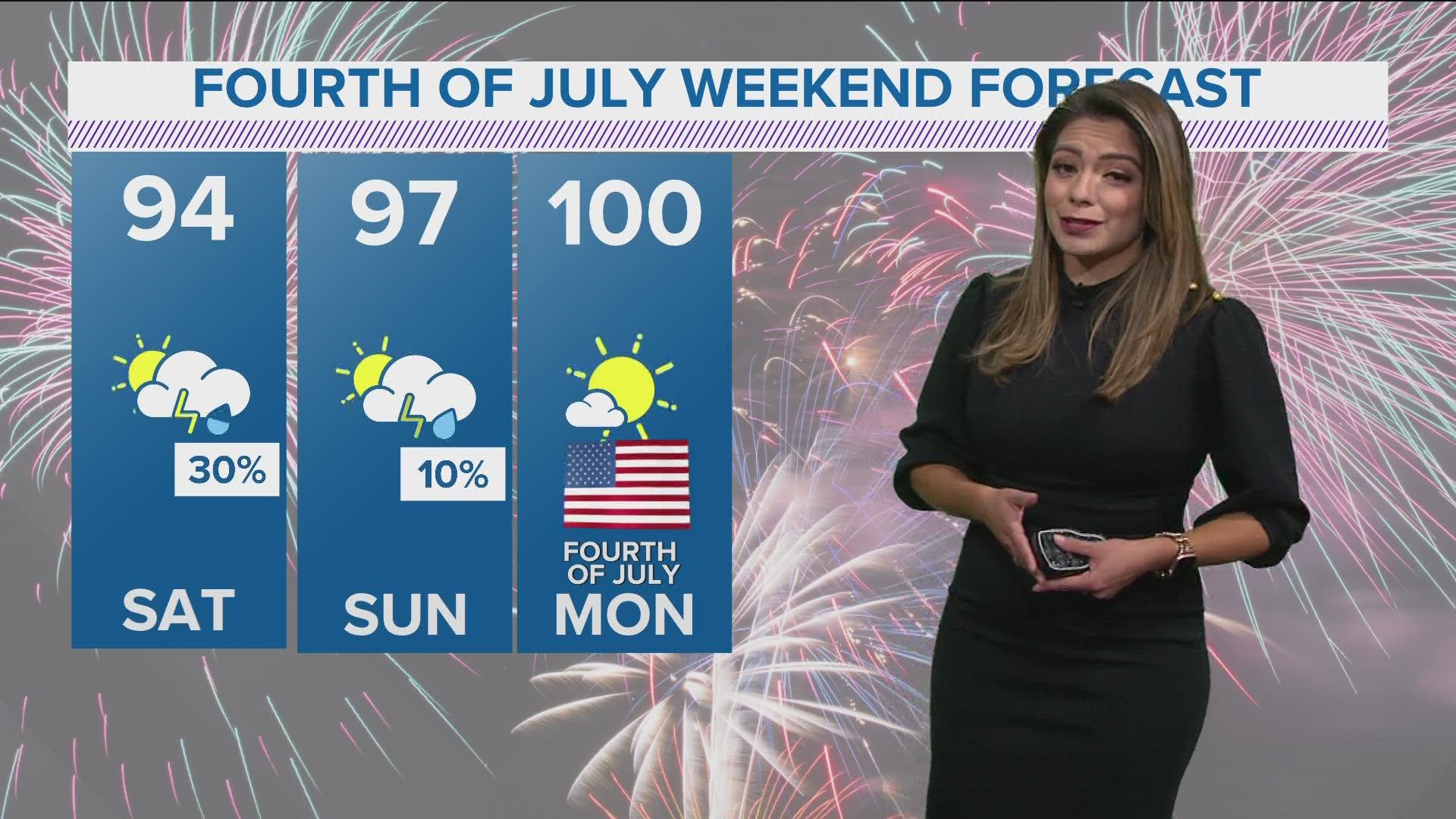
Good news: The added cloud cover, humidity and proximity to rain will help keep temperatures out of the triple digits for late June.

If you have Fourth of July weekend plans, don't cancel just yet. The system looks to move north-northeast on Sunday keeping Monday sunny and dry.
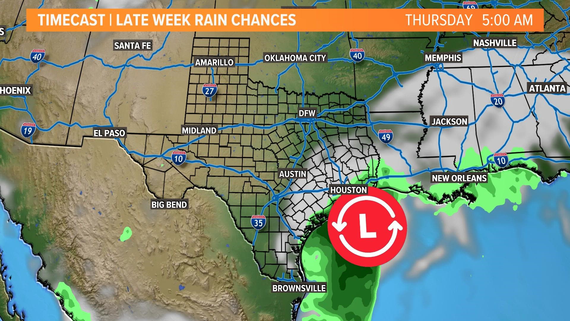
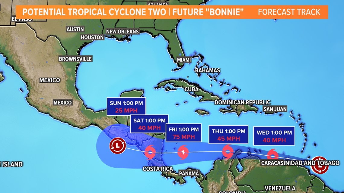
Here's the current track:
And a look at the Texas-wide rain potential:

The takeaways:
- Nothing has formed yet, but it doesn't have to in order to see beneficial rain
- Not everyone sees the rain in North Texas
- Don't cancel weekend plans, depending on how the low moves over the next couple of days could mean drastic chances in the forecast.
Other areas in the tropics:
The National Hurricane Center is watching an additional two areas in the Western Atlantic. One of which is now Potential Tropical Cyclone Two located several hundred miles east of the southern Windward Islands. It is expected to continue into the Caribbean eventually making landfall in Central America late week into the weekend.

The other is a tropical wave about 1200 miles west of the Windward Islands is producing showers and thunderstorms. This has a low chance for development in the next 5 days as it moves west-northwest across the Central Atlantic.
If any of these storms develop into named systems, the next 3 names on the list are Bonnie, Colin, and Danielle.